Guadacorte
Located in Barrios, Los, Cadiz Coordinates: 36°11′34″ N 5°25′51″ W
- Population
- 1,113
- 1.1K
- Elevation
- 1 m
- above sea level
- Local time
- UTC+01:00
- Europe/Madrid · UTC+01:00
About Guadacorte
Guadacorte is a village. Location: Barrios, Los, Cadiz. Population: 1,113. Elevation: 1 m.
Guadacorte is a village and district of the Spanish municipality of Los Barrios in the Province of Cádiz, Spain, between Gibraltar and Algeciras. It is located eight kilometers east of the main town of the municipality and had a population of 1,113 inhabitants in 2009. This town is located on the right bank of the Guadarranque River, which separates the towns of San Roque and Los Barrios. Taraguilla lies to the north across the river, and Los Cortijillos is just to the south.
Read more on Wikipedia Text: Wikipedia contributors · CC BY-SA 4.0 · shortened
In comparison
- Nearest larger town: Palmones, 2 km S
- 57 sights and natural places within 10 km Cartera, Arroyo de la Madre Vieja
Climate of Guadacorte
Best months for sightseeing: May–June, September–October.
| Month | Jan | Feb | Mar | Apr | May | Jun | Jul | Aug | Sep | Oct | Nov | Dec |
|---|---|---|---|---|---|---|---|---|---|---|---|---|
| Average high (°C) | 16° | 17° | 19° | 20° | 23° | 26° | 29° | 30° | 27° | 23° | 20° | 17° |
| Average low (°C) | 9° | 10° | 11° | 12° | 14° | 17° | 19° | 20° | 19° | 16° | 13° | 11° |
| Precipitation (mm) | 118 | 92 | 84 | 64 | 32 | 11 | 1 | 4 | 18 | 71 | 117 | 141 |
Monthly averages for 1970–2000 at about 18 km resolution, adjusted for elevation. Highlighted months are mild and relatively dry. Source: WorldClim 2.1 (CC BY 4.0).
Other places to visit in this season: May · June · September · October
Airports nearest to Guadacorte
- Gibraltar Airport (GIB) Gibraltar 9 km
- Sania Ramel Airport (TTU) Tétouan 67 km
- Tangier Ibn Battuta Airport (TNG) Tangier 68 km
Straight-line distance; airports with scheduled flights only. Source: OurAirports (public domain).
Nearby attractions & nature
Everything nearby-
Cartera Historic site, Barrios, Los0.8 km N
-
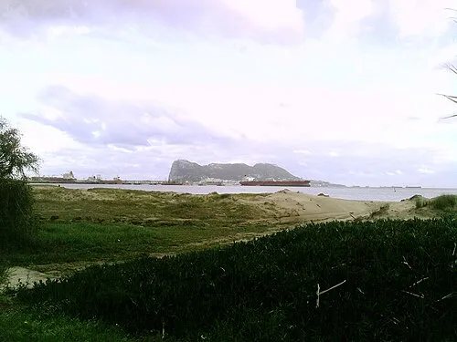 Playa Guadarranque Beach, Barrios, Los2.1 km S
-
Parroquia de la Pura y Limpia Concepción Attraction, Barrios, Los2 km S
-
Enclave Arquelógico Carteia Museum, San Roque2.1 km SE
-
Yacimiento Arqueológico Romano Carteia Historic site, San Roque2.1 km SE
-
Arroyo de la Madre Vieja River, Barrios, Los1.5 km SE
Sources & licences
Data last updated: · 2 independent sources