- Population
- 1,972
- 2K
- Elevation
- 4 m
- above sea level
- Local time
- UTC+01:00
- Europe/Madrid · UTC+01:00
- Airports
- GIB Gibraltar Airport8 km
- TTU Sania Ramel Airport65 km
About Palmones
Palmones is a village. Location: Barrios, Los, Cadiz. Population: 1,972. Elevation: 4 m.
Palmones is a village on the Bay of Gibraltar between Algeciras and La Linea de la Concepcion in the Province of Cádiz in Spain. The San Roque Refinery and Los Barrios commercial centre lie on either side of the town. The village has a waterfront promenade with benches, offering views of the Palmones estuary and river. The harbor is prone to oil spillage and is a catchment area for waste and garbage of yachts and other boats moored at Algeciras or Gibraltar.
Source: Wikipedia · CC BY-SA 4.0
Climate of Palmones
Best months for sightseeingBest months for sightseeing: May–June, September–October.
This month · November
A wet month
Day 20° · Night 13° · Rain 117 mm
Better nearby cities in November
- Málaga · 109 km northeast20°
- Dos Hermanas · 130 km north20°
- Seville · 142 km north20°
- Hottest month
- August (day 30°)
- Coldest month
- January (night 9°)
- Wettest month
- December (141 mm)
- Driest month
- July (1 mm)
Bars: average monthly low and high temperature. Below: precipitation. Monthly averages for 1970–2000 at about 18 km resolution, adjusted for elevation. Highlighted months are mild and relatively dry. Source: WorldClim 2.1 (CC BY 4.0).
Show values as a table
| Month | Jan | Feb | Mar | Apr | May | Jun | Jul | Aug | Sep | Oct | Nov | Dec |
|---|---|---|---|---|---|---|---|---|---|---|---|---|
| Average high (°C) | 16° | 17° | 19° | 20° | 23° | 26° | 29° | 30° | 27° | 23° | 20° | 17° |
| Average low (°C) | 9° | 10° | 11° | 12° | 14° | 17° | 19° | 20° | 19° | 16° | 13° | 11° |
| Precipitation (mm) | 118 | 92 | 84 | 64 | 32 | 11 | 1 | 4 | 18 | 71 | 117 | 141 |
Other places to visit in this season: May June September October
How to get to Palmones
The nearest airport is Gibraltar Airport (GIB), 8 km to the east as the crow flies. The nearest large city is Algeciras, 5 km to the south.
Airports
- Gibraltar Airport (GIB) Gibraltar 8 kmeast
- Sania Ramel Airport (TTU) Tétouan 65 kmsouth
- Tangier Ibn Battuta Airport (TNG) Tangier 66 kmsouthwest
Nearby large cities
- Algeciras Population: 121.4K 5 kmsouth
- Marbella Population: 156.3K 62 kmnortheast
- Jerez de la Frontera Population: 212.9K 84 kmnorthwest
- Cadiz Population: 117K 86 kmnorthwest
- Málaga Population: 592.3K 109 kmnortheast
Straight-line distances; road distances are longer. Airport data: OurAirports.
Nearby attractions & nature
Everything nearby-
Parroquia de la Pura y Limpia Concepción Attraction, Barrios, Los<0.1 km SW
-
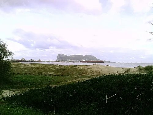 Playa Guadarranque Beach, Barrios, Los0.8 km E
-
Río Guadacortes River, Barrios, Los0.6 km W
-
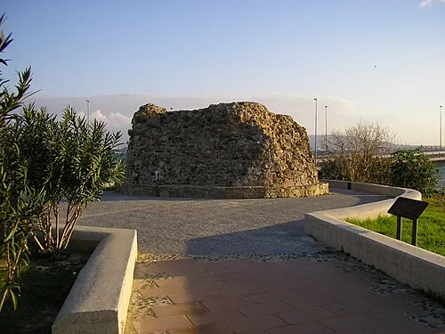 Torre del Almirante Landmark, Barrios, Los3 km S
-
Río de las Cañas River, Barrios, Los0.7 km SE
-
Cerro Marcelo Mountain, Barrios, Los2.7 km W
Sources & licences
Data last updated: · 2 independent sources