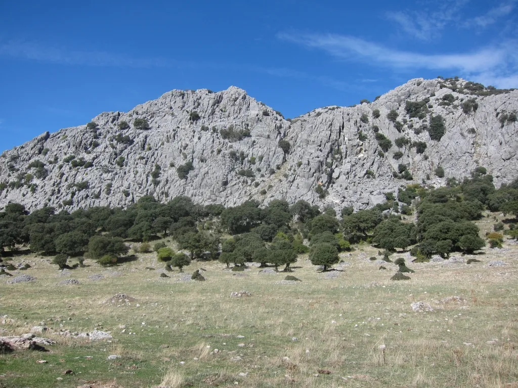
Cerro del Javato
Located in Jerez de la Frontera, Cadiz Coordinates: 36°35′00″ N 5°30′00″ W
- Elevation
- 444 m
- above sea level
- Local time
- UTC+01:00
- Europe/Madrid · UTC+01:00
- Airports
- GIB Gibraltar Airport50 km
- XRY Jerez Airport53 km
About Cerro del Javato
Cerro del Javato is a mountain. Location: Jerez de la Frontera, Cadiz. Elevation: 444 m. The best months to visit are May–June, September–October. The nearest airport is Gibraltar Airport (50 km). Nearby sights include Cerro de la Fantasía and Arroyo de Pasada Blanca.
Climate of Cerro del Javato
Best months for sightseeingBest months for sightseeing: May–June, September–October.
This month · November
A wet month
Day 17° · Night 10° · Rain 117 mm
Better nearby cities in November
- Dos Hermanas · 86 km northwest20°
- Málaga · 98 km east20°
- Seville · 98 km northwest20°
- Hottest month
- July (day 30°)
- Coldest month
- January (night 6°)
- Wettest month
- December (127 mm)
- Driest month
- July (1 mm)
Bars: average monthly low and high temperature. Below: precipitation. Monthly averages for 1970–2000 at about 18 km resolution, adjusted for elevation. Highlighted months are mild and relatively dry. Source: WorldClim 2.1 (CC BY 4.0).
Show values as a table
| Month | Jan | Feb | Mar | Apr | May | Jun | Jul | Aug | Sep | Oct | Nov | Dec |
|---|---|---|---|---|---|---|---|---|---|---|---|---|
| Average high (°C) | 13° | 14° | 17° | 18° | 21° | 26° | 30° | 30° | 27° | 21° | 17° | 14° |
| Average low (°C) | 6° | 6° | 7° | 9° | 12° | 15° | 18° | 18° | 16° | 13° | 10° | 7° |
| Precipitation (mm) | 117 | 105 | 93 | 60 | 41 | 14 | 1 | 3 | 20 | 75 | 117 | 127 |
Other places to visit in this season: May June September October
How to get to Cerro del Javato
The nearest airport is Gibraltar Airport (GIB), 50 km to the south as the crow flies. The nearest large city is Algeciras, 50 km to the south.
Airports
- Gibraltar Airport (GIB) Gibraltar 50 kmsouth
- Jerez Airport (XRY) Jerez de la Frontera 53 kmwest
- Málaga-Costa del Sol Airport (AGP) Málaga 90 kmeast
Nearby large cities
- Algeciras Population: 121.4K 50 kmsouth
- Marbella Population: 156.3K 56 kmeast
- Jerez de la Frontera Population: 212.9K 58 kmwest
- Cadiz Population: 117K 71 kmwest
- Dos Hermanas Population: 122.9K 86 kmnorthwest
Straight-line distances; road distances are longer. Airport data: OurAirports.
Day trips from Cerro del Javato
Within 100 km: 518 historic and cultural sites, 257 natural sites, 426 lakes, rivers and coasts.
0–25 km62 places
- Pantano de Guadalcacín Lake 22 kmW
- Loma de Royales Mountain 19 kmW
- Sierra de Ubrique Mountain 10 kmNE
- Sierra de los Pinos Mountain 12 kmNE
25–60 km436 places
- Playa de Atlanterra Beach 60 kmSW
- Playa de Poniente Beach 49 kmS
- Playa de Levante Beach 46 kmS
- La Alcaidesa Beach 42 kmSE
60–100 km703 places
- Playa de Zahora Beach 65 kmSW
- Jebel Zem Zem Mountain 100 kmS
- Kasbah Mosque Attraction 93 kmS
- Grand Mosque of Tangier Attraction 93 kmS
Straight-line distances.
Nearest towns and villages
-
 Cortes de la Frontera Municipality, Malaga6.3 km E
-
 Ubrique Municipality, Cadiz9.5 km N
-
Ubrique Town, Ubrique12 km NE
-
 Benaocaz Municipality, Cadiz15 km N
-
 Jimena de la Frontera Municipality, Cadiz19 km S
-
 San Pablo Village, Jimena de la Frontera15 km SE
Nearby attractions & nature
Everything nearby-
Cerro de la Fantasía Mountain, Jerez de la Frontera1.5 km SE
-
Arroyo de Pasada Blanca River, Jerez de la Frontera3.6 km S
-
Cerro del Algarrobal Mountain, Ubrique11 km NE
-
 Sierra de Libar Mountain, Villaluenga del Rosario14 km NE
-
Arroyo de los Negros River, Jerez de la Frontera8.1 km NW
-
Sierra de Ubrique Mountain, Ubrique9.7 km NE
-
Pico del Montero Mountain, Alcalá de los Gazules15 km SW
-
Garganta de la Balsa River, Jimena de la Frontera9.2 km S
Sources & licences
Data last updated: