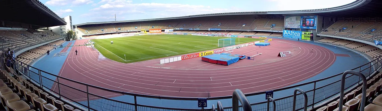
Estadio Municipal de Chapín
Located in Jerez de la Frontera, Cadiz Coordinates: 36°41′22″ N 6°07′13″ W
- Local time
- UTC+01:00
- Europe/Madrid · UTC+01:00
- Elevation
- 44 m
- above sea level
- Airports
- XRY Jerez Airport8 km
- SVQ Seville Airport83 km
About Estadio Municipal de Chapín
Estadio Municipal de Chapín is a landmark. Location: Jerez de la Frontera, Cadiz.
Estadio Municipal de Chapín is a multi-purpose stadium in Jerez, Spain. It is currently used mostly for football matches and is the home ground of Xerez Deportivo FC. Xerez Deportivo are the current tenants and Xerez CD former tenants. The stadium holds 20,523 and it was opened on 28 June 1988.
Source: Wikipedia · CC BY-SA 4.0
At a glance
- Built
- 1988
- Opened
- 1988
- Architect
- Cruz y Ortiz
- Official website
- jerez.es
Source: Wikidata
Photos of Estadio Municipal de Chapín
-

El Pantera · CC BY-SA 4.0 -

El Pantera · CC BY-SA 4.0 -
Teatro Villamarta Mao06 · CC BY-SA 3.0 -
Palacio de Campo Real Jerezplataforma · CC BY 3.0 -
Castle of Doña Blanca Emilio J. Rodríguez Posada · CC BY-SA 3.0


Climate of Estadio Municipal de Chapín
Best months for sightseeingBest months for sightseeing: March–June, October.
This month · November
Outside the best season
Day 20° · Night 10° · Rain 87 mm
Better nearby cities in November
- Dos Hermanas · 68 km north20°
- Seville · 78 km north20°
- Málaga · 152 km east20°
- Hottest month
- July (day 32°)
- Coldest month
- January (night 7°)
- Wettest month
- December (104 mm)
- Driest month
- July (1 mm)
Bars: average monthly low and high temperature. Below: precipitation. Monthly averages for 1970–2000 at about 18 km resolution, adjusted for elevation. Highlighted months are mild and relatively dry. Source: WorldClim 2.1 (CC BY 4.0).
Show values as a table
| Month | Jan | Feb | Mar | Apr | May | Jun | Jul | Aug | Sep | Oct | Nov | Dec |
|---|---|---|---|---|---|---|---|---|---|---|---|---|
| Average high (°C) | 16° | 17° | 19° | 21° | 24° | 28° | 32° | 32° | 29° | 24° | 20° | 17° |
| Average low (°C) | 7° | 8° | 9° | 10° | 13° | 16° | 19° | 19° | 17° | 14° | 10° | 8° |
| Precipitation (mm) | 90 | 61 | 44 | 52 | 36 | 15 | 1 | 4 | 19 | 65 | 87 | 104 |
Other places to visit in this season: March April May June October
How to get to Estadio Municipal de Chapín
The nearest airport is Jerez Airport (XRY), 8 km to the northeast as the crow flies. For international flights: Seville Airport (SVQ) (83 km). The nearest large city is Jerez de la Frontera, 1 km to the west.
Airports
- Jerez Airport (XRY) Jerez de la Frontera 8 kmnortheast
- Seville Airport (SVQ) Seville 83 kmnorth
- Gibraltar Airport (GIB) Gibraltar 91 kmsoutheast
Nearby large cities
- Jerez de la Frontera Population: 212.9K 1 kmwest
- Cadiz Population: 117K 24 kmsouthwest
- Dos Hermanas Population: 122.9K 68 kmnorth
- Seville Population: 686.7K 78 kmnorth
- Algeciras Population: 121.4K 86 kmsoutheast
Straight-line distances; road distances are longer. Airport data: OurAirports.
Day trips from Estadio Municipal de Chapín
Within 100 km: 432 historic and cultural sites, 197 natural sites, 419 lakes, rivers and coasts.
0–25 km139 places
- Playa de la Victoria Beach 25 kmSW
- Playa de Levante Beach 18 kmSW
- Caleta Beach Beach 24 kmSW
- Playa del Bajo Beach 25 kmNW
25–60 km249 places
- Playa de Zahora Beach 55 kmS
- Playa de Castilla Beach 58 kmNW
- Playa de las Tres Piedras Beach 28 kmW
- Playa de las Canteras Beach 29 kmW
60–100 km660 places
- Playa de Castilla Beach 84 kmNW
- Playa de Punta Umbría Beach 95 kmNW
- Playa de la Bota Beach 99 kmNW
- Playa de Atlanterra Beach 69 kmS
Straight-line distances.
Nearby attractions & nature
Everything nearby-
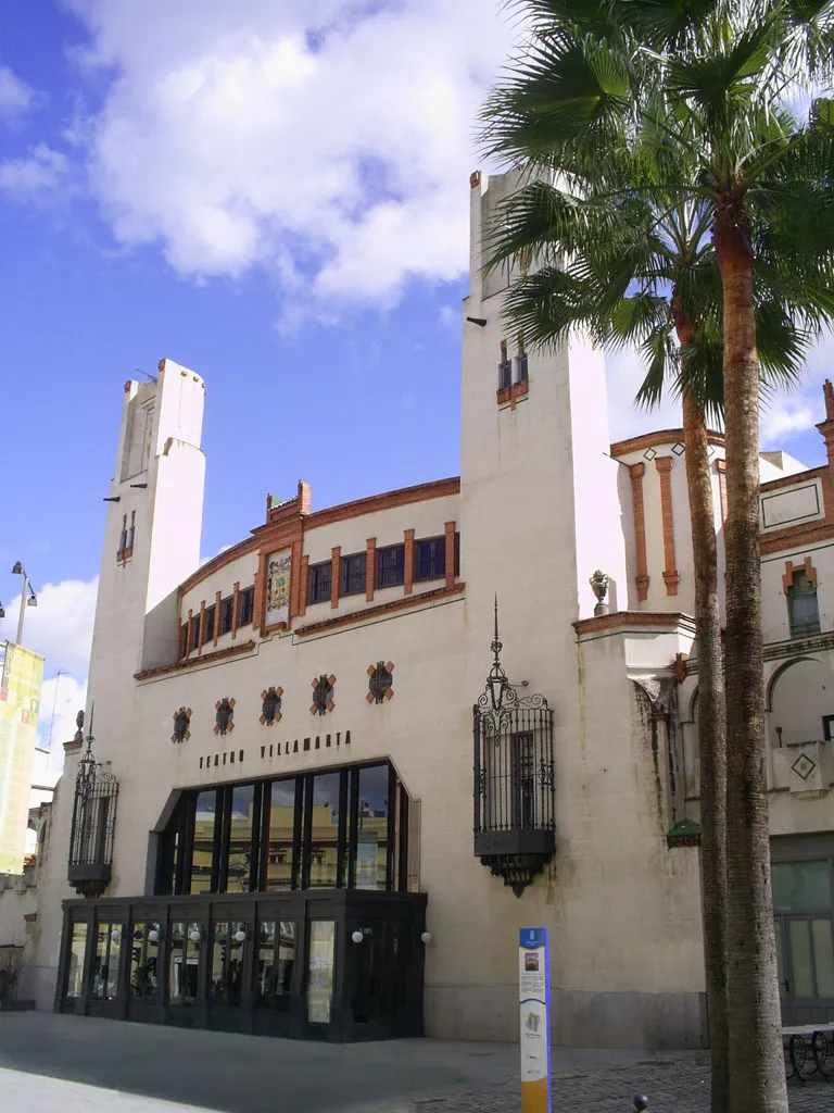
Teatro Villamarta Attraction, Jerez de la Frontera1.5 km SW
-
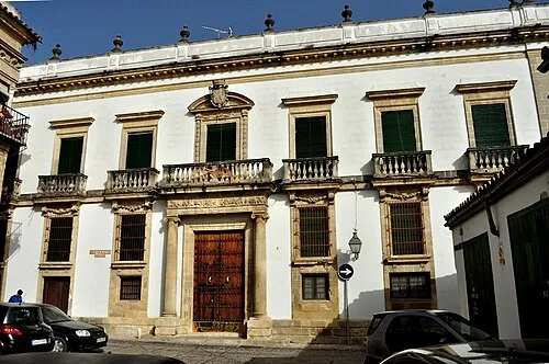
Palacio de Campo Real Historic site, Jerez de la Frontera2.1 km W
-
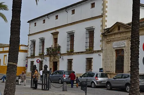 Archaeological Museum of Jerez Museum, Jerez de la Frontera2.2 km W
-
Plaza de Toros de Jerez Attraction, Jerez de la Frontera0.9 km W
-
Jardín Escénico "El Altillo" Attraction, Jerez de la Frontera1.2 km N
-
Palacio Domecq Historic site, Jerez de la Frontera1.5 km W
-
Real Escuela Andaluza del Arte Ecuestre Museum, Jerez de la Frontera1.5 km W
-
Parroquia De San Dionisio Attraction, Jerez de la Frontera1.7 km W
Nearest towns and villages
-
Jerez de la Frontera City, Jerez de la Frontera1.4 km W
-
Las Abiertas Village, Jerez de la Frontera1.9 km E
-
Albaladejo Village, Jerez de la Frontera2 km NE
-
Bogás Village, Jerez de la Frontera2.8 km N
More sights in Jerez de la Frontera
-
Palacio de la Condesa de Casares Historic site, Jerez de la Frontera1.8 km W
-
Palacio del Virrey Laserna Museum, Jerez de la Frontera1.9 km SW
-
Alcazar of Jerez de la Frontera Historic site, Jerez de la Frontera2 km SW
-
Catedral de San Salvador de Jerez de la Frontera Attraction, Jerez de la Frontera2 km SW
-
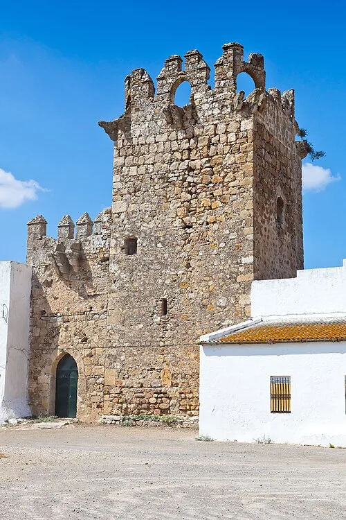 Castillo de Melgarejo Historic site, Jerez de la Frontera8.4 km E
-
Basílica Menor Nuestra Señora de la Merced Attraction, Jerez de la Frontera2.3 km W
Sources & licences
Data last updated: · 2 independent sources