- Elevation
- 85 m
- above sea level
- Local time
- UTC+01:00
- Europe/Madrid · UTC+01:00
- Airports
- XRY Jerez Airport42 km
- GIB Gibraltar Airport59 km
About Cerro del Niño
Cerro del Niño is a mountain. Location: Medina-Sidonia, Cadiz. Elevation: 85 m. The best months to visit are May–June, October. The nearest airport is Jerez Airport (42 km). Nearby sights include Mesa del Algar and Cerro Lucas.
Climate of Cerro del Niño
Best months for sightseeingBest months for sightseeing: May–June, October.
This month · November
A wet month
Day 19° · Night 11° · Rain 109 mm
Better nearby cities in November
- Dos Hermanas · 101 km north20°
- Seville · 112 km north20°
- Málaga · 142 km east20°
- Hottest month
- July (day 30°)
- Coldest month
- January (night 8°)
- Wettest month
- December (113 mm)
- Driest month
- July (0 mm)
Bars: average monthly low and high temperature. Below: precipitation. Monthly averages for 1970–2000 at about 18 km resolution, adjusted for elevation. Highlighted months are mild and relatively dry. Source: WorldClim 2.1 (CC BY 4.0).
Show values as a table
| Month | Jan | Feb | Mar | Apr | May | Jun | Jul | Aug | Sep | Oct | Nov | Dec |
|---|---|---|---|---|---|---|---|---|---|---|---|---|
| Average high (°C) | 15° | 16° | 18° | 20° | 23° | 27° | 30° | 30° | 28° | 23° | 19° | 16° |
| Average low (°C) | 8° | 8° | 10° | 11° | 13° | 16° | 19° | 19° | 18° | 15° | 11° | 9° |
| Precipitation (mm) | 97 | 83 | 68 | 55 | 34 | 14 | 0 | 3 | 20 | 72 | 109 | 113 |
How to get to Cerro del Niño
The nearest airport is Jerez Airport (XRY), 42 km to the north as the crow flies. For international flights: Gibraltar Airport (GIB) (59 km). The nearest large city is Cadiz, 35 km to the northwest.
Airports
- Jerez Airport (XRY) Jerez de la Frontera 42 kmnorth
- Gibraltar Airport (GIB) Gibraltar 59 kmsoutheast
- Tangier Ibn Battuta Airport (TNG) Tangier 71 kmsouth
Nearby large cities
- Cadiz Population: 117K 35 kmnorthwest
- Jerez de la Frontera Population: 212.9K 38 kmnorthwest
- Algeciras Population: 121.4K 52 kmsoutheast
- Marbella Population: 156.3K 97 kmeast
- Dos Hermanas Population: 122.9K 101 kmnorth
Straight-line distances; road distances are longer. Airport data: OurAirports.
Day trips from Cerro del Niño
Within 100 km: 309 historic and cultural sites, 191 natural sites, 334 lakes, rivers and coasts.
0–25 km116 places
- Playa de Zahora Beach 21 kmSW
- Playa de la Barrosa Beach 20 kmW
- Los Caños de Meca Beach 21 kmS
- Islote de Sancti Petri Island 24 kmW
25–60 km351 places
- Playa de la Victoria Beach 33 kmNW
- Playa de Levante Beach 32 kmNW
- Caleta Beach Beach 36 kmNW
- Playa de las Tres Piedras Beach 57 kmNW
60–100 km367 places
- Jebel Zem Zem Mountain 81 kmS
- Kasbah Mosque Attraction 66 kmS
- Grand Mosque of Tangier Attraction 66 kmS
- Baie De Tanger Natural site 67 kmS
Straight-line distances.
Nearest towns and villages
-
Los Naveros Village, Vejer de la Frontera2.8 km SW
-
Medina-Sidonia Town, Medina-Sidonia9.6 km N
-
 Vejer de la Frontera Municipality, Cadiz12 km S
-
 Chiclana de la Frontera Municipality, Cadiz16 km W
-
Los Baladejos Village, Medina-Sidonia7 km E
-
 Conil de la Frontera Municipality, Cadiz16 km SW
Nearby attractions & nature
Everything nearby-
Mesa del Algar Mountain, Vejer de la Frontera4.1 km SE
-
Cerro Lucas Mountain, Conil de la Frontera6.1 km SW
-
Arroyo del Navero River, Vejer de la Frontera6 km SW
-
Cerro Cantora Mountain, Medina-Sidonia7.9 km NE
-
Cerro Patria Mountain, Vejer de la Frontera12 km SW
-
Cerro de la Cueva Mountain, Chiclana de la Frontera12 km NW
-
Arroyo Salado River, Chiclana de la Frontera11 km NW
-
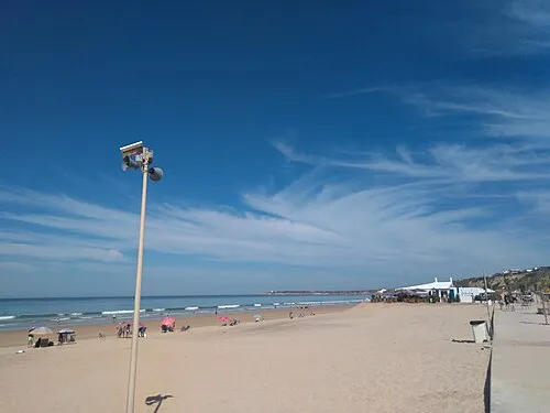 Playa La Fontanilla Beach, Conil de la Frontera17 km SW
Sources & licences
Data last updated: