Punta Umbría
Located in Province of Huelva, Andalusia Coordinates: 37°12′40″ N 7°00′52″ W
- Population
- 14,919
- 14.9K
- Elevation
- 2 m
- above sea level
- Local time
- UTC+01:00
- Europe/Madrid · UTC+01:00
- Places inside
- 9
- listed under Punta Umbría
- Airports
- FAO Faro - Gago Coutinho International Airport88 km
- XRY Jerez Airport99 km
About Punta Umbría
Punta Umbría is a municipality. Location: Province of Huelva, Andalusia. Population: 14,919. Elevation: 2 m. The best months to visit are March–June, October. The nearest airport is Faro - Gago Coutinho International Airport (88 km). Nearby sights include Río de la Bota and Estero de Cantaya.
Photos of Punta Umbría
-
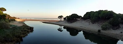
Playa del Portil Calapito · CC BY 3.0 -
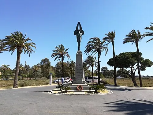
Monumento al Plus Ultra CarlosVdeHabsburgo · CC BY-SA 4.0 -
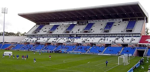
Estadio Nuevo Colombino Anonymous Unknown author · Public domain


Climate of Punta Umbría
Best months for sightseeingBest months for sightseeing: March–June, October.
This month · November
Outside the best season
Day 20° · Night 11° · Rain 76 mm
Better nearby cities in November
- Seville · 94 km east20°
- Dos Hermanas · 97 km east20°
- Málaga · 237 km east20°
- Hottest month
- July (day 32°)
- Coldest month
- January (night 7°)
- Wettest month
- December (84 mm)
- Driest month
- July (2 mm)
Bars: average monthly low and high temperature. Below: precipitation. Monthly averages for 1970–2000 at about 18 km resolution, adjusted for elevation. Highlighted months are mild and relatively dry. Source: WorldClim 2.1 (CC BY 4.0).
Show values as a table
| Month | Jan | Feb | Mar | Apr | May | Jun | Jul | Aug | Sep | Oct | Nov | Dec |
|---|---|---|---|---|---|---|---|---|---|---|---|---|
| Average high (°C) | 16° | 17° | 20° | 21° | 24° | 28° | 32° | 31° | 29° | 24° | 20° | 17° |
| Average low (°C) | 7° | 8° | 9° | 11° | 13° | 17° | 19° | 19° | 17° | 14° | 11° | 8° |
| Precipitation (mm) | 72 | 49 | 37 | 46 | 28 | 12 | 2 | 4 | 16 | 58 | 76 | 84 |
Other places to visit in this season: March April May June October
How to get to Punta Umbría
The nearest airport is Faro - Gago Coutinho International Airport (FAO), 88 km to the west as the crow flies. The nearest large city is Huelva, 9 km to the northeast.
Airports
- Faro - Gago Coutinho International Airport (FAO) Faro 88 kmwest
- Jerez Airport (XRY) Jerez de la Frontera 99 kmsoutheast
- Seville Airport (SVQ) Seville 102 kmeast
Nearby large cities
- Huelva Population: 144.3K 9 kmnortheast
- Seville Population: 686.7K 94 kmeast
- Dos Hermanas Population: 122.9K 97 kmeast
- Jerez de la Frontera Population: 212.9K 98 kmsoutheast
- Cadiz Population: 117K 100 kmsoutheast
Straight-line distances; road distances are longer. Airport data: OurAirports.
Day trips from Punta Umbría
Within 100 km: 292 historic and cultural sites, 88 natural sites, 305 lakes, rivers and coasts.
0–25 km112 places
- Playa de Castilla Beach 15 kmSE
- Playa de Punta Umbría Beach 3 kmSE
- Playa de la Bota Beach 2 kmSW
- Playa de Mazagón Beach 21 kmSE
25–60 km171 places
- Playa de Castilla Beach 41 kmSE
- Punta del Moral Beach 29 kmW
- Punta del Caiman Beach 28 kmW
- Playa de Matalascañas Beach 47 kmSE
60–100 km402 places
- Caleta Beach Beach 98 kmSE
- Playa de las Tres Piedras Beach 76 kmSE
- Playa de las Canteras Beach 73 kmSE
- Playa del Bajo Beach 74 kmSE
Straight-line distances.
Places in Punta Umbría
9 placesBar: population relative to the most populous place in this list.
Cities & villages1
- El Rincón · Village
Lakes, rivers & coasts3
- Isla de Enmedio · Island
- Playa de la Bota · Beach
- Playa de Punta Umbría · Beach
Heritage & sights4
- Capilla Nuestra Señora De Lourdes · Attraction
- Jardines De Lourdes · Attraction
- Parroquia Santa María del Mar · Attraction
- Teatro Del Mar · Attraction
Nearby attractions & nature
Everything nearby-
Río de la Bota River, Andalusia1.4 km NE
-
Estero de Cantaya River, Andalusia1.6 km NE
-
Isla de la Liebre Island, Andalusia2.1 km NE
-
Estero de Cajarias River, Andalusia2.6 km NE
-
Estadio Nuevo Colombino Landmark, Huelva6.6 km NE
-
Playa del Portil Beach, Cartaya4.2 km W
-
Saltes Island Island, Huelva5.4 km E
-
Parque Pedro de Almagro Natural site, Cartaya4.5 km W
Other cities and towns in Province of Huelva
-
 Lepe Municipality, Province of Huelva17 km NW
-
 Moguer Municipality, Province of Huelva18 km E
-
Cartaya Municipality, Province of Huelva18 km NW
-
Gibraleón Municipality, Province of Huelva20 km N
-
 San Juan del Puerto Municipality, Province of Huelva21 km NE
-
 Isla Cristina Municipality, Province of Huelva26 km W
Sources & licences
Data last updated: