- Elevation
- 2 m
- above sea level
- Local time
- UTC+01:00
- Europe/Madrid · UTC+01:00
- Airports
- FAO Faro - Gago Coutinho International Airport93 km
- XRY Jerez Airport94 km
About Saltes Island
Saltes Island is an island. Location: Huelva, Province of Huelva.
Saltés Island (Spanish: Isla Saltés) is a fluvial islet in the Huelva River estuary, in the province of Huelva, Andalusia, Spain. It is part of the Odiel Marshes biosphere reserve.
Source: Wikipedia · CC BY-SA 4.0
Photos of Saltes Island
-
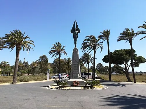
Monumento al Plus Ultra CarlosVdeHabsburgo · CC BY-SA 4.0 -
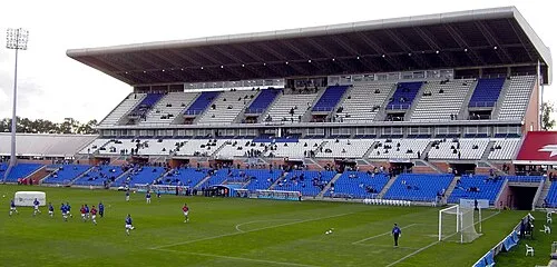
Estadio Nuevo Colombino Anonymous Unknown author · Public domain


Climate of Saltes Island
Best months for sightseeingBest months for sightseeing: March–June, October–November.
This month · November
A good month to visit
Day 20° · Night 10° · Rain 76 mm
- Hottest month
- July (day 32°)
- Coldest month
- January (night 7°)
- Wettest month
- December (80 mm)
- Driest month
- July (2 mm)
Bars: average monthly low and high temperature. Below: precipitation. Monthly averages for 1970–2000 at about 18 km resolution, adjusted for elevation. Highlighted months are mild and relatively dry. Source: WorldClim 2.1 (CC BY 4.0).
Show values as a table
| Month | Jan | Feb | Mar | Apr | May | Jun | Jul | Aug | Sep | Oct | Nov | Dec |
|---|---|---|---|---|---|---|---|---|---|---|---|---|
| Average high (°C) | 16° | 17° | 20° | 22° | 25° | 28° | 32° | 32° | 29° | 25° | 20° | 17° |
| Average low (°C) | 7° | 8° | 9° | 11° | 14° | 17° | 19° | 19° | 18° | 14° | 10° | 8° |
| Precipitation (mm) | 71 | 48 | 37 | 46 | 27 | 12 | 2 | 4 | 15 | 57 | 76 | 80 |
Other places to visit in this season: March April May June October November
How to get to Saltes Island
The nearest airport is Faro - Gago Coutinho International Airport (FAO), 93 km to the west as the crow flies. The nearest large city is Huelva, 7 km to the north.
Airports
- Faro - Gago Coutinho International Airport (FAO) Faro 93 kmwest
- Jerez Airport (XRY) Jerez de la Frontera 94 kmsoutheast
- Seville Airport (SVQ) Seville 97 kmeast
Nearby large cities
- Huelva Population: 144.3K 7 kmnorth
- Seville Population: 686.7K 89 kmeast
- Dos Hermanas Population: 122.9K 92 kmeast
- Jerez de la Frontera Population: 212.9K 93 kmsoutheast
- Cadiz Population: 117K 95 kmsoutheast
Straight-line distances; road distances are longer. Airport data: OurAirports.
Day trips from Saltes Island
Within 100 km: 308 historic and cultural sites, 92 natural sites, 323 lakes, rivers and coasts.
0–25 km111 places
- Playa de Castilla Beach 10 kmSE
- Playa de Punta Umbría Beach 3 kmSW
- Playa de la Bota Beach 7 kmW
- Playa de Mazagón Beach 16 kmSE
25–60 km174 places
- Playa de Castilla Beach 36 kmSE
- Punta del Moral Beach 34 kmW
- Punta del Caiman Beach 33 kmW
- Playa de Matalascañas Beach 42 kmSE
60–100 km438 places
- Playa de la Victoria Beach 98 kmSE
- Playa de Levante Beach 97 kmSE
- Caleta Beach Beach 94 kmSE
- Playa de las Tres Piedras Beach 72 kmSE
Straight-line distances.
Nearest towns and villages
-
Punta Umbría Town, Punta Umbría2.2 km SW
-
Punta Umbría Municipality, Province of Huelva5.4 km W
-
Huelva City, Huelva7.5 km N
-
Palos de la Frontera Municipality, Province of Huelva5.7 km E
-
Palos de la Frontera Town, Palos de la Frontera6.6 km NE
-
Fábrica de Gas del Puerto Village, Huelva3.7 km N
Nearby attractions & nature
Everything nearby-
Estero de Doña Sancha River, Andalusia1.6 km S
-
Río Tinto River, Spain1.7 km NE
-
Isla de Bacuta Island, Gibraleón3.8 km N
-
Monumento a Colón Landmark, Huelva1.9 km NE
-
Playa de Punta Umbría Beach, Punta Umbría3.4 km SW
-
Estero de los Caños River, Andalusia3.3 km NE
-
Monumento al Plus Ultra Landmark, Palos de la Frontera2.6 km NE
-
Río de Punta Umbría River, Andalusia3.6 km S
Sources & licences
Data last updated: · 2 independent sources