Zaragoza Municipality
Located in Saragossa, Aragon Coordinates: 41°38′54″ N 0°52′59″ W
- Population
- 691,037
- 691K
- Elevation
- 228 m
- above sea level
- Local time
- UTC+01:00
- Europe/Madrid · UTC+01:00
- Places inside
- 127
- listed under Zaragoza Municipality
About Zaragoza Municipality
Zaragoza Municipality is a municipality. Location: Saragossa, Aragon. Population: 691,037. Elevation: 228 m.
In comparison
- Most populous of 293 places in Saragossa
- 77 sights and natural places within 10 km Basilica of Santa Engracia Church, Patio de la Infanta
- Listed here: Village: 35, Attraction: 23, Natural site: 20, Neighbourhood: 15
Climate of Zaragoza Municipality
Best months for sightseeing: April–May, September–October.
| Month | Jan | Feb | Mar | Apr | May | Jun | Jul | Aug | Sep | Oct | Nov | Dec |
|---|---|---|---|---|---|---|---|---|---|---|---|---|
| Average high (°C) | 11° | 14° | 17° | 19° | 24° | 28° | 32° | 32° | 28° | 21° | 15° | 12° |
| Average low (°C) | 3° | 4° | 5° | 8° | 11° | 15° | 18° | 18° | 15° | 10° | 6° | 4° |
| Precipitation (mm) | 22 | 20 | 23 | 38 | 51 | 37 | 19 | 23 | 31 | 33 | 30 | 26 |
Monthly averages for 1970–2000 at about 18 km resolution, adjusted for elevation. Highlighted months are mild and relatively dry. Source: WorldClim 2.1 (CC BY 4.0).
Other places to visit in this season: April · May · September · October
Airports nearest to Zaragoza Municipality
- Zaragoza Airport (ZAZ) Zaragoza 13 km
- Lleida-Alguaire Airport (ILD) Lleida 118 km
- Pamplona Airport (PNA) Pamplona 140 km
Straight-line distance; airports with scheduled flights only. Source: OurAirports (public domain).
Places in Zaragoza Municipality
127 places-
Las Fuentes Village
-
Las Fuentes Neighbourhood
-
Leaning Tower of Zaragoza Historic site
-
Macanaz Park Natural site
-
Miraflores Park Natural site
-
Miralbueno Neighbourhood
-
Miralbueno Village
-
Monasterio de Santa Fé Historic site
-
Montañana Village
-
Monumento a César Augusto Landmark
-
Monzalbarba Village
-
Museo de Zaragoza Museum
-
Museo de Zaragoza Etnología Museum
-
Museo Pablo Gargallo Museum
-
Museo Pablo Serrano IAACC Museum
-
Oliver - Valdefierro Village
-
Pabellón Príncipe Felipe Landmark
-
Palacio de La Aljafería Historic site
-
Palacio de los Condes de Morata o de Luna Historic site
-
Palacio de Sástago Historic site
-
Palacio Fuenclara Historic site
-
Palacio Municipal de Deportes Landmark
-
Parque de la Palabra Natural site
-
Parque de las Delicias Natural site
-
Parque del Conocimiento Natural site
-
Parque del Oeste Natural site
-
Parque de los Volcanes Natural site
-
Parque Frente Fluvial Expo de Zaragoza Natural site
-
Parque Goya Neighbourhood
-
Parroquia de Santa María Attraction
-
Parroquia de San Valero Attraction
-
Parroquia Madre de Dios de Begoña Attraction
-
Patio de la Infanta Museum
-
Peñaflor Village
-
Pignatelli Park Natural site
-
Plaza Village
-
Poetas Park Natural site
-
Puente del Tercer Milenio Landmark
-
Razón Park Natural site
-
Respeto Park Natural site
-
Río Jalón River
-
Roman Theater Historic site
-
San Gregorio Mediumwave Transmitter Landmark
-
San José Village
-
San José Village
-
San Juan de Mozarrifar Village
-
Santa Isabel Village
-
Santa Isabel Village
-
Sur Village
-
Teatro Arbole S.L. Attraction
-
Teatro de la Estación Attraction
-
Teatro de las Esquinas Attraction
-
Tío Jorge Park Natural site
-
Torrecilla de Valmadrid Village
Nearby attractions & nature
Everything nearby-
Río Huerva River, Aragon1.5 km E
-
Río Gállego River, Aragon2.9 km E
-
Ermita de Nuestra Señora del Pueyo Historic site, Villamayor de Gállego11 km NE
-
Monumento a Los Caidos Landmark, Utebo Municipality12 km NW
-
Parroquia Ntra Sra de la Asunción Attraction, Utebo Municipality12 km NW
-
Iglesia Nuestra Señora de la Asunción Attraction, Utebo Municipality12 km NW
-
Asociación Cultural Teatro Conton y Son Attraction, Utebo Municipality12 km NW
-
Museo Mesonada Museum, Utebo Municipality12 km NW
Other cities and towns in Saragossa
-
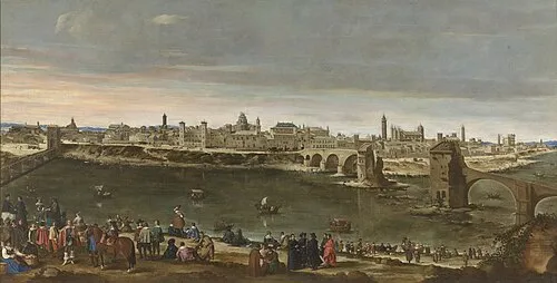 Zaragoza City, Zaragoza Municipality1 km NE
-
Villamayor de Gállego Municipality, Saragossa14 km E
-
Sobradiel Municipalities Municipality, Saragossa16 km NW
-
Villanueva de Gállego Municipality Municipality, Saragossa15 km N
-
Pinseque Municipality Municipality, Saragossa19 km NW
-
El Burgo de Ebro Municipality Municipality, Saragossa16 km SE
Sources & licences
Data last updated: