Playa de sa Farola
Located in Ciutadella de Menorca, Balearic Islands Coordinates: 39°59′53″ N 3°49′20″ E
- Elevation
- 9 m
- above sea level
- Local time
- UTC+01:00
- Europe/Madrid · UTC+01:00
- Airports
- MAH Menorca Airport37 km
- PMI Palma de Mallorca Airport105 km
About Playa de sa Farola
Playa de sa Farola is a beach. Location: Ciutadella de Menorca, Balearic Islands. The best months to visit are May–July, September–October. The nearest airport is Menorca Airport (37 km). Nearby sights include Cathedral of Minorca and Platja Gran.
Photos of Playa de sa Farola
-
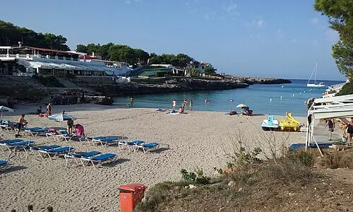
Playa Cala Blanca Herodotptlomeu · CC BY-SA 4.0 -
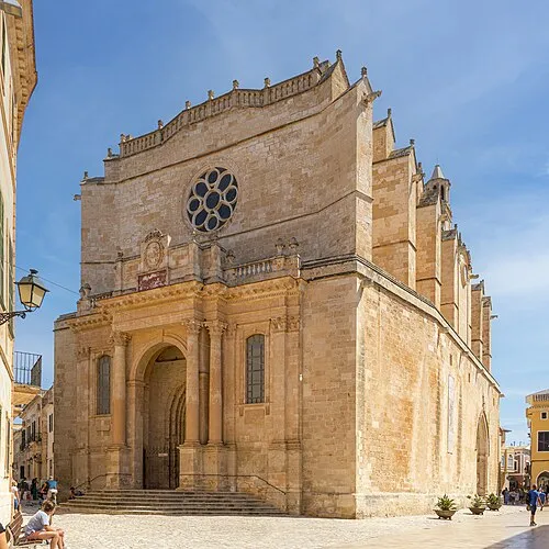
Cathedral of Minorca Fernando · CC BY-SA 4.0


Climate of Playa de sa Farola
Best months for sightseeingBest months for sightseeing: May–July, September–October.
This month · November
Outside the best season
Day 18° · Night 11° · Rain 77 mm
- Hottest month
- August (day 29°)
- Coldest month
- February (night 7°)
- Wettest month
- October (88 mm)
- Driest month
- July (6 mm)
Bars: average monthly low and high temperature. Below: precipitation. Monthly averages for 1970–2000 at about 18 km resolution, adjusted for elevation. Highlighted months are mild and relatively dry. Source: WorldClim 2.1 (CC BY 4.0).
Show values as a table
| Month | Jan | Feb | Mar | Apr | May | Jun | Jul | Aug | Sep | Oct | Nov | Dec |
|---|---|---|---|---|---|---|---|---|---|---|---|---|
| Average high (°C) | 15° | 15° | 16° | 18° | 21° | 25° | 28° | 29° | 26° | 22° | 18° | 16° |
| Average low (°C) | 7° | 7° | 8° | 10° | 13° | 17° | 20° | 21° | 18° | 15° | 11° | 9° |
| Precipitation (mm) | 65 | 51 | 49 | 51 | 34 | 15 | 6 | 26 | 57 | 88 | 77 | 70 |
Other places to visit in this season: May June July September October
How to get to Playa de sa Farola
The nearest airport is Menorca Airport (MAH), 37 km to the southeast as the crow flies. The nearest large city is Palma, 111 km to the southwest.
Airports
- Menorca Airport (MAH) Mahón (Maó) 37 kmsoutheast
- Palma de Mallorca Airport (PMI) Palma de Mallorca 105 kmsouthwest
- Josep Tarradellas Barcelona-El Prat Airport (BCN) Barcelona 206 kmnorthwest
Nearby large cities
- Palma Population: 438.2K 111 kmsouthwest
- Mataró Population: 127K 207 kmnorthwest
- Barcelona Population: 1.7M 209 kmnorthwest
- Sant Martí Population: 235.7K 209 kmnorthwest
- Badalona Population: 217.7K 209 kmnorthwest
Straight-line distances; road distances are longer. Airport data: OurAirports.
Day trips from Playa de sa Farola
Within 100 km: 126 historic and cultural sites, 58 natural sites, 89 lakes, rivers and coasts.
0–25 km47 places
- Minorca Island 22 kmE
- Platja Gran Beach 1 kmE
- Cabo Menorca Natural site 3 kmNW
- Auditori de Ferreries Attraction 17 kmE
25–60 km90 places
- Cala Biniancolla Beach 43 kmSE
- Playas de Fornells Beach 25 kmE
- Badia de Pollença Natural site 59 kmW
- Cap de Menorca Natural site 55 kmW
60–100 km136 places
- Majorca Island 82 kmSW
- Playa Llombards Beach 95 kmSW
- Es Pontàs Landmark 95 kmSW
- Murada Mediaval d'Alcúdia Landmark 62 kmW
Straight-line distances.
Nearest towns and villages
-
Ciutadella Town, Ciutadella de Menorca1.7 km E
-
Cala'N Blanes Village, Ciutadella de Menorca1.5 km W
-
Sa Caleta Neighbourhood, Ciutadella de Menorca2.2 km SE
-
ses Truqueries Village, Ciutadella de Menorca2.3 km NE
-
Cala Santandria Village, Ciutadella de Menorca2.3 km SE
-
Cala Blanca Village, Ciutadella de Menorca2.9 km S
Nearby attractions & nature
Everything nearby-
Cathedral of Minorca Attraction, Ciutadella de Menorca1.4 km E
-
Platja Gran Beach, Ciutadella de Menorca1.2 km E
-
Sant Nicolau Castle Historic site, Ciutadella de Menorca0.4 km SE
-
Cala'n Forcat Beach, Ciutadella de Menorca1.9 km W
-
Cabo Baños Natural site, Ciutadella de Menorca2.2 km W
-
Playa Cala Blanca Beach, Ciutadella de Menorca3.6 km S
-
Palacio Torresaura Historic site, Ciutadella de Menorca1.3 km E
-
Palau Salort Historic site, Ciutadella de Menorca1.3 km E
More lakes, rivers and coasts in Spain
-
Playa Santandría Beach, Ciutadella de Menorca2.7 km SE
-
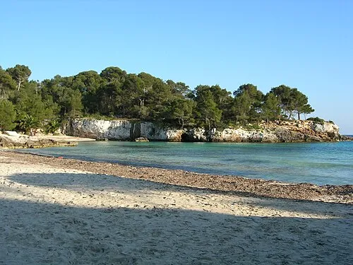 Playa en Turqueta Beach, Ciutadella de Menorca11 km SE
-
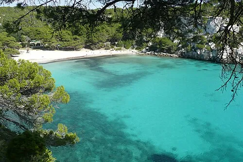 Cala Macarella Beach, Ciutadella de Menorca12 km SE
-
Platja de Bellavista Beach, Ciutadella de Menorca10 km SE
Sources & licences
Data last updated: