Fortaleza de la Mola
Located in Mahón, Balearic Islands Coordinates: 39°52′27″ N 4°18′43″ E
- Local time
- UTC+01:00
- Europe/Madrid · UTC+01:00
- Elevation
- 23 m
- above sea level
- Airports
- MAH Menorca Airport8 km
- PMI Palma de Mallorca Airport140 km
About Fortaleza de la Mola
Fortaleza de la Mola is a historic site. Location: Mahón, Balearic Islands. The best months to visit are May–July, September–October. The nearest airport is Menorca Airport (8 km). Nearby sights include Lazareto de Mahón and Castell de Sant Felip.
Photos of Fortaleza de la Mola
-
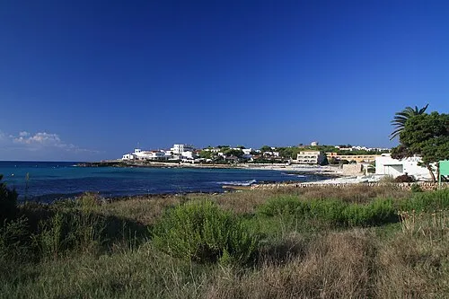
Playa Punta Prima Dreizung · CC BY-SA 3.0 -
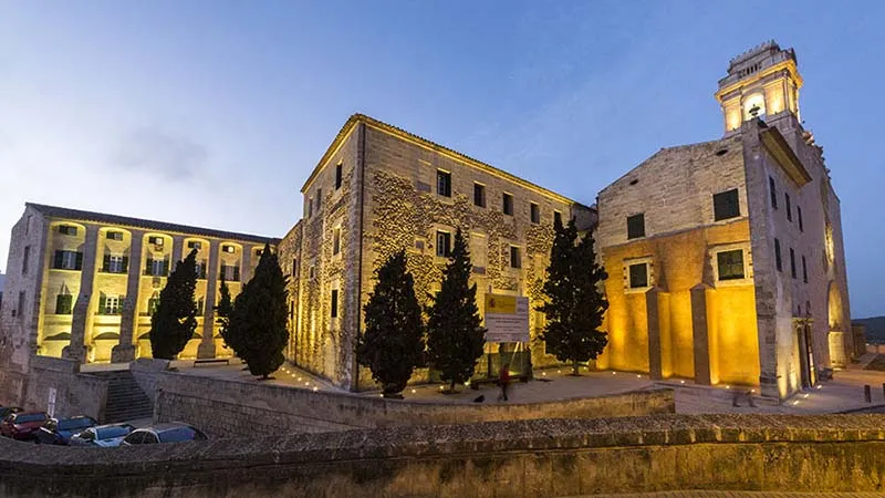
Museo de Menorca Tònia.Marti · CC BY-SA 4.0


Climate of Fortaleza de la Mola
Best months for sightseeingBest months for sightseeing: May–July, September–October.
This month · November
Outside the best season
Day 18° · Night 11° · Rain 73 mm
- Hottest month
- August (day 29°)
- Coldest month
- January (night 8°)
- Wettest month
- October (83 mm)
- Driest month
- July (3 mm)
Bars: average monthly low and high temperature. Below: precipitation. Monthly averages for 1970–2000 at about 18 km resolution, adjusted for elevation. Highlighted months are mild and relatively dry. Source: WorldClim 2.1 (CC BY 4.0).
Show values as a table
| Month | Jan | Feb | Mar | Apr | May | Jun | Jul | Aug | Sep | Oct | Nov | Dec |
|---|---|---|---|---|---|---|---|---|---|---|---|---|
| Average high (°C) | 14° | 14° | 16° | 18° | 21° | 25° | 29° | 29° | 26° | 22° | 18° | 15° |
| Average low (°C) | 8° | 8° | 8° | 10° | 14° | 17° | 20° | 21° | 19° | 15° | 11° | 9° |
| Precipitation (mm) | 61 | 50 | 46 | 49 | 33 | 15 | 3 | 22 | 53 | 83 | 73 | 68 |
Other places to visit in this season: May June July September October
How to get to Fortaleza de la Mola
The nearest airport is Menorca Airport (MAH), 8 km to the west as the crow flies. The nearest large city is Palma, 146 km to the west.
Airports
- Menorca Airport (MAH) Mahón (Maó) 8 kmwest
- Palma de Mallorca Airport (PMI) Palma de Mallorca 140 kmwest
- Josep Tarradellas Barcelona-El Prat Airport (BCN) Barcelona 246 kmnorthwest
Nearby large cities
- Palma Population: 438.2K 146 kmwest
- Mataró Population: 127K 243 kmnorthwest
- Badalona Population: 217.7K 247 kmnorthwest
- Sant Martí Population: 235.7K 248 kmnorthwest
- Barcelona Population: 1.7M 248 kmnorthwest
Straight-line distances; road distances are longer. Airport data: OurAirports.
Day trips from Fortaleza de la Mola
Within 100 km: 54 historic and cultural sites, 35 natural sites, 61 lakes, rivers and coasts.
0–25 km61 places
- Minorca Island 23 kmNW
- Cala Biniancolla Beach 8 kmSW
- Isla Colom Island 10 kmN
- Museo Militar de Menorca Museum 2 kmW
25–60 km46 places
- Playa de sa Farola Beach 44 kmW
- Platja Gran Beach 43 kmW
- Cabo Menorca Natural site 47 kmW
- Auditori de Ferreries Attraction 28 kmNW
60–100 km43 places
- Badia de Pollença Natural site 100 kmW
- Cap de Menorca Natural site 95 kmW
- Cala Torta Beach 78 kmW
- Ermita de Betlem Attraction 87 kmW
Straight-line distances.
Nearby attractions & nature
Everything nearby-
Lazareto de Mahón Museum, Mahón0.7 km W
-
Castell de Sant Felip Historic site, Es Castell1.1 km SW
-
Mahon DGPS-Transmitter Landmark, Es Castell1.1 km SW
-
Punta s'Espero Light Landmark, Mahón1.3 km E
-
Fort Marlborough Historic site, Es Castell1.6 km SW
-
Museo Militar de Menorca Museum, Es Castell1.9 km W
-
Illa de l'hospital Museum, Mahón2.5 km NW
-
Museo de Menorca Museum, Mahón4.8 km NW
Nearest towns and villages
-
Es Castell Town, Es Castell1.9 km W
-
Es Castell Municipality, Balearic Islands2.3 km W
-
Maó Town, Mahón4.3 km W
-
Cala Llonga Village, Mahón2 km NW
Sources & licences
Data last updated: