- Population
- 161
- 161
- Elevation
- 696 m
- above sea level
- Local time
- UTC+01:00
- Europe/Madrid · UTC+01:00
- Airports
- VLL Valladolid Airport62 km
- SLM Salamanca Airport72 km
About Gallegos del Pan
Gallegos del Pan is a village. Location: Gallegos del Pan, Zamora. Population: 161. Elevation: 696 m. The best months to visit are May–September. The nearest airport is Valladolid Airport (62 km). Nearby sights include Río Salado and Teatro Principal.
Climate of Gallegos del Pan
Best months for sightseeingBest months for sightseeing: May–September.
This month · November
Outside the best season
Day 13° · Night 4° · Rain 65 mm
- Hottest month
- July (day 29°)
- Coldest month
- January (night 0°)
- Wettest month
- December (74 mm)
- Driest month
- August (16 mm)
Bars: average monthly low and high temperature. Below: precipitation. Monthly averages for 1970–2000 at about 18 km resolution, adjusted for elevation. Highlighted months are mild and relatively dry. Source: WorldClim 2.1 (CC BY 4.0).
Show values as a table
| Month | Jan | Feb | Mar | Apr | May | Jun | Jul | Aug | Sep | Oct | Nov | Dec |
|---|---|---|---|---|---|---|---|---|---|---|---|---|
| Average high (°C) | 9° | 11° | 14° | 16° | 20° | 25° | 29° | 29° | 25° | 18° | 13° | 9° |
| Average low (°C) | 0° | 1° | 3° | 5° | 8° | 11° | 14° | 14° | 11° | 7° | 4° | 2° |
| Precipitation (mm) | 67 | 59 | 39 | 50 | 54 | 39 | 17 | 16 | 36 | 61 | 65 | 74 |
Other places to visit in this season: May June July August September
How to get to Gallegos del Pan
The nearest airport is Valladolid Airport (VLL), 62 km to the east as the crow flies. The nearest large city is Salamanca, 70 km to the south.
Airports
- Valladolid Airport (VLL) Valladolid 62 kmeast
- Salamanca Airport (SLM) Salamanca 72 kmsouth
- Bragança Airport (BGC) Bragança 98 kmwest
Nearby large cities
- Salamanca Population: 144.8K 70 kmsouth
- Valladolid Population: 300.6K 72 kmeast
- León Population: 124.8K 111 kmnorth
- Burgos Population: 176.4K 176 kmnortheast
- Oviedo Population: 220K 197 kmnorth
Straight-line distances; road distances are longer. Airport data: OurAirports.
Day trips from Gallegos del Pan
Within 100 km: 137 historic and cultural sites, 49 natural sites, 209 lakes, rivers and coasts.
0–25 km39 places
- Monte de la Reina Natural site 11 kmSE
- Tres Arboles Park Natural site 17 kmSW
- Parque Ignacio Sarda Natural site 17 kmSW
- Parque de La Marina Española Natural site 17 kmSW
25–60 km91 places
- Embalse de Ricobayo Lake 25 kmNW
- Embalse del Esla Lake 29 kmW
- Teso Santo Mountain 48 kmSW
- Campanario Mountain 44 kmNW
60–100 km265 places
- Sierra de Casica Mountain 72 kmW
- Sierra de Peña Negra Mountain 96 kmNW
- Peña Mira Mountain 82 kmNW
- Sierra de la Culebra Mountain 65 kmNW
Straight-line distances.
Nearby attractions & nature
Everything nearby-
Río Salado River, Zamora7.6 km W
-
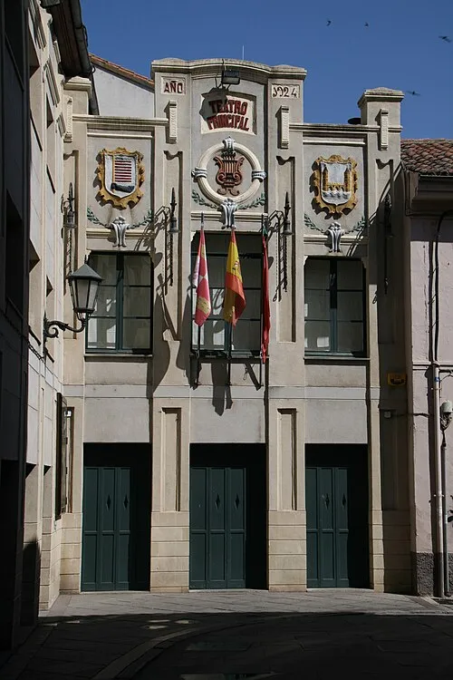 Teatro Principal Attraction, Zamora17 km SW
-
Monte de la Reina Natural site, Toro11 km SE
-
Ctre. Aldehuela Mediumwave Transmitter Landmark, Zamora14 km SW
-
Arroyo Talanda River, Villalazán10 km S
-
Zamora transmitter Landmark, Zamora15 km SW
Sources & licences
Data last updated: