Navahermosa
Located in Province of Toledo, Castille-La Mancha Coordinates: 39°39′23″ N 4°28′19″ W

- Population
- 4,143
- 4.1K
- Elevation
- 689 m
- above sea level
- Local time
- UTC+01:00
- Europe/Madrid · UTC+01:00
- Places inside
- 1
- listed under Navahermosa
- Airports
- MAD Adolfo Suárez Madrid–Barajas Airport121 km
- SLM Salamanca Airport168 km
About Navahermosa
Navahermosa is a municipality. Location: Province of Toledo, Castille-La Mancha. Population: 4,143. Elevation: 689 m.
Navahermosa is a village in the province of Toledo and autonomous community of Castile-La Mancha, Spain.
Source: Wikipedia · CC BY-SA 4.0
Photos of Navahermosa
-

LBM1948 · CC BY-SA 4.0 -

LBM1948 · CC BY-SA 4.0 -

Rodelar · CC BY-SA 4.0


Places bordering Navahermosa
- Hontanar
- Menasalbas
Population of Navahermosa over time
| 2014 | 3,972 | |
|---|---|---|
| 2015 | 3,878 | |
| 2016 | 3,818 | |
| 2017 | 3,738 | |
| 2018 | 3,647 | |
| 2019 | 3,609 | |
| 2020 | 3,564 | |
| 2021 | 3,600 | |
| 2022 | 3,586 | |
| 2023 | 3,618 | |
| 2024 | 3,592 | |
| 2025 | 3,587 |
Censuses and official estimates; source: Wikidata.
Climate of Navahermosa
Best months for sightseeingBest months for sightseeing: May–June, September–October.
This month · November
Outside the best season
Day 14° · Night 6° · Rain 54 mm
Better nearby cities in November
- Seville · 285 km southwest20°
- Dos Hermanas · 292 km southwest20°
- Málaga · 327 km south20°
- Hottest month
- July (day 32°)
- Coldest month
- January (night 2°)
- Wettest month
- December (60 mm)
- Driest month
- August (10 mm)
Bars: average monthly low and high temperature. Below: precipitation. Monthly averages for 1970–2000 at about 18 km resolution, adjusted for elevation. Highlighted months are mild and relatively dry. Source: WorldClim 2.1 (CC BY 4.0).
Show values as a table
| Month | Jan | Feb | Mar | Apr | May | Jun | Jul | Aug | Sep | Oct | Nov | Dec |
|---|---|---|---|---|---|---|---|---|---|---|---|---|
| Average high (°C) | 10° | 12° | 16° | 17° | 22° | 27° | 32° | 32° | 27° | 20° | 14° | 11° |
| Average low (°C) | 2° | 3° | 5° | 7° | 10° | 15° | 18° | 18° | 14° | 10° | 6° | 3° |
| Precipitation (mm) | 47 | 41 | 35 | 51 | 52 | 34 | 12 | 10 | 26 | 51 | 54 | 60 |
Other places to visit in this season: May June September October
How to get to Navahermosa
The nearest airport is Adolfo Suárez Madrid–Barajas Airport (MAD), 121 km to the northeast as the crow flies. The nearest large city is Parla, 88 km to the northeast.
Airports
- Adolfo Suárez Madrid–Barajas Airport (MAD) Madrid 121 kmnortheast
- Salamanca Airport (SLM) Salamanca 168 kmnorthwest
- Córdoba Airport (ODB) Córdoba 204 kmsouth
Nearby large cities
- Parla Population: 115.6K 88 kmnortheast
- Móstoles Population: 207.1K 90 kmnortheast
- Fuenlabrada Population: 190.5K 91 kmnortheast
- Alcorcón Population: 172.4K 94 kmnortheast
- Getafe Population: 187.5K 96 kmnortheast
Straight-line distances; road distances are longer. Airport data: OurAirports.
Day trips from Navahermosa
Within 100 km: 223 historic and cultural sites, 127 natural sites, 233 lakes, rivers and coasts.
0–25 km20 places
- Pantano del Torcón Lake 10 kmSE
- Montes de Toledo Mountain 17 kmSE
- Corocho de Rocigalgo Mountain 19 kmSW
- Arroyo de la Yedra River 10 kmSE
25–60 km127 places
- Embalse de Cijara Lake 50 kmSW
- Sierra del Trincheto Mountain 58 kmSE
- Sierra de Palancosillo Mountain 60 kmS
- Cerro de Layos Mountain 39 kmE
60–100 km436 places
- Laguna de Valparaíso Lake 74 kmS
- Embalse de Valdecañas Lake 84 kmW
- Laguna de San Pedro Lake 95 kmSW
- Laguna Romani Lake 84 kmSE
Straight-line distances.
Places in Navahermosa
1 placeBar: population relative to the most populous place in this list.
Nearby attractions & nature
Everything nearby-
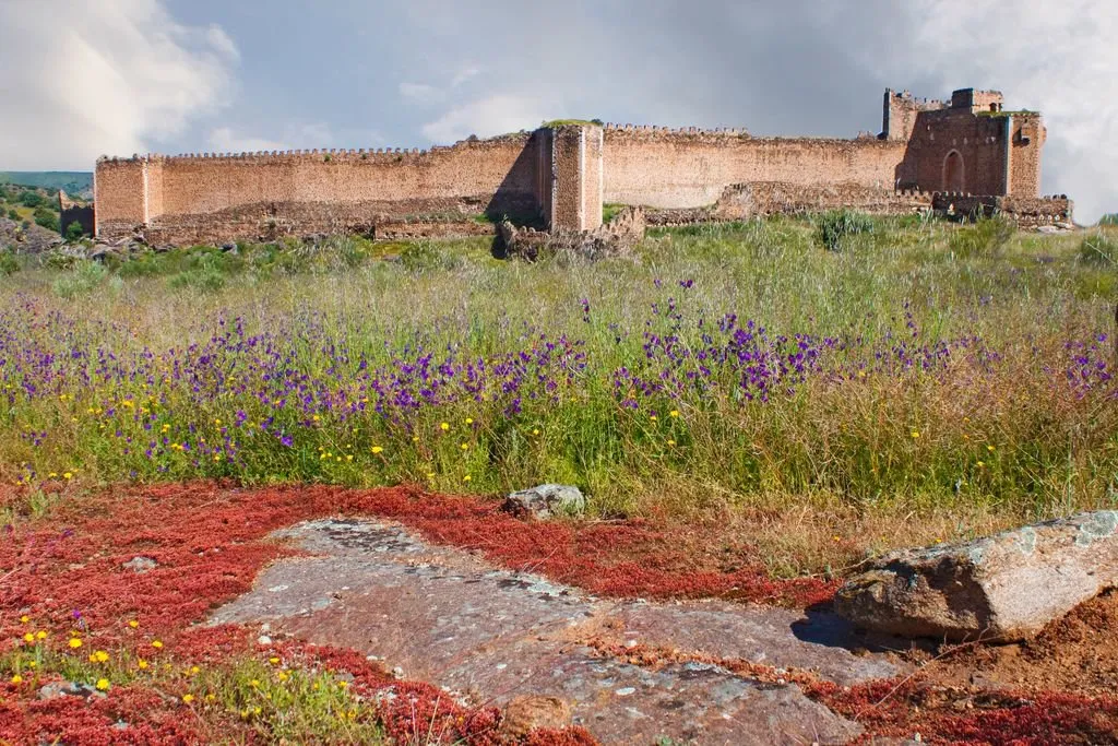 Castle of Montalbán Historic site, San Martín de Montalbán12 km N
-
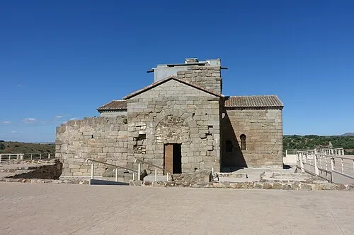 Santa María de Melque Attraction, San Martín de Montalbán14 km NE
-
Arroyo Jimena River, Menasalbas8.6 km SE
-
Arroyo de la Yedra River, San Pablo de los Montes10 km SE
-
Pantano del Torcón Lake, Menasalbas10 km SE
-
Arroyo del Mimbre River, Villarejo de Montalbán9.9 km N
-
Arroyo de Villapalos River, Menasalbas12 km SE
-
Montes de Toledo Mountain, Spain17 km SE
Other cities and towns in Province of Toledo
-
 San Pablo de los Montes Municipality, Province of Toledo19 km SE
-
 Cuerva Municipality, Province of Toledo22 km E
-
 Pulgar Municipality, Province of Toledo27 km E
-
 Santa Ana de Pusa Municipality, Province of Toledo24 km NW
-
Puebla de Montalbán, La Municipality, Province of Toledo20 km NE
-
 Noez Municipality, Province of Toledo29 km E
Sources & licences
Data last updated: · 2 independent sources