Santa Ana de Pusa
Located in Province of Toledo, Castille-La Mancha Coordinates: 39°45′37″ N 4°42′42″ W

- Population
- 512
- 512
- Elevation
- 593 m
- above sea level
- Local time
- UTC+01:00
- Europe/Madrid · UTC+01:00
- Places inside
- 1
- listed under Santa Ana de Pusa
- Airports
- MAD Adolfo Suárez Madrid–Barajas Airport127 km
- SLM Salamanca Airport148 km
About Santa Ana de Pusa
Santa Ana de Pusa is a municipality. Location: Province of Toledo, Castille-La Mancha. Population: 512. Elevation: 593 m.
Santa Ana de Pusa is a municipality located in the province of Toledo, Castile-La Mancha, Spain. According to the 2006 census (INE), the municipality has a population of 411 inhabitants.
Source: Wikipedia · CC BY-SA 4.0
Photos of Santa Ana de Pusa
-

LBM1948 · CC BY-SA 4.0 -

Centro Nacional de Información Geográfica · CC BY 4.0 -

Rodelar · CC BY-SA 4.0 -

Rodelar · CC BY-SA 4.0 -

LBM1948 · CC BY-SA 4.0


Places bordering Santa Ana de Pusa
- Alcaudete de la Jara
Population of Santa Ana de Pusa over time
| 2014 | 437 | |
|---|---|---|
| 2015 | 449 | |
| 2016 | 413 | |
| 2017 | 397 | |
| 2018 | 365 | |
| 2019 | 353 | |
| 2020 | 350 | |
| 2021 | 346 | |
| 2022 | 358 | |
| 2023 | 346 | |
| 2024 | 342 | |
| 2025 | 345 |
Censuses and official estimates; source: Wikidata.
Climate of Santa Ana de Pusa
Best months for sightseeingBest months for sightseeing: May–June, September–October.
This month · November
Outside the best season
Day 15° · Night 5° · Rain 46 mm
Better nearby cities in November
- Seville · 286 km southwest20°
- Dos Hermanas · 295 km south20°
- Málaga · 339 km south20°
- Hottest month
- July (day 32°)
- Coldest month
- January (night 2°)
- Wettest month
- December (50 mm)
- Driest month
- July (9 mm)
Bars: average monthly low and high temperature. Below: precipitation. Monthly averages for 1970–2000 at about 18 km resolution, adjusted for elevation. Highlighted months are mild and relatively dry. Source: WorldClim 2.1 (CC BY 4.0).
Show values as a table
| Month | Jan | Feb | Mar | Apr | May | Jun | Jul | Aug | Sep | Oct | Nov | Dec |
|---|---|---|---|---|---|---|---|---|---|---|---|---|
| Average high (°C) | 11° | 13° | 16° | 18° | 22° | 28° | 32° | 32° | 27° | 20° | 15° | 11° |
| Average low (°C) | 2° | 3° | 5° | 7° | 10° | 14° | 17° | 17° | 14° | 10° | 5° | 3° |
| Precipitation (mm) | 40 | 37 | 29 | 41 | 42 | 30 | 9 | 9 | 23 | 43 | 46 | 50 |
Other places to visit in this season: May June September October
How to get to Santa Ana de Pusa
The nearest airport is Adolfo Suárez Madrid–Barajas Airport (MAD), 127 km to the northeast as the crow flies. The nearest large city is Móstoles, 95 km to the northeast.
Airports
- Adolfo Suárez Madrid–Barajas Airport (MAD) Madrid 127 kmnortheast
- Salamanca Airport (SLM) Salamanca 148 kmnorthwest
- Badajoz Airport (BJZ) Badajoz 206 kmsouthwest
Nearby large cities
- Móstoles Population: 207.1K 95 kmnortheast
- Parla Population: 115.6K 96 kmnortheast
- Fuenlabrada Population: 190.5K 98 kmnortheast
- Alcorcón Population: 172.4K 100 kmnortheast
- Leganés Population: 188.4K 103 kmnortheast
Straight-line distances; road distances are longer. Airport data: OurAirports.
Day trips from Santa Ana de Pusa
Within 100 km: 166 historic and cultural sites, 118 natural sites, 240 lakes, rivers and coasts.
0–25 km27 places
- La Picaza Mountain 21 kmW
- Alameda Park Natural site 24 kmNW
- Cañillo Park Natural site 24 kmNW
- Arroyo de Tamujoso River 24 kmW
25–60 km132 places
- Pantano del Torcón Lake 34 kmSE
- Embalse de Cijara Lake 50 kmS
- Sierra de Altamira Mountain 45 kmSW
- Montes de Toledo Mountain 40 kmSE
60–100 km365 places
- Laguna de Valparaíso Lake 89 kmS
- Embalse de Valdecañas Lake 62 kmW
- Laguna de San Pedro Lake 89 kmSW
- Laguna Redonda Lake 84 kmSW
Straight-line distances.
Places in Santa Ana de Pusa
1 placeBar: population relative to the most populous place in this list.
Nearby attractions & nature
Everything nearby-
Arroyo de la Fresneda River, Alcaudete de la Jara7.1 km SW
-
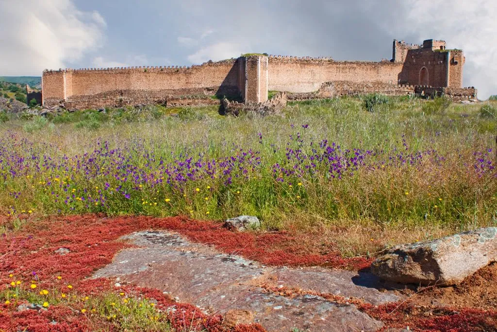 Castle of Montalbán Historic site, San Martín de Montalbán25 km E
-
La Picaza Mountain, Belvís de la Jara21 km W
-
Arroyo Guijo River, Villarejo de Montalbán13 km E
-
Museo Etnografico Museum, Talavera de la Reina24 km NW
-
Plaza de Toros la Caprichosa Attraction, Talavera de la Reina24 km NW
-
Basílica Nuestra Señora del Prado Attraction, Talavera de la Reina24 km NW
-
Iglesia Santa María la Mayor Attraction, Talavera de la Reina24 km NW
Other cities and towns in Province of Toledo
-
 Talavera de la Reina Municipality, Province of Toledo25 km NW
-
 Espinoso del Rey Municipality, Province of Toledo15 km SW
-
Navalmorales, Los Municipality, Province of Toledo10 km SE
-
 Navahermosa Municipality, Province of Toledo24 km SE
-
 Torrecilla de la Jara Municipality, Province of Toledo15 km SW
-
 Calera y Chozas Municipality, Province of Toledo29 km NW
Sources & licences
Data last updated: · 2 independent sources