
- Population
- 11,800
- 11.8K
- Elevation
- 130 m
- above sea level
- Local time
- UTC+01:00
- Europe/Madrid · UTC+01:00
- Airports
- BCN Josep Tarradellas Barcelona-El Prat Airport11 km
- GRO Girona-Costa Brava Airport79 km
About Pedralbes
Pedralbes is a neighbourhood. Location: Les Corts, Barcelona. Population: 11,800.
Pedralbes (Catalan pronunciation: [pəˈðɾalβəs], Old Catalan for white stones, Spanish pronunciation: [peˈðɾalβes]) is a neighborhood in Les Corts district of Barcelona, Catalonia (Spain). Before the administrative division of 1984, the neighborhood was part of Sarrià and the former municipality of Sant Vicenç de Sarrià. Pedralbes was the home of the Infanta Cristina of Spain from 2004 to 2013. The Lycée Français de Barcelone, a French international school, is located in Pedralbes.
Source: Wikipedia · CC BY-SA 4.0
At a glance
- Area
- 2.7 km²
Source: Wikidata
Photos of Pedralbes
-

Bengt Nyman from Vaxholm, Sweden · CC BY 2.0 -

pere prlpz · CC BY-SA 3.0 -

pere prlpz · CC BY-SA 3.0 -

Pere López Brosa · CC BY-SA 4.0 -

Pere López Brosa · CC BY-SA 4.0


Climate of Pedralbes
Best months for sightseeingBest months for sightseeing: May–July, September–October.
This month · November
Outside the best season
Day 16° · Night 8° · Rain 58 mm
- Hottest month
- August (day 28°)
- Coldest month
- January (night 4°)
- Wettest month
- October (82 mm)
- Driest month
- July (27 mm)
Bars: average monthly low and high temperature. Below: precipitation. Monthly averages for 1970–2000 at about 18 km resolution, adjusted for elevation. Highlighted months are mild and relatively dry. Source: WorldClim 2.1 (CC BY 4.0).
Show values as a table
| Month | Jan | Feb | Mar | Apr | May | Jun | Jul | Aug | Sep | Oct | Nov | Dec |
|---|---|---|---|---|---|---|---|---|---|---|---|---|
| Average high (°C) | 13° | 14° | 16° | 18° | 21° | 25° | 28° | 28° | 25° | 21° | 16° | 13° |
| Average low (°C) | 4° | 5° | 7° | 8° | 12° | 16° | 19° | 19° | 16° | 12° | 8° | 5° |
| Precipitation (mm) | 44 | 34 | 46 | 49 | 59 | 47 | 27 | 58 | 79 | 82 | 58 | 52 |
Other places to visit in this season: May June July September October
How to get to Pedralbes
The nearest airport is Josep Tarradellas Barcelona-El Prat Airport (BCN), 11 km to the south as the crow flies. The nearest large city is L'Hospitalet de Llobregat, 4 km to the south.
Airports
- Josep Tarradellas Barcelona-El Prat Airport (BCN) Barcelona 11 kmsouth
- Girona-Costa Brava Airport (GRO) Girona 79 kmnortheast
- Reus Airport (REU) Reus 83 kmwest
Nearby large cities
- L'Hospitalet de Llobregat Population: 257K 4 kmsouth
- Barcelona Population: 1.7M 4 kmeast
- Sant Martí Population: 235.7K 8 kmnortheast
- Santa Coloma de Gramenet Population: 118.8K 11 kmnortheast
- Badalona Population: 217.7K 13 kmnortheast
Straight-line distances; road distances are longer. Airport data: OurAirports.
Day trips from Pedralbes
Within 100 km: 611 historic and cultural sites, 643 natural sites, 223 lakes, rivers and coasts.
0–25 km419 places
- Platja del Besòs Beach 10 kmE
- Platja de Badalona Beach 13 kmNE
- Barceloneta Beach Beach 7 kmE
- Platja de Sant Miquel Beach 7 kmE
25–60 km364 places
- Playa de Sant Simó Beach 34 kmNE
- Platja de Garbí Beach 51 kmNE
- Platja del Cavalló Beach 44 kmNE
- Playa Barà Beach 59 kmSW
60–100 km694 places
- Playa del Rincón Beach 86 kmSW
- Platja de Lloret Beach 70 kmNE
- Platja de Canyelles Beach 73 kmNE
- Cala del Vigatà Beach 87 kmNE
Straight-line distances.
Nearby attractions & nature
Everything nearby-
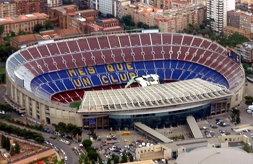 Camp Nou Landmark, Les Corts1.5 km SE
-
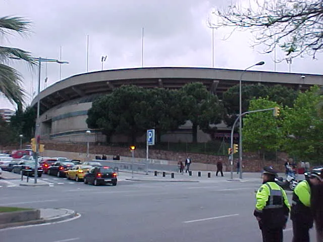 Mini Estadi Landmark, Les Corts1.3 km SE
-
Pedralbes Monastery Attraction, Les Corts0.6 km N
-
Jardins de William Shakespeare Attraction, Les Corts0.6 km E
-
Pedralbes Palace Historic site, Les Corts0.6 km E
-
Finca Güell Historic site, Les Corts0.8 km E
Sources & licences
Data last updated: · 2 independent sources