- Local time
- UTC+01:00
- Europe/Madrid · UTC+01:00
- Airports
- BCN Josep Tarradellas Barcelona-El Prat Airport25 km
- GRO Girona-Costa Brava Airport63 km
About Platja de Montgat
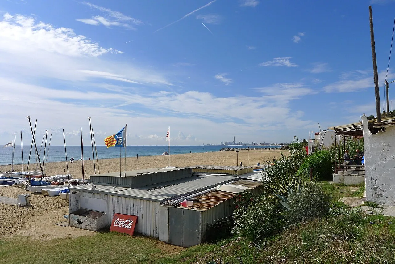
Platja de Montgat is a beach. Location: Montgat, Barcelona. The best months to visit are April–July, September–October. The nearest airport is Josep Tarradellas Barcelona-El Prat Airport (25 km). Nearby sights include Parc De Les Bateries and Playa Masnou.
Photos of Platja de Montgat
-

azxzcukl55 · CC0 -

Manuel C · CC BY-SA 4.0 -

candi... from Sabadell, España · CC BY 2.0 -

Msoengas · CC BY 3.0 -

Isidro Jabato · CC BY-SA 3.0


Climate of Platja de Montgat
Best months for sightseeingBest months for sightseeing: April–July, September–October.
This month · November
Outside the best season
Day 16° · Night 8° · Rain 55 mm
- Hottest month
- August (day 29°)
- Coldest month
- January (night 4°)
- Wettest month
- October (82 mm)
- Driest month
- July (25 mm)
Bars: average monthly low and high temperature. Below: precipitation. Monthly averages for 1970–2000 at about 18 km resolution, adjusted for elevation. Highlighted months are mild and relatively dry. Source: WorldClim 2.1 (CC BY 4.0).
Show values as a table
| Month | Jan | Feb | Mar | Apr | May | Jun | Jul | Aug | Sep | Oct | Nov | Dec |
|---|---|---|---|---|---|---|---|---|---|---|---|---|
| Average high (°C) | 13° | 14° | 16° | 18° | 21° | 25° | 28° | 29° | 26° | 21° | 16° | 14° |
| Average low (°C) | 4° | 5° | 7° | 8° | 12° | 16° | 19° | 19° | 17° | 12° | 8° | 6° |
| Precipitation (mm) | 46 | 36 | 44 | 46 | 55 | 44 | 25 | 56 | 74 | 82 | 55 | 52 |
Other places to visit in this season: April May June July September October
How to get to Platja de Montgat
The nearest airport is Josep Tarradellas Barcelona-El Prat Airport (BCN), 25 km to the southwest as the crow flies. The nearest large city is Badalona, 3 km to the southwest.
Airports
- Josep Tarradellas Barcelona-El Prat Airport (BCN) Barcelona 25 kmsouthwest
- Girona-Costa Brava Airport (GRO) Girona 63 kmnortheast
- Reus Airport (REU) Reus 100 kmwest
Nearby large cities
- Badalona Population: 217.7K 3 kmsouthwest
- Santa Coloma de Gramenet Population: 118.8K 6 kmwest
- Sant Martí Population: 235.7K 9 kmsouthwest
- Barcelona Population: 1.7M 13 kmsouthwest
- Mataró Population: 127K 16 kmnortheast
Straight-line distances; road distances are longer. Airport data: OurAirports.
Day trips from Platja de Montgat
Within 100 km: 603 historic and cultural sites, 703 natural sites, 240 lakes, rivers and coasts.
0–25 km424 places
- Platja del Besòs Beach 7 kmSW
- Platja de Badalona Beach 4 kmSW
- Playa de Sant Simó Beach 17 kmNE
- Barceloneta Beach Beach 12 kmSW
25–60 km416 places
- Platja de Lloret Beach 54 kmNE
- Platja de Canyelles Beach 57 kmNE
- es Llevador Beach 59 kmNE
- Cala de l'Ull de Vidre Beach 59 kmNE
60–100 km706 places
- Platja de Port Pelegrí Beach 88 kmNE
- Platgeta d'en Cosme Beach 88 kmNE
- Platja d'en Calau Beach 89 kmNE
- Platja d'Aiguablava Beach 94 kmNE
Straight-line distances.
Nearest towns and villages
Nearby attractions & nature
Everything nearby-
Parc De Les Bateries Natural site, Montgat0.9 km W
-
 Playa Masnou Beach, Barcelona2.2 km NE
-
Parc del Llac Natural site, Masnou, El2.3 km NE
-
Riera de Tiana River, Badalona1.2 km W
-
Vallmora Park Natural site, Masnou, El3.5 km NE
-
Ctra. Conseria Mediumwave Transmitter Landmark, Badalona1.6 km W
-
Parc de Nelson Mandela Natural site, Badalona3.8 km W
-
Platja d'Ocata Beach, Masnou, El3.6 km NE
Sources & licences
Data last updated: · 2 independent sources