
- Population
- 60
- 60
- Elevation
- 14 m
- above sea level
- Local time
- UTC+01:00
- Europe/Madrid · UTC+01:00
- Airports
- GRO Girona-Costa Brava Airport39 km
- PGF Perpignan-Rivesaltes (Llabanère) Airport70 km
About Sant Marti d'Empuries
Sant Marti d'Empuries is a village. Location: l'Escala, Girona. Population: 60. Elevation: 14 m.
Sant Martí d'Empúries is an entity of the town of L'Escala. It is located next to the ruins of Empúries or Empòrion. Ancient Greeks established the settlement in the 6th century BC. It was the county seat until 1079 Empúries moved to Castelló d'Empúries place less exposed to attack. Sant Martí d'Empúries is a staging point on the GR 92 long distance footpath, which roughly follows the length of the Mediterranean coast of Spain.
Source: Wikipedia · CC BY-SA 4.0
At a glance
- Architectural style
- Gothic architecture, vernacular architecture
- Heritage designation
- bien de interés cultural, Cultural Asset of National Interest
- Official website
- noticies.lescala-empuries.com
Source: Wikidata
Photos of Sant Marti d'Empuries
-
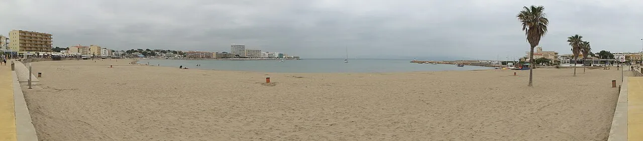
Platja dels Riells Isidro Jabato · CC BY-SA 4.0 -
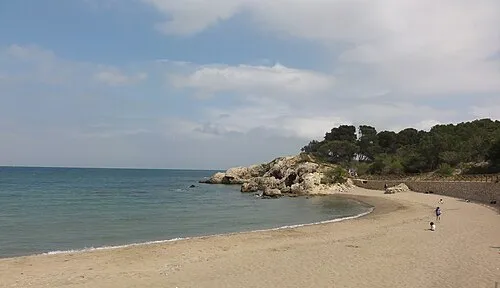
Platja del Portitxol Isidro Jabato · CC BY-SA 4.0 -
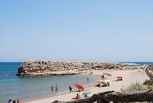
Platja del Moll Grec CésarOP · CC BY-SA 3.0 -
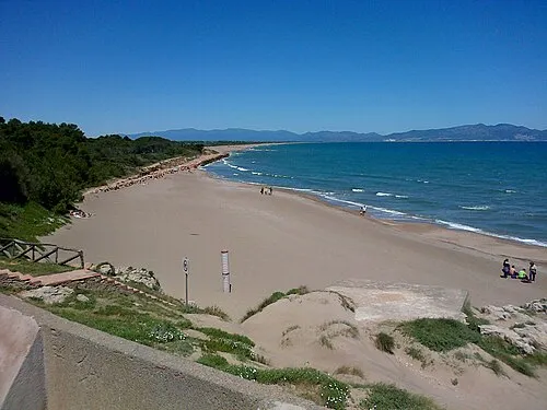
Platja de Riuet Castellbo · CC BY-SA 3.0 -
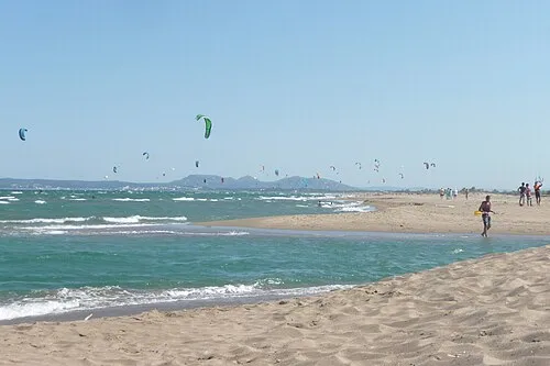
Platja de la Devesa Olga Gairin · CC BY-SA 3.0


Population of Sant Marti d'Empuries over time
| 1991 | 20 | |
|---|---|---|
| 2000 | 33 | |
| 2010 | 60 | |
| 2023 | 43 | |
| 2024 | 48 | |
| 2025 | 47 |
Censuses and official estimates; source: Wikidata.
Climate of Sant Marti d'Empuries
Best months for sightseeingBest months for sightseeing: May–July, September–October.
This month · November
Outside the best season
Day 16° · Night 7° · Rain 47 mm
- Hottest month
- July (day 28°)
- Coldest month
- January (night 3°)
- Wettest month
- October (78 mm)
- Driest month
- July (19 mm)
Bars: average monthly low and high temperature. Below: precipitation. Monthly averages for 1970–2000 at about 18 km resolution, adjusted for elevation. Highlighted months are mild and relatively dry. Source: WorldClim 2.1 (CC BY 4.0).
Show values as a table
| Month | Jan | Feb | Mar | Apr | May | Jun | Jul | Aug | Sep | Oct | Nov | Dec |
|---|---|---|---|---|---|---|---|---|---|---|---|---|
| Average high (°C) | 13° | 14° | 16° | 18° | 21° | 25° | 28° | 28° | 25° | 21° | 16° | 14° |
| Average low (°C) | 3° | 4° | 6° | 8° | 12° | 16° | 18° | 18° | 15° | 11° | 7° | 4° |
| Precipitation (mm) | 35 | 34 | 48 | 47 | 44 | 39 | 19 | 43 | 66 | 78 | 47 | 48 |
Other places to visit in this season: May June July September October
How to get to Sant Marti d'Empuries
The nearest airport is Girona-Costa Brava Airport (GRO), 39 km to the southwest as the crow flies. The nearest large city is Girona, 30 km to the southwest.
Airports
- Girona-Costa Brava Airport (GRO) Girona 39 kmsouthwest
- Perpignan-Rivesaltes (Llabanère) Airport (PGF) Perpignan/Rivesaltes 70 kmnorth
- Josep Tarradellas Barcelona-El Prat Airport (BCN) Barcelona 127 kmsouthwest
Nearby large cities
- Girona Population: 100.3K 30 kmsouthwest
- Perpignan Population: 110.7K 65 kmnorth
- Mataró Population: 127K 87 kmsouthwest
- Badalona Population: 217.7K 105 kmsouthwest
- Sabadell Population: 211.7K 107 kmsouthwest
Straight-line distances; road distances are longer. Airport data: OurAirports.
Day trips from Sant Marti d'Empuries
Within 100 km: 290 historic and cultural sites, 966 natural sites, 268 lakes, rivers and coasts.
0–25 km216 places
- Platja de Port-alguer Beach 21 kmNE
- Platja d'Aiguablava Beach 24 kmS
- Platja d'en Malaret Beach 24 kmS
- Cala de l'Illa Roja Beach 20 kmSE
25–60 km596 places
- Platja de Perafita Beach 36 kmN
- Puig Joan Mountain 35 kmN
- Platja de Lloret Beach 54 kmSW
- Platja de Canyelles Beach 52 kmS
60–100 km712 places
- Playa de Sant Simó Beach 86 kmSW
- Platja del Camí de la Pomereda Beach 63 kmSW
- Platja de Garbí Beach 71 kmSW
- Platja del Cavalló Beach 77 kmSW
Straight-line distances.
Nearby attractions & nature
Everything nearby-
Platja de Riuet Beach, l'Escala0.1 km N
-
Platja del Moll Grec Beach, l'Escala0.6 km SE
-
Iglésia de Sant Martí d'Empúries Attraction, l'Escala<0.1 km NE
-
Platja d'Empúries Beach, l'Escala0.2 km SE
-
Platja del Portitxol Beach, l'Escala1 km S
-
MAC Empúries Museum, l'Escala0.6 km S
Sources & licences
Data last updated: · 2 independent sources