- Elevation
- 10 m
- above sea level
- Local time
- UTC+01:00
- Europe/Madrid · UTC+01:00
- Airports
- GRO Girona-Costa Brava Airport25 km
- BCN Josep Tarradellas Barcelona-El Prat Airport83 km
About Cala d'en Carlos
Cala d'en Carlos is a beach. Location: Tossa de Mar, Girona. The best months to visit are May–July, September–October. The nearest airport is Girona-Costa Brava Airport (25 km). Nearby sights include Platja de Llevant de Llorell and Cala de l'Ull de Vidre.
Climate of Cala d'en Carlos
Best months for sightseeingBest months for sightseeing: May–July, September–October.
This month · November
Outside the best season
Day 17° · Night 7° · Rain 64 mm
- Hottest month
- July (day 29°)
- Coldest month
- January (night 4°)
- Wettest month
- October (87 mm)
- Driest month
- July (28 mm)
Bars: average monthly low and high temperature. Below: precipitation. Monthly averages for 1970–2000 at about 18 km resolution, adjusted for elevation. Highlighted months are mild and relatively dry. Source: WorldClim 2.1 (CC BY 4.0).
Show values as a table
| Month | Jan | Feb | Mar | Apr | May | Jun | Jul | Aug | Sep | Oct | Nov | Dec |
|---|---|---|---|---|---|---|---|---|---|---|---|---|
| Average high (°C) | 13° | 14° | 16° | 18° | 21° | 25° | 29° | 29° | 26° | 21° | 17° | 14° |
| Average low (°C) | 4° | 5° | 6° | 8° | 12° | 16° | 18° | 19° | 16° | 12° | 7° | 5° |
| Precipitation (mm) | 56 | 42 | 57 | 60 | 64 | 52 | 28 | 53 | 74 | 87 | 64 | 66 |
Other places to visit in this season: May June July September October
How to get to Cala d'en Carlos
The nearest airport is Girona-Costa Brava Airport (GRO), 25 km to the northwest as the crow flies. The nearest large city is Girona, 31 km to the north.
Airports
- Girona-Costa Brava Airport (GRO) Girona 25 kmnorthwest
- Josep Tarradellas Barcelona-El Prat Airport (BCN) Barcelona 83 kmsouthwest
- Perpignan-Rivesaltes (Llabanère) Airport (PGF) Perpignan/Rivesaltes 114 kmnorth
Nearby large cities
- Girona Population: 100.3K 31 kmnorth
- Mataró Population: 127K 43 kmsouthwest
- Badalona Population: 217.7K 62 kmsouthwest
- Santa Coloma de Gramenet Population: 118.8K 65 kmsouthwest
- Sant Martí Population: 235.7K 67 kmsouthwest
Straight-line distances; road distances are longer. Airport data: OurAirports.
Day trips from Cala d'en Carlos
Within 100 km: 561 historic and cultural sites, 896 natural sites, 270 lakes, rivers and coasts.
0–25 km175 places
- Platja de Lloret Beach 5 kmW
- Platja de Canyelles Beach 2 kmW
- Cala del Vigatà Beach 12 kmNE
- Cala de Salionç Beach 6 kmNE
25–60 km446 places
- Playa de Sant Simó Beach 42 kmSW
- Platja de Port Pelegrí Beach 30 kmNE
- Platgeta d'en Cosme Beach 30 kmNE
- Platja d'en Calau Beach 30 kmNE
60–100 km1,106 places
- Platja de Perafita Beach 86 kmN
- Puig Joan Mountain 85 kmN
- Platja del Besòs Beach 65 kmSW
- Platja de Badalona Beach 63 kmSW
Straight-line distances.
Nearest towns and villages
-
Tossa de Mar Town, Tossa de Mar2.3 km E
-
Lloret de Mar Municipality, Girona4.4 km W
-
Lloret de Mar Town, Lloret de Mar5.2 km W
-
Sant Eloi Village, Tossa de Mar2.1 km N
-
Blanes Municipality, Girona9.9 km W
-
Blanes Town, Blanes11 km W
Nearby attractions & nature
Everything nearby-
Platja de Llevant de Llorell Beach, Tossa de Mar0.2 km W
-
Cala de l'Ull de Vidre Beach, Tossa de Mar0.1 km E
-
es Llevador Beach, Tossa de Mar0.3 km E
-
Platja de Garbí de Llorell Beach, Tossa de Mar0.4 km W
-
Platja de Portopí Beach, Tossa de Mar0.7 km W
-
Platja de sa Somera Beach, Lloret de Mar2 km W
-
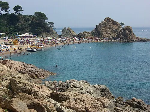 Platja de la Mar Menuda Beach, Tossa de Mar2.9 km NE
-
Cap de Tossa Natural site, Tossa de Mar2.4 km E
More lakes, rivers and coasts in Spain
-
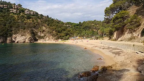 Cala de Giverola Beach, Tossa de Mar4.9 km NE
-
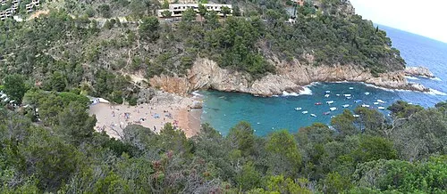 Cala Pola Beach, Tossa de Mar4.4 km NE
-
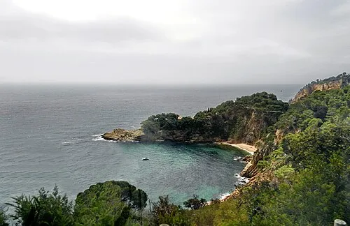 Cala Fotedera Beach, Tossa de Mar5.2 km NE
-
es Codolar Beach, Tossa de Mar2.2 km E
-
sa Platja Beach, Tossa de Mar2.4 km NE
-
Platja de Vallpresona Beach, Tossa de Mar7.1 km NE
Sources & licences
Data last updated: