- Elevation
- 565 m
- above sea level
- Local time
- UTC+01:00
- Europe/Madrid · UTC+01:00
- Airports
- ILD Lleida-Alguaire Airport49 km
- LEU Pirineus - la Seu d'Urgel Airport62 km
About Barranc del Pont
Barranc del Pont is a river. Location: Tremp, Lleida.
In comparison
- 8 sights and natural places within 10 km Mont-rebei, Castell de Girbeta
Climate of Barranc del Pont
Best months for sightseeingBest months for sightseeing: May–June, September–October.
Bars: average monthly low and high temperature. Below: precipitation. Monthly averages for 1970–2000 at about 18 km resolution, adjusted for elevation. Highlighted months are mild and relatively dry. Source: WorldClim 2.1 (CC BY 4.0).
Show values as a table
| Month | Jan | Feb | Mar | Apr | May | Jun | Jul | Aug | Sep | Oct | Nov | Dec |
|---|---|---|---|---|---|---|---|---|---|---|---|---|
| Average high (°C) | 9° | 11° | 14° | 16° | 20° | 25° | 30° | 30° | 26° | 20° | 14° | 10° |
| Average low (°C) | 1° | 2° | 3° | 5° | 9° | 12° | 16° | 16° | 13° | 9° | 5° | 2° |
| Precipitation (mm) | 49 | 44 | 49 | 60 | 81 | 74 | 40 | 59 | 70 | 70 | 74 | 60 |
Other places to visit in this season: May June September October
Airports nearest to Barranc del Pont
- Lleida-Alguaire Airport (ILD) Lleida 49 km
- Pirineus - la Seu d'Urgel Airport (LEU) La Seu d'Urgell Pyrenees and Andorra 62 km
- Reus Airport (REU) Reus 118 km
Straight-line distance; airports with scheduled flights only. Source: OurAirports (public domain).
Nearest towns and villages
-
el Pont de Montanyana / Puente de Montañana Village, Puente de Montañana0.9 km W
-
Puente de Montañana Municipality, Huesca4 km NW
-
Montanyana Village, Puente de Montañana2.4 km W
-
Girbeta Village, Viacamp y Litera4.3 km S
-
Claramunt Village, Tremp7 km NE
-
Colls Village, Puente de Montañana5.7 km N
Nearby attractions & nature
Everything nearby-
Serra de l'Almúnia Mountain, Tolva7.6 km W
-
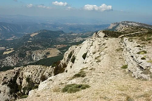 Sant Alís Mountain, Sant Esteve de la Sarga14 km S
-
Congost de Mont-rebei Natural site, Sant Esteve de la Sarga8.5 km S
-
Barranc de les Ortogues River, Viacamp y Litera6.1 km SW
-
Congost del Seguer Natural site, Àger9.8 km S
-
Mont-rebei Historic site, Sant Esteve de la Sarga5.3 km S
-
Tossal de Codonyac Mountain, Tremp12 km NE
-
la Tualdeta Mountain, Sant Esteve de la Sarga11 km S
Sources & licences
Data last updated: