- Elevation
- 26 m
- above sea level
- Local time
- UTC+01:00
- Europe/Madrid · UTC+01:00
- Airports
- VGO Vigo Airport25 km
- SCQ Santiago-Rosalía de Castro Airport91 km
About Río Termes
Río Termes is a river. Location: Salvaterra de Miño, Pontevedra. The best months to visit are May–September. The nearest airport is Vigo Airport (25 km). Nearby sights include Parque da Canuda and Río Deva.
Climate of Río Termes
Best months for sightseeingBest months for sightseeing: May–September.
This month · November
A wet month
Day 16° · Night 9° · Rain 176 mm
- Hottest month
- July (day 27°)
- Coldest month
- January (night 6°)
- Wettest month
- December (211 mm)
- Driest month
- July (28 mm)
Bars: average monthly low and high temperature. Below: precipitation. Monthly averages for 1970–2000 at about 18 km resolution, adjusted for elevation. Highlighted months are mild and relatively dry. Source: WorldClim 2.1 (CC BY 4.0).
Show values as a table
| Month | Jan | Feb | Mar | Apr | May | Jun | Jul | Aug | Sep | Oct | Nov | Dec |
|---|---|---|---|---|---|---|---|---|---|---|---|---|
| Average high (°C) | 13° | 14° | 17° | 18° | 21° | 25° | 27° | 27° | 25° | 21° | 16° | 13° |
| Average low (°C) | 6° | 6° | 8° | 9° | 12° | 14° | 16° | 16° | 15° | 12° | 9° | 7° |
| Precipitation (mm) | 177 | 170 | 147 | 110 | 107 | 63 | 28 | 37 | 81 | 149 | 176 | 211 |
Other places to visit in this season: May June July August September
How to get to Río Termes
The nearest airport is Vigo Airport (VGO), 25 km to the northwest as the crow flies. For international flights: Santiago-Rosalía de Castro Airport (SCQ) (91 km). The nearest large city is Vigo, 32 km to the northwest.
Airports
- Vigo Airport (VGO) Vigo 25 kmnorthwest
- Santiago-Rosalía de Castro Airport (SCQ) Santiago de Compostela 91 kmnorth
- Francisco de Sá Carneiro Airport (OPO) Porto 96 kmsouth
Nearby large cities
- Vigo Population: 293.6K 32 kmnorthwest
- Ourense Population: 105.2K 52 kmnortheast
- Braga Population: 193.3K 59 kmsouth
- Porto Population: 252.7K 105 kmsouth
- A Coruña Population: 250.4K 143 kmnorth
Straight-line distances; road distances are longer. Airport data: OurAirports.
Day trips from Río Termes
Within 100 km: 181 historic and cultural sites, 218 natural sites, 383 lakes, rivers and coasts.
0–25 km56 places
- Praia de Areeiros Beach 19 kmW
- Alto de Tilleira Mountain 19 kmN
- Alto da Serra Mountain 20 kmNE
- Peñagache Mountain 25 kmE
25–60 km379 places
- Illa de Ons Island 55 kmNW
- A Illa da Toxa Island 59 kmNW
- Islas Cíes Island 44 kmW
- Playa de San Martín Beach 43 kmW
60–100 km347 places
- Illa de Arousa Island 65 kmNW
- Praia da Lagoa Beach 76 kmNW
- Playa Vilagarcía Beach 66 kmNW
- Praia de Barraña Beach 74 kmNW
Straight-line distances.
Nearest towns and villages
Nearby attractions & nature
Everything nearby-
Parque da Canuda Natural site, Salvaterra de Miño8.9 km W
-
Río Deva River, Arbo9.8 km E
-
Río Cea River, Arbo6.7 km E
-
Chan de Vila Mountain, Mondariz11 km N
-
Alto do Fojo Mountain, Gavieira14 km SE
-
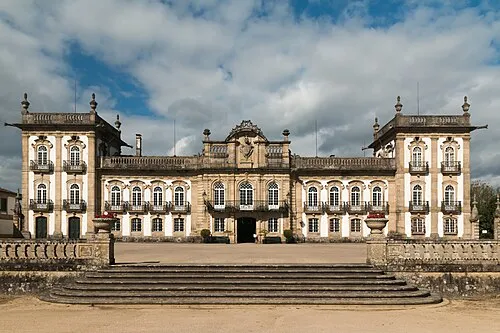 Brejoeira Palace Historic site, Pinheiros9.1 km SW
-
Río Caselas River, Galicia13 km W
-
Castelo de Salvaterra Historic site, Salvaterra de Miño8.1 km W
Sources & licences
Data last updated: