
- Population
- 2,198
- 2.2K
- Elevation
- 27 m
- above sea level
- Local time
- UTC+01:00
- Europe/Madrid · UTC+01:00
- Airports
- VGO Vigo Airport24 km
- SCQ Santiago-Rosalía de Castro Airport65 km
About Portonovo
Portonovo is a village. Location: Sanxenxo, Pontevedra. Population: 2,198. Elevation: 27 m.
Portonovo is a fishing village and tourist center within the municipality of Sanxenxo. It belongs to the parish of Adina. Situated in the Ria de Pontevedra, its climate is cold and rainy in winter and warm and sunny in summer. Tourism is the main economic engine of the town, and the temporary population in the summer months increases considerably. Three beaches are found along the coast for the town: Portonovo Beach (also known as Baltar Beach), Caneliñas and Canelas.
Source: Wikipedia · CC BY-SA 4.0
Photos of Portonovo
-

Luis Miguel Bugallo Sánchez · CC BY-SA 3.0 -

Vanbasten 23 · CC BY-SA 3.0 -

Lameiro · CC BY-SA 4.0 -

Lameiro · CC BY-SA 4.0 -

Lmbuga · CC BY 3.0


Climate of Portonovo
Best months for sightseeingBest months for sightseeing: June–September.
This month · November
A wet month
Day 15° · Night 10° · Rain 188 mm
- Hottest month
- August (day 24°)
- Coldest month
- January (night 7°)
- Wettest month
- December (221 mm)
- Driest month
- July (35 mm)
Bars: average monthly low and high temperature. Below: precipitation. Monthly averages for 1970–2000 at about 18 km resolution, adjusted for elevation. Highlighted months are mild and relatively dry. Source: WorldClim 2.1 (CC BY 4.0).
Show values as a table
| Month | Jan | Feb | Mar | Apr | May | Jun | Jul | Aug | Sep | Oct | Nov | Dec |
|---|---|---|---|---|---|---|---|---|---|---|---|---|
| Average high (°C) | 12° | 13° | 15° | 17° | 19° | 22° | 24° | 24° | 22° | 19° | 15° | 13° |
| Average low (°C) | 7° | 7° | 9° | 10° | 12° | 14° | 16° | 16° | 15° | 12° | 10° | 8° |
| Precipitation (mm) | 220 | 197 | 146 | 126 | 120 | 70 | 35 | 38 | 101 | 173 | 188 | 221 |
Other places to visit in this season: June July August September
How to get to Portonovo
The nearest airport is Vigo Airport (VGO), 24 km to the southeast as the crow flies. For international flights: Santiago-Rosalía de Castro Airport (SCQ) (65 km). The nearest large city is Vigo, 20 km to the southeast.
Airports
- Vigo Airport (VGO) Vigo 24 kmsoutheast
- Santiago-Rosalía de Castro Airport (SCQ) Santiago de Compostela 65 kmnortheast
- A Coruña Airport (LCG) Culleredo 107 kmnorth
Nearby large cities
- Vigo Population: 293.6K 20 kmsoutheast
- Ourense Population: 105.2K 79 kmeast
- Braga Population: 193.3K 99 kmsouth
- A Coruña Population: 250.4K 114 kmnorth
- Porto Population: 252.7K 140 kmsouth
Straight-line distances; road distances are longer. Airport data: OurAirports.
Day trips from Portonovo
Within 100 km: 166 historic and cultural sites, 173 natural sites, 364 lakes, rivers and coasts.
0–25 km269 places
- Illa de Arousa Island 18 kmN
- Illa de Ons Island 9 kmW
- A Illa da Toxa Island 11 kmN
- Islas Cíes Island 21 kmS
25–60 km193 places
- Praia da Lagoa Beach 26 kmNW
- Praia América Beach 29 kmS
- Praia de Barraña Beach 28 kmN
- Playa Da Torre Beach 30 kmN
60–100 km241 places
- Torres do Allo Landmark 85 kmN
- Playa de Mórdomo Beach 90 kmN
- Islote Villano de Fuera Island 91 kmN
- Embalse de Belesar Lake 94 kmE
Straight-line distances.
Nearby attractions & nature
Everything nearby-
Parque do Espiñeiro Natural site, Sanxenxo0.3 km N
-
Areas Gordas Beach, Sanxenxo0.5 km NE
-
Parque Do Vicaño Natural site, Sanxenxo0.8 km NE
-
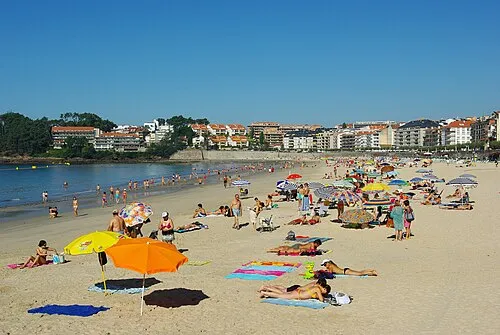 Playa del Silgar Beach, Pontevedra1.4 km NE
-
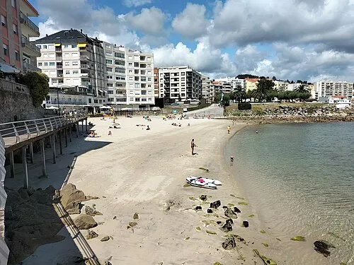 Lavapanos Beach, Sanxenxo1.9 km E
-
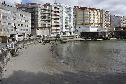 Panadeira Beach, Sanxenxo2.1 km E
Sources & licences
Data last updated: · 2 independent sources