Grado Municipality
Located in Asturias, Principality of Asturias Coordinates: 43°18′48″ N 6°05′59″ W

- Population
- 10,746
- 10.7K
- Elevation
- 615 m
- above sea level
- Local time
- UTC+01:00
- Europe/Madrid · UTC+01:00
- Places inside
- 79
- listed under Grado Municipality
- Airports
- OVD Asturias Airport28 km
- LEN León Airport88 km
About Grado Municipality
Grado Municipality is a municipality. Location: Asturias, Principality of Asturias. Population: 10,746. Elevation: 615 m.
Grado (Spanish pronunciation: [ˈɡɾaðo], commonly Grao; Asturian: Grau, and officially Grau/Grado) is a municipality in the Autonomous Community of the Principality of Asturias in Spain. It is bordered on the north by Candamo and Las Regueras, on the east by Proaza, Santo Adriano and Oviedo, on the south by Teverga and Yernes y Tameza, and on the west by Belmonte de Miranda and Salas. The municipality's capital town, also with the same name, is famous for its markets, celebrated every Wednesday and Sunday.
Source: Wikipedia · CC BY-SA 4.0
Photos of Grado Municipality
-

Luciagaro · CC BY-SA 4.0 -

Simon Burchell · CC BY-SA 4.0 -

Simon Burchell · CC BY-SA 4.0 -

Denissf · CC BY-SA 3.0 -

Denissf · CC BY-SA 3.0


Travel notes for Grado Municipality
From Wikivoyage
Grado is a town in Asturias in northern Spain, known in Asturian as Grau. With a population of 9700 in 2027, it's a commuter town for Oviedo 27 km east. The main reason to visit is that it's a stopover point on Camino Primitivo, the original line of the pilgrimage trail to Santiago.
Get in+
The nearest airport is Asturias (OVD IATA) near Avilés. A bus runs direct to Oviedo.
Grado is on A-63, a spur of A-66 from Oviedo.
ALSA buses run every 30 min from Oviedo, taking 40 min and making several stops in town.
1 Grado railway station is northeast end of town. Cercanías Train C7 grinds through the hills from Oviedo every 2 hours, taking 50 min, and continues north down the Nalón valley to San Esteban de Pravia on the coast. Change at Oviedo for trains from Madrid.
Source: Wikivoyage · CC BY-SA 4.0 · abridged
Places bordering Grado Municipality
- Proaza Municipality
- Santo Adriano Municipality
- Oviedo
- Yernes y Tameza Municipality
- Belmonte de Miranda
Population of Grado Municipality over time
| 2014 | 10,471 | |
|---|---|---|
| 2015 | 10,309 | |
| 2016 | 10,127 | |
| 2017 | 9,980 | |
| 2018 | 9,839 | |
| 2019 | 9,784 | |
| 2020 | 9,703 | |
| 2021 | 9,644 | |
| 2022 | 9,598 | |
| 2023 | 9,616 | |
| 2024 | 9,688 | |
| 2025 | 9,681 |
Censuses and official estimates; source: Wikidata.
Climate of Grado Municipality
Best months for sightseeingBest months for sightseeing: June–September.
This month · November
A wet month
Day 12° · Night 5° · Rain 116 mm
- Hottest month
- August (day 23°)
- Coldest month
- January (night 2°)
- Wettest month
- November (116 mm)
- Driest month
- August (48 mm)
Bars: average monthly low and high temperature. Below: precipitation. Monthly averages for 1970–2000 at about 18 km resolution, adjusted for elevation. Highlighted months are mild and relatively dry. Source: WorldClim 2.1 (CC BY 4.0).
Show values as a table
| Month | Jan | Feb | Mar | Apr | May | Jun | Jul | Aug | Sep | Oct | Nov | Dec |
|---|---|---|---|---|---|---|---|---|---|---|---|---|
| Average high (°C) | 9° | 11° | 13° | 14° | 17° | 21° | 23° | 23° | 21° | 17° | 12° | 10° |
| Average low (°C) | 2° | 2° | 4° | 5° | 8° | 11° | 13° | 13° | 11° | 8° | 5° | 3° |
| Precipitation (mm) | 107 | 95 | 85 | 109 | 100 | 60 | 52 | 48 | 63 | 108 | 116 | 114 |
Other places to visit in this season: June July August September
How to get to Grado Municipality
The nearest airport is Asturias Airport (OVD), 28 km to the north as the crow flies. The nearest large city is Oviedo, 21 km to the east.
Airports
- Asturias Airport (OVD) Ranón 28 kmnorth
- León Airport (LEN) La Virgen del Camino 88 kmsoutheast
- Bragança Airport (BGC) Bragança 169 kmsouth
Nearby large cities
- Oviedo Population: 220K 21 kmeast
- Gijón Population: 271.8K 43 kmnortheast
- León Population: 124.8K 90 kmsoutheast
- Ourense Population: 105.2K 181 kmsouthwest
- A Coruña Population: 250.4K 186 kmwest
Straight-line distances; road distances are longer. Airport data: OurAirports.
Day trips from Grado Municipality
Within 100 km: 156 historic and cultural sites, 100 natural sites, 122 lakes, rivers and coasts.
0–25 km48 places
- Sierra de Fontebona Mountain 21 kmN
- Monte Agudo Mountain 23 kmN
- Gamoniteiru Mountain 20 kmSE
- Campo de San Francisco Natural site 21 kmE
25–60 km175 places
- Playa de Santa Ana Beach 38 kmNW
- Playa de la Ñora Beach 49 kmNE
- Playa Cervigón Beach 46 kmNE
- Playón de Bayas Beach 29 kmN
60–100 km155 places
- Playa de San Antonio del Mar Beach 96 kmE
- Playa de Represas Beach 73 kmNW
- Praia de Paixás Beach 98 kmW
- Praia de Lobás Beach 97 kmW
Straight-line distances.
Places in Grado Municipality
79 places- 1 Grado 9.8K
- 2 Peñaflor 261
- 3 Castañedo 251
- 4 Fuejo (Grado) 71
- 5 Llantrales 56
- 6 Los Fornos 30
- 7 La Figal 6
- 8 La Cabaña 1
- 9 La Mata 1
Bar: population relative to the most populous place in this list.
Cities & villages47
- Acebedo · Village
- Ambás · Village
- Anzo · Village
- Ballongo · Village
- Barredo · Village
- Bárzana · Village
- Báscones · Village
- Baselgas · Village
- Bayo · Village
- Belandres · Village
- Berció · Village
- Borondes · Village
- Cabruñana · Village
- Cañedo · Village
- Coalla · Village
- Cubía · Village
- Cueto · Village
- El Fresno · Village
- El Lobio · Village
- El Palacio · Village
- Fondil · Village
- Gurullés · Village
- La Caleya · Village
- La Fueja · Village
- La Fuexa · Village
- Las Murias · Village
- Las Villas · Village
- La Vega · Village
- Llera · Village
- Loredo · Village
- Los Lodos · Village
- Momalo · Village
- Moutas · Village
- Nalió · Village
- Noceda · Village
- Pando · Village
- Panicera · Village
- Panizal · Village
- Pereda · Village
- Rañeces · Village
- Restiello · Village
- Robledo · Village
- Rodiles · Village
- Rubiano · Village
- Sama · Village
- San Miguel · Village
- San Pelayo-Sienra · Village
Lakes, rivers & coasts2
- Río Nora · River
- Río Pigueña · River
Heritage & sights2
- Centro Parroquial de Fuejo · Attraction
- Palacio de Báscones · Historic site
Nearby attractions & nature
Everything nearby-
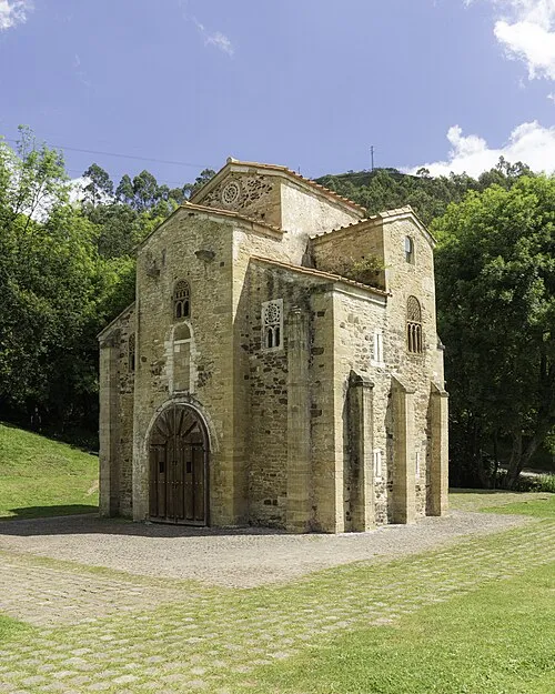 San Miguel de Lillo Attraction, Oviedo20 km E
-
 Estadio Carlos Tartiere Landmark, Oviedo19 km E
-
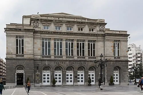 Teatro Campoamor Attraction, Oviedo21 km E
-
Peñaflor Bridge Landmark, Candamo11 km NE
-
Casa del Oso Museum, Proaza Municipality9.5 km SE
-
Río Trubia River, Oviedo11 km E
-
Monte Gamonedo Mountain, Cudillero Municipality24 km N
-
 San Julián de los Prados Attraction, Oviedo22 km E
Other cities and towns in Asturias
-
 Santo Adriano Municipality Municipality, Asturias9.9 km E
-
 Oviedo Municipality, Asturias19 km E
-
 Belmonte de Miranda Municipality, Asturias11 km W
-
 Proaza Municipality Municipality, Asturias10 km SE
-
 Pravia Municipality, Asturias20 km N
-
 Riosa Municipality Municipality, Asturias20 km SE
Sources & licences
Data last updated: · 2 independent sources