Pravia
Located in Asturias, Principality of Asturias Coordinates: 43°29′26″ N 6°09′03″ W

- Population
- 9,016
- 9K
- Elevation
- 262 m
- above sea level
- Local time
- UTC+01:00
- Europe/Madrid · UTC+01:00
- Places inside
- 49
- listed under Pravia
- Airports
- OVD Asturias Airport12 km
- LEN León Airport108 km
About Pravia
Pravia is a municipality. Location: Asturias, Principality of Asturias. Population: 9,016. Elevation: 262 m.
Pravia is a municipality in the Autonomous Community of the Principality of Asturias in Spain. It is bordered on the north by Cudillero and Muros de Nalón, on the east by Candamo and Soto del Barco, on the west by Cudillero and Salas, and on the south by Candamo and Salas. Since 774, when King Silo established his court at Santianes de Pravia, until the reign of Alfonso II, it was the capital of the kingdom of Asturias.
Source: Wikipedia · CC BY-SA 4.0
Photos of Pravia
-

Centro Nacional de Información Geográfica · CC BY 4.0 -

Centro Nacional de Información Geográfica · CC BY 4.0 -

LCAsturias · CC BY-SA 4.0 -

Asturkian · CC BY-SA 4.0 -

Earth Science and Remote Sensing Unit, NASA Johnson Space Center · Public domain


Places bordering Pravia
- Cudillero Municipality
- Soto del Barco Municipality
Population of Pravia over time
| 2014 | 8,799 | |
|---|---|---|
| 2015 | 8,667 | |
| 2016 | 8,502 | |
| 2017 | 8,384 | |
| 2018 | 8,282 | |
| 2019 | 8,113 | |
| 2020 | 7,984 | |
| 2021 | 7,936 | |
| 2022 | 7,905 | |
| 2023 | 7,830 | |
| 2024 | 7,790 | |
| 2025 | 7,792 |
Censuses and official estimates; source: Wikidata.
Climate of Pravia
Best months for sightseeingBest months for sightseeing: June–September.
This month · November
A wet month
Day 14° · Night 7° · Rain 108 mm
- Hottest month
- August (day 23°)
- Coldest month
- January (night 4°)
- Wettest month
- April (108 mm)
- Driest month
- July (48 mm)
Bars: average monthly low and high temperature. Below: precipitation. Monthly averages for 1970–2000 at about 18 km resolution, adjusted for elevation. Highlighted months are mild and relatively dry. Source: WorldClim 2.1 (CC BY 4.0).
Show values as a table
| Month | Jan | Feb | Mar | Apr | May | Jun | Jul | Aug | Sep | Oct | Nov | Dec |
|---|---|---|---|---|---|---|---|---|---|---|---|---|
| Average high (°C) | 11° | 12° | 14° | 15° | 17° | 20° | 22° | 23° | 22° | 18° | 14° | 12° |
| Average low (°C) | 4° | 4° | 5° | 6° | 9° | 12° | 14° | 14° | 12° | 10° | 7° | 5° |
| Precipitation (mm) | 99 | 90 | 85 | 108 | 92 | 53 | 48 | 48 | 59 | 106 | 108 | 104 |
Other places to visit in this season: June July August September
How to get to Pravia
The nearest airport is Asturias Airport (OVD), 12 km to the northeast as the crow flies. The nearest large city is Oviedo, 29 km to the southeast.
Airports
- Asturias Airport (OVD) Ranón 12 kmnortheast
- León Airport (LEN) La Virgen del Camino 108 kmsouth
- A Coruña Airport (LCG) Culleredo 182 kmwest
Nearby large cities
- Oviedo Population: 220K 29 kmsoutheast
- Gijón Population: 271.8K 40 kmeast
- León Population: 124.8K 110 kmsoutheast
- A Coruña Population: 250.4K 182 kmwest
- Santander Population: 173.6K 190 kmeast
Straight-line distances; road distances are longer. Airport data: OurAirports.
Day trips from Pravia
Within 100 km: 127 historic and cultural sites, 84 natural sites, 111 lakes, rivers and coasts.
0–25 km59 places
- Playa de Santa Ana Beach 23 kmW
- Playón de Bayas Beach 13 kmNE
- Playa de Aguilar Beach 8 kmN
- Playa de San Pedro Beach 11 kmNW
25–60 km159 places
- Playa de la Ñora Beach 46 kmE
- Playa Cervigón Beach 42 kmE
- Playa de San Lorenzo Beach 41 kmE
- Playa de Poniente Beach 39 kmE
60–100 km104 places
- Playa de San Antonio del Mar Beach 99 kmE
- Playa de Represas Beach 64 kmW
- Praia de Paixás Beach 89 kmW
- Praia de Lobás Beach 88 kmW
Straight-line distances.
Places in Pravia
49 placesBar: population relative to the most populous place in this list.
Cities & villages36
- Ablanedo · Village
- Agones · Village
- Allence · Village
- Bances · Village
- Beifar · Village
- Cañedo · Village
- Corias · Village
- Escoredo · Village
- Folgueras · Village
- Forcinas · Village
- Godina · Village
- Las Piñeras · Village
- Loro · Village
- Los Cabos · Village
- Malleza · Village
- Palación · Village
- Peñaullán · Village
- Prahúa · Village
- Pravia · Village
- Pronga · Village
- Quinzanas · Village
- Recuevo · Village
- Repollés · Village
- San Bartolomé · Village
- Sandamías · Village
- San Esteban de Inclán · Village
- Sangreña · Village
- San Martín de Arango · Village
- Santianes · Village
- Selgas de Abajo · Village
- Selgas de Arriba · Village
- Somado · Village
- Villafría · Village
- Villameján · Village
- Villamondrid · Village
- Villavaler · Village
Mountains & nature2
- Monte Agudo · Mountain
- Sierra de Fontebona · Mountain
Lakes, rivers & coasts3
- Arroyo del Valle Candamo · River
- Nalon River · River
- Río Narcea · River
Heritage & sights2
- Chalet de Solís · Historic site
- La Casa de la Torre o Casa Amarilla · Historic site
Nearby attractions & nature
Everything nearby-
Monte Gamonedo Mountain, Cudillero Municipality4.4 km N
-
Palacio de Valdecarzana y Vallehermoso Historic site, Muros de Nalón6.7 km NE
-
Monte Montarés Mountain, Cudillero Municipality7.2 km N
-
Castillo Medieval Soto del Barco Historic site, Soto del Barco Municipality8.4 km NE
-
Playa de Aguilar Beach, Muros de Nalón7.7 km N
-
Río Uncín River, Cudillero Municipality7.8 km NW
-
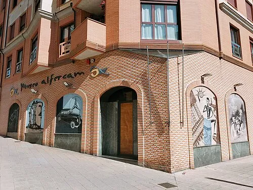 Alfercam Museum Museum, Avilés19 km NE
-
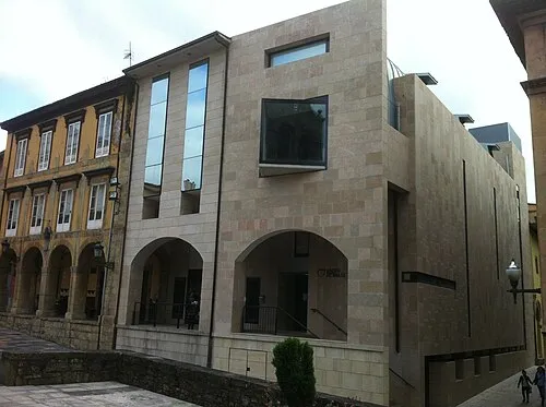 Museum of Avilés Urban History Museum, Avilés20 km E
Other cities and towns in Asturias
-
 Soto del Barco Municipality Municipality, Asturias8.3 km NE
-
 Cudillero Municipality Municipality, Asturias10 km NW
-
 Illas Municipality, Asturias15 km E
-
 Oviedo Municipality, Asturias27 km SE
-
 Corvera de Asturias Municipality, Asturias23 km E
-
Candamo Municipality, Asturias8.8 km SE
Sources & licences
Data last updated: · 2 independent sources