Drottningholm
Located in Ekerö Municipality, Stockholm County Coordinates: 59°19′30″ N 17°53′16″ E

- Population
- 348
- 348
- Elevation
- 21 m
- above sea level
- Local time
- UTC+01:00
- Europe/Stockholm · UTC+01:00
- Airports
- BMA Stockholm-Bromma Airport4 km
- ARN Stockholm-Arlanda Airport36 km
About Drottningholm
Drottningholm is a village. Location: Ekerö Municipality, Stockholm County. Population: 348. Elevation: 21 m.
Drottningholm, literally "Queen's Islet", is a locality situated in Ekerö Municipality, Stockholm County, Sweden, with 398 inhabitants in 2010. It is on the island Lovön in lake Mälaren on the outskirts of Stockholm. Drottningholm Palace, the residence of the Swedish royal family since 1981, is here. The village was planned and built in the mid-18th century for the people working at the palace.
Source: Wikipedia · CC BY-SA 4.0
At a glance
- Area
- 48 ha
Source: Wikidata
Photos of Drottningholm
-
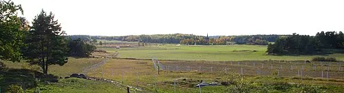
Lovön Holger.Ellgaard · CC BY-SA 3.0 -
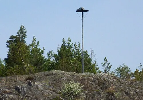
Kungshatt Holger.Ellgaard · CC BY-SA 3.0 -
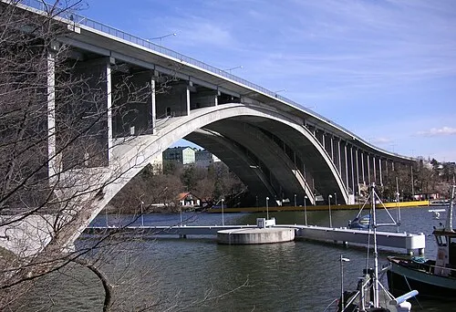
Tranebergsbron Holger.Ellgaard · CC BY-SA 3.0 -

Tensta Konsthall Mimmicarolina · CC BY-SA 4.0


Population of Drottningholm over time
| 1970 | 420 | |
|---|---|---|
| 1975 | 460 | |
| 1980 | 284 | |
| 2005 | 410 | |
| 2010 | 398 | |
| 2015 | 348 | |
| 2016 | 349 | |
| 2017 | 364 | |
| 2018 | 374 | |
| 2019 | 312 | |
| 2020 | 322 | |
| 2023 | 320 |
Censuses and official estimates; source: Wikidata.
Climate of Drottningholm
Best months for sightseeingBest months for sightseeing: June–August.
This month · November
A cold month
Day 5° · Night 0° · Rain 59 mm
- Hottest month
- July (day 21°)
- Coldest month
- February (night -6°)
- Wettest month
- July (66 mm)
- Driest month
- February (29 mm)
Bars: average monthly low and high temperature. Below: precipitation. Monthly averages for 1970–2000 at about 18 km resolution, adjusted for elevation. Highlighted months are mild and relatively dry. Source: WorldClim 2.1 (CC BY 4.0).
Show values as a table
| Month | Jan | Feb | Mar | Apr | May | Jun | Jul | Aug | Sep | Oct | Nov | Dec |
|---|---|---|---|---|---|---|---|---|---|---|---|---|
| Average high (°C) | 0° | 0° | 3° | 8° | 15° | 19° | 21° | 20° | 15° | 10° | 5° | 2° |
| Average low (°C) | -5° | -6° | -3° | 0° | 5° | 10° | 12° | 12° | 8° | 4° | 0° | -3° |
| Precipitation (mm) | 41 | 29 | 35 | 36 | 31 | 54 | 66 | 61 | 56 | 51 | 59 | 51 |
How to get to Drottningholm
The nearest airport is Stockholm-Bromma Airport (BMA), 4 km to the northeast as the crow flies. For international flights: Stockholm-Arlanda Airport (ARN) (36 km). The nearest large city is Stockholm, 10 km to the east.
Airports
- Stockholm-Bromma Airport (BMA) Stockholm 4 kmnortheast
- Stockholm-Arlanda Airport (ARN) Stockholm 36 kmnorth
- Stockholm Västerås Airport (VST) Stockholm / Västerås 77 kmnorthwest
Nearby large cities
- Stockholm Population: 1.5M 10 kmeast
- Sollentuna Population: 139.6K 12 kmnorth
- Västerås Population: 127.8K 82 kmnorthwest
- Örebro Population: 156K 153 kmwest
- Jönköping Population: 112.8K 277 kmsouthwest
Straight-line distances; road distances are longer. Airport data: OurAirports.
Day trips from Drottningholm
Within 100 km: 38 historic and cultural sites, 78 natural sites, 1,089 lakes, rivers and coasts.
0–25 km53 places
- Lillön Island 13 kmW
- Lagnö Island 23 kmNW
- Stadsholmen Island 10 kmE
- Skeppsholmen Island 11 kmE
25–60 km788 places
- Rindö Island 30 kmE
- Runmarö Island 50 kmE
- Husarö Island 58 kmE
- Granskär Island 39 kmNW
60–100 km364 places
- Lillö Island 90 kmE
- Högholmen Natural site 78 kmNE
- Hamnholmen Island 82 kmNE
- Bredholmen Island 73 kmNE
Straight-line distances.
Nearby attractions & nature
Everything nearby-
Kungshatt Island, Stockholm County2.8 km S
-
Lovön Island, Stockholm County3.2 km W
-
Tranebergsbron Landmark, Stockholm6.2 km E
-
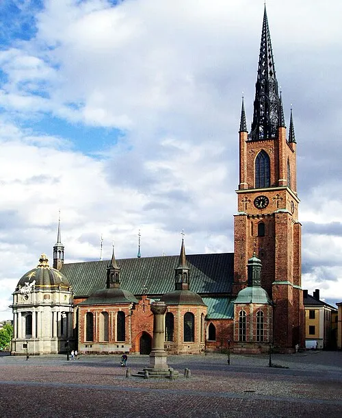 Riddarholm Church Attraction, Stockholm Municipality10 km E
-
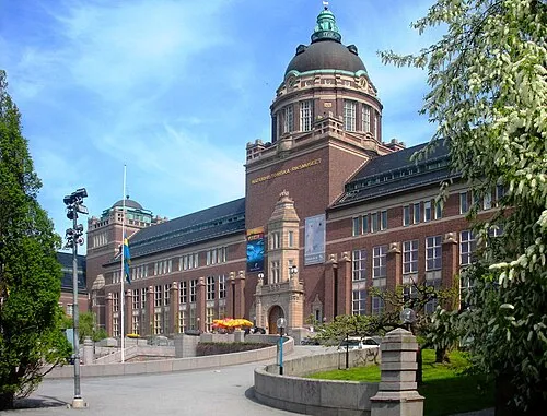 Swedish Museum of Natural History Museum, Stockholm Municipality11 km NE
-
Tensta Konsthall Museum, Stockholm7.7 km N
Other cities and towns in Ekerö Municipality


Sources & licences
Data last updated: · 2 independent sources