Stockholm
Located in Stockholm Municipality, Stockholm County Coordinates: 59°19′46″ N 18°04′07″ E
- Population
- 1,515,017
- 1.5M
- Elevation
- 17 m
- above sea level
- Local time
- UTC+01:00
- Europe/Stockholm · UTC+01:00
- Airports
- BMA Stockholm-Bromma Airport8 km
- ARN Stockholm-Arlanda Airport36 km
About Stockholm
Stockholm is a city. Location: Stockholm Municipality, Stockholm County. Population: 1,515,017. Elevation: 17 m.
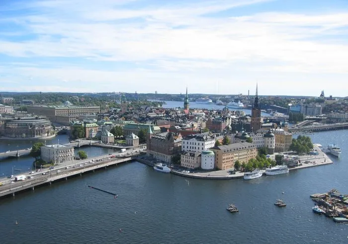
Stockholm (; Swedish: [ˈstɔ̂kː(h)ɔlm] ) is the capital and most populous city of Sweden, as well as the largest urban area in the Nordic countries. Approximately 1 million people live in the municipality, with 1.6 million in the urban area, and 2.5 million in the metropolitan area. The city stretches across fourteen islands where Lake Mälaren flows into the Baltic Sea. Outside the city to the east, and along the coast, is the island chain of the Stockholm archipelago.
Source: Wikipedia · CC BY-SA 4.0
Photos of Stockholm
-

Richardmaackphotography · CC BY 4.0 -
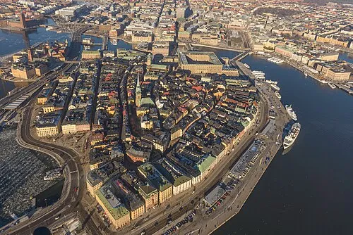
Stadsholmen Arild Vågen · CC BY-SA 3.0 -
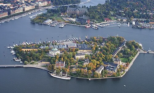
Skeppsholmen Jan Ainali · CC BY-SA 3.0 -
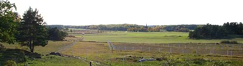
Lovön Holger.Ellgaard · CC BY-SA 3.0 -
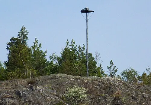
Kungshatt Holger.Ellgaard · CC BY-SA 3.0


Travel notes for Stockholm
From Wikivoyage
Stockholm is Sweden's capital and largest city, with nearly a million inhabitants in the city, and 2.4 million within Stockholm County (as of 2021). The inner city is made up of 14 islands across Lake Mälaren and three streams into the brackish Baltic Sea, with the Stockholm archipelago with some 24,000 islands, islets and skerries. Over 30% of the city area is made up of waterways, and another 30% is made up of green areas. Air and water are said to be the freshest of any European capital. Stockholm hosts the Nobel Prize ceremony and has around 70 museums.
Stockholm is the hub of most Swedish rail and bus traffic and has two of the country's busiest airports nearby, so it is a good starting point for visiting other parts of Sweden.
Understand+
Due to the post-glacial rebound, Stockholm is slowly rising from the sea. Mälaren was a bay of the Baltic Sea throughout the Viking Age of the 9th and 10th centuries; today's Stockholm was the waterway for the first Swedish cities; Birka, Uppsala, and Sigtuna. As Sigtuna was sacked by pirates in AD 1187, the Swedes needed to fortify the strait.
As the rising land cut off Mälaren from the sea in the 13th century, Stockholm became an important trading post. The city is said to be founded by Birger jarl (jarl is a title corresponding to British earl), who had a fortress built on an island later known as Gamla Stan. The first known written records that mention Stockholm date from 1252; this is the considered year of foundation. In the 15th century Stockholm replaced Uppsala as the effective capital. Stockholm was an associate of the Hanseatic League, and since its liberation from Denmark by King Gustav Vasa in 1523, Stockholm has remained Sweden's most important center of commerce, although Gothenburg later became the largest international port. During the 17th century, Stockholm was the base of the Swedish Empire, with a land area twice the country's current size, nearly encircling the Baltic Sea.
Much of the inner city plan was laid out in the 19th century, and the inner city still contains buildings from all ages since the 15th century. Like the rest of Sweden, Stockholm was largely untouched by the World Wars, but, particularly between 1955 and 1975, hundreds of old buildings in Norrmalm were demolished in a large-scale modernization process, emulating similar projects in other European cities.
Get in+
By plane:
Stockholm (STO IATA) is served by several international airports; Stockholm-Arlanda Airport (ARN IATA; near Sigtuna) being the dominant one. Stockholm-Bromma (BMA IATA) is the only airport within the city. The airports in Skavsta (NYO IATA; near Nyköping) and Västerås (VST IATA) also receive some international flights.
Arlanda Airport:
1 Arlanda Airport (ARN IATA) 40 km north of the city is Sweden's largest airport, and the destination for most flights to Sweden.
There is a dedicated train every 15 minutes from the Arlanda terminals to Stockholm Central Station (20 min; 175–350 kr/person depending on group size, youth 160 kr). Also regular trains (270 kr; much cheaper fares can be had in advance) and SL commuter trains (180/90 kr) serve the airport.
The cheapest ride – unless you have an SL day card and don't use the airport's train stations – is by the FlixBus buses (45 min; 79–99 kr, cheaper in advance). With SL, you can take the commuter train or a bus to a station with more frequent services to the city. There are also airport coaches (45 min).
Taxis and rental cars are available.
Bromma Airport:
2 Bromma Airport, (BMA IATA) in Västerort is a smaller airport 8 km west of central Stockholm. Bromma has been under threat of closure for many years and as of 2025 the only remaining operator is NyxAir to Trollhättan–Vänersborg Airport near Göteborg.
From Bromma, it's easiest to take tram 31 from Bromma flygplats 31 to Alvik strand 30 31 . At Alvik 12 17 18 19 30 31 , you can change onto the green line of Stockholm's metro, which will connect you to T-Centralen, the central hub of Stockholm's public transit. Alternatively, to get to Sundbyberg and Solna, you can change trams at Norra Ulvsunda 30 31 heading towards Solna station with line 30. Getting to T-Centralen takes just shy of 30 minutes, with tramline 31 departing from Bromma every 20 minutes.
Skavsta Airport:
Source: Wikivoyage · CC BY-SA 4.0 · abridged
Population of Stockholm over time
| 1980 | 647,214 | |
|---|---|---|
| 1990 | 674,452 | |
| 2000 | 750,348 | |
| 2010 | 847,073 | |
| 2020 | 975,551 | |
| 2021 | 978,770 | |
| 2022 | 984,748 |
Censuses and official estimates; source: Wikidata.
Climate of Stockholm
Best months for sightseeingBest months for sightseeing: June–August.
This month · November
A cold month
Day 5° · Night 0° · Rain 62 mm
- Hottest month
- July (day 22°)
- Coldest month
- February (night -6°)
- Wettest month
- July (69 mm)
- Driest month
- February (30 mm)
Bars: average monthly low and high temperature. Below: precipitation. Monthly averages for 1970–2000 at about 18 km resolution, adjusted for elevation. Highlighted months are mild and relatively dry. Source: WorldClim 2.1 (CC BY 4.0).
Show values as a table
| Month | Jan | Feb | Mar | Apr | May | Jun | Jul | Aug | Sep | Oct | Nov | Dec |
|---|---|---|---|---|---|---|---|---|---|---|---|---|
| Average high (°C) | 0° | 0° | 3° | 8° | 15° | 19° | 22° | 21° | 15° | 10° | 5° | 2° |
| Average low (°C) | -5° | -6° | -3° | 0° | 5° | 10° | 12° | 12° | 8° | 4° | 0° | -3° |
| Precipitation (mm) | 43 | 30 | 35 | 37 | 31 | 55 | 69 | 64 | 58 | 53 | 62 | 53 |
How to get to Stockholm
The nearest airport is Stockholm-Bromma Airport (BMA), 8 km to the west as the crow flies. For international flights: Stockholm-Arlanda Airport (ARN) (36 km). The nearest large city is Sollentuna, 13 km to the northwest.
Airports
- Stockholm-Bromma Airport (BMA) Stockholm 8 kmwest
- Stockholm-Arlanda Airport (ARN) Stockholm 36 kmnorth
- Stockholm Västerås Airport (VST) Stockholm / Västerås 86 kmwest
Nearby large cities
- Sollentuna Population: 139.6K 13 kmnorthwest
- Västerås Population: 127.8K 92 kmwest
- Örebro Population: 156K 163 kmwest
- Jönköping Population: 112.8K 286 kmsouthwest
- Tallinn Population: 394K 380 kmeast
Straight-line distances; road distances are longer. Airport data: OurAirports.
Day trips from Stockholm
Within 100 km: 38 historic and cultural sites, 79 natural sites, 1,103 lakes, rivers and coasts.
0–25 km77 places
- Rindö Island 20 kmNE
- Kalvholmen Island 22 kmSE
- Lillön Island 23 kmW
- Härsö Island 23 kmSE
25–60 km847 places
- Runmarö Island 40 kmE
- Husarö Island 48 kmNE
- Granskär Island 48 kmW
- Galtholmen Island 35 kmE
60–100 km296 places
- Lillö Island 80 kmE
- Högholmen Natural site 70 kmNE
- Hamnholmen Island 73 kmNE
- Bredholmen Island 65 kmNE
Straight-line distances.
Stockholm and similar cities
Side by side with cities of similar size in the same country: population, elevation and climate.
| Measure | Stockholm | Gothenburg |
|---|---|---|
| Population | 1.5M | 608.5K |
| Elevation | 17 m | 10 m |
| Summer day (hottest month) | 22° | 21° |
| Winter night (coldest month) | -6° | -3° |
| Annual rainfall | 590 mm | 803 mm |
| Best months | Jun–Aug | Jun–Aug |
| Distance | — | 399 km |
Climate values are 1970–2000 monthly averages; straight-line distance.
Nearby attractions & nature
Everything nearby-
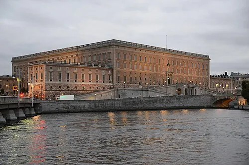 Stockholm Palace Historic site, Stockholm Municipality0.4 km SE
-
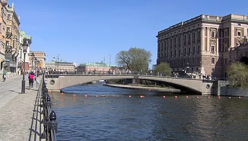 Riksbron Landmark, Stockholm Municipality0.2 km SW
-
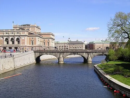 Norrbro Landmark, Stockholm Municipality0.1 km SE
-
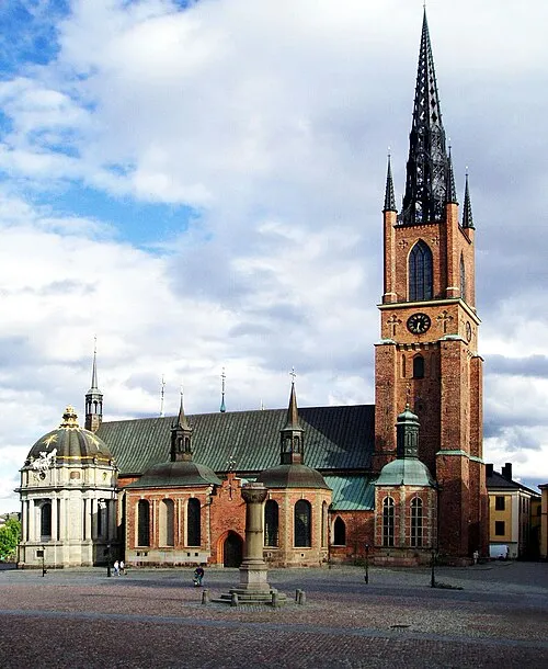 Riddarholm Church Attraction, Stockholm Municipality0.6 km SW
-
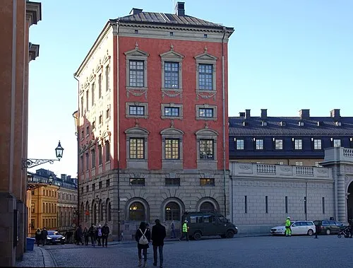 Axel Oxenstiernas Palace Historic site, Stockholm Municipality0.4 km S
-
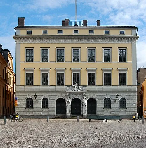 Tessin Palace Historic site, Stockholm Municipality0.4 km SE
-
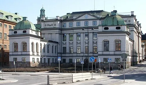 Bonde Palace Historic site, Stockholm Municipality0.4 km S
-
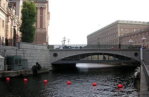 Stallbron Landmark, Stockholm Municipality0.3 km S
Sources & licences
Data last updated: · 2 independent sources