- Population
- 173,232
- 173.2K
- Elevation
- 247 m
- above sea level
- Local time
- UTC+01:00
- Europe/Zurich · UTC+01:00
- Places inside
- 41
- listed under Basel
- Airports
- BSL EuroAirport Basel–Mulhouse–Freiburg7 km
- BRN Bern Airport72 km
About Basel
Basel is a municipality. Location: Basel-Stadt, Canton of Basel-City. Population: 173,232. Elevation: 247 m. The best months to visit are May–September. The nearest airport is EuroAirport Basel–Mulhouse–Freiburg (7 km). Nearby sights include Schloss Binningen and Kirche St. Margarethen.
Photos of Basel
-
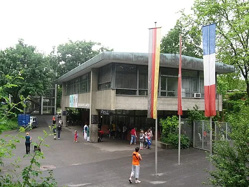
Basel Zoo TeamBurton 17:20, 5. Juni 2009 · Public domain -
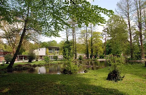
Tierpark Lange Erlen Wladyslaw Sojka · CC BY-SA 3.0 -
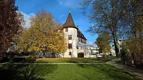
Schloss Binningen Andreas Kraneis · CC BY-SA 3.0 de -
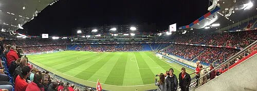
St. Jakob-Park Chris Wachtler · CC BY-SA 4.0


Climate of Basel
Best months for sightseeingBest months for sightseeing: May–September.
This month · November
A cold month
Day 9° · Night 2° · Rain 65 mm
- Hottest month
- July (day 25°)
- Coldest month
- January (night -1°)
- Wettest month
- June (86 mm)
- Driest month
- March (49 mm)
Bars: average monthly low and high temperature. Below: precipitation. Monthly averages for 1970–2000 at about 18 km resolution, adjusted for elevation. Highlighted months are mild and relatively dry. Source: WorldClim 2.1 (CC BY 4.0).
Show values as a table
| Month | Jan | Feb | Mar | Apr | May | Jun | Jul | Aug | Sep | Oct | Nov | Dec |
|---|---|---|---|---|---|---|---|---|---|---|---|---|
| Average high (°C) | 5° | 7° | 11° | 15° | 20° | 23° | 25° | 25° | 21° | 15° | 9° | 6° |
| Average low (°C) | -1° | -1° | 2° | 5° | 9° | 12° | 14° | 14° | 11° | 7° | 2° | 0° |
| Precipitation (mm) | 52 | 53 | 49 | 63 | 84 | 86 | 82 | 75 | 67 | 64 | 65 | 65 |
Other places to visit in this season: May June July August September
How to get to Basel
The nearest airport is EuroAirport Basel–Mulhouse–Freiburg (BSL), 7 km to the northwest as the crow flies. The nearest large city is Basel, 2 km to the west.
Airports
- EuroAirport Basel–Mulhouse–Freiburg (BSL) Bâle / Mulhouse 7 kmnorthwest
- Bern Airport (BRN) Bern 72 kmsouth
- Zürich Airport (ZRH) Zurich 73 kmeast
Nearby large cities
- Basel Population: 177.6K 2 kmwest
- Mulhouse Population: 111.4K 29 kmnorthwest
- Freiburg im Breisgau Population: 237.5K 52 kmnorth
- Bern Population: 121.6K 69 kmsouth
- Zurich Population: 415.4K 75 kmeast
Straight-line distances; road distances are longer. Airport data: OurAirports.
Day trips from Basel
Within 100 km: 486 historic and cultural sites, 1,932 natural sites, 568 lakes, rivers and coasts.
0–25 km152 places
- Basler Weiher Lake 15 kmS
- Rheinhafen Kleinhüningen Lake 3 kmN
- Neuer Teich Lake 4 kmNE
- Oelisee Lake 8 kmS
25–60 km752 places
- Arbeiterstrandbad Tennwil Beach 55 kmSE
- Mauesee-Insel Island 56 kmSE
- Gamma-Inseli Island 59 kmSE
- Mauensee Lake 56 kmSE
60–100 km2,082 places
- Kleiner Bremgartenwald Mountain 66 kmS
- Fahr Abbey Attraction 66 kmE
- Strandbad Neuhaus Beach 99 kmS
- Strandbad Manor Farm Beach 99 kmS
Straight-line distances.
Basel and similar cities
Side by side with cities of similar size in the same country: population, elevation and climate.
| Measure | Basel | Basel | Geneva | Lausanne |
|---|---|---|---|---|
| Population | 173.2K | 177.6K | 201.7K | 139.1K |
| Elevation | 247 m | 279 m | 400 m | 453 m |
| Summer day (hottest month) | 25° | 25° | 26° | 25° |
| Winter night (coldest month) | -1° | -1° | -1° | -1° |
| Annual rainfall | 805 mm | 805 mm | 1,039 mm | 1,181 mm |
| Best months | May–Sep | May–Sep | May–Sep | May–Sep |
| Distance | — | 2 km | 187 km | 137 km |
Climate values are 1970–2000 monthly averages; straight-line distance.
Places in Basel
41 placesBar: population relative to the most populous place in this list.
Cities & villages20
- Am Ring · Neighbourhood
- Bachletten · Neighbourhood
- Brüglingen · Village
- Clara · Neighbourhood
- Gotthelf · Neighbourhood
- Grossbasel · Neighbourhood
- Gundeldingen · Neighbourhood
- Iselin · Neighbourhood
- Kleinbasel · Neighbourhood
- Kleinbasel Altstadt · Neighbourhood
- Kleinhüningen · Neighbourhood
- Klybeck · Neighbourhood
- Matthäus · Neighbourhood
- Neuhaus · Village
- Rosental · Neighbourhood
- Sankt Jakob · Neighbourhood
- Sankt Johann · Neighbourhood
- St. Alban · Neighbourhood
- Vorstädte · Neighbourhood
- Wettsteinquartier · Neighbourhood
Lakes, rivers & coasts1
- Rheinhafen Kleinhüningen · Lake
Heritage & sights16
- Basel Minster · Attraction
- Basel Wiesenbrücke · Landmark
- Basel Zoo · Attraction
- Grosses Gundeldingen Schloss · Historic site
- Kunstmuseum Basel · Museum
- Martinskirche · Attraction
- Museum der Kulturen · Museum
- Peterskirche · Attraction
- Predigerkirche · Attraction
- Sankt Marien, Basel · Attraction
- Spalentor · Landmark
- St. Jakob-Park · Landmark
- Tierpark Lange Erlen · Attraction
- Tinguely Museum · Museum
- Tituskirche · Attraction
- Wettsteinbrücke · Landmark
Nearby attractions & nature
Everything nearby-
Schloss Binningen Historic site, Binningen2.7 km SW
-
Kirche St. Margarethen Attraction, Binningen1.9 km SW
-
Birs River, Switzerland1.8 km E
-
Römisch-katholische Kirche Binningen Attraction, Binningen2.4 km SW
-
Wiese River River, Germany2.8 km N
-
Neuer Teich Lake, Riehen3.7 km NE
-
Schloss Münchenstein Historic site, Münchenstein5.4 km SE
-
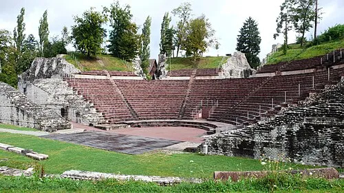 Augusta Raurica Historic site, Augst10 km E
Sources & licences
Data last updated: