Saanen
Located in Obersimmental-Saanen District, Canton of Bern Coordinates: 46°28′54″ N 7°17′18″ E
- Population
- 6,817
- 6.8K
- Elevation
- 1,117 m
- above sea level
- Local time
- UTC+01:00
- Europe/Zurich · UTC+01:00
- Places inside
- 66
- listed under Saanen
- Airports
- BRN Bern Airport51 km
- GVA Geneva International Airport95 km
About Saanen
Saanen is a municipality. Location: Obersimmental-Saanen District, Canton of Bern. Population: 6,817. Elevation: 1,117 m. The best months to visit are July–September. The nearest airport is Bern Airport (51 km). Nearby sights include Gifferhorn and Saanerslochflue.
Climate of Saanen
Best months for sightseeingBest months for sightseeing: July–September.
This month · November
A wet month
Day 7° · Night 1° · Rain 128 mm
- Hottest month
- August (day 21°)
- Coldest month
- February (night -3°)
- Wettest month
- December (139 mm)
- Driest month
- September (89 mm)
Bars: average monthly low and high temperature. Below: precipitation. Monthly averages for 1970–2000 at about 18 km resolution, adjusted for elevation. Highlighted months are mild and relatively dry. Source: WorldClim 2.1 (CC BY 4.0).
Show values as a table
| Month | Jan | Feb | Mar | Apr | May | Jun | Jul | Aug | Sep | Oct | Nov | Dec |
|---|---|---|---|---|---|---|---|---|---|---|---|---|
| Average high (°C) | 3° | 4° | 6° | 9° | 14° | 17° | 20° | 21° | 17° | 13° | 7° | 4° |
| Average low (°C) | -3° | -3° | -1° | 1° | 6° | 9° | 11° | 12° | 9° | 5° | 1° | -2° |
| Precipitation (mm) | 124 | 129 | 102 | 102 | 110 | 117 | 103 | 105 | 89 | 111 | 128 | 139 |
How to get to Saanen
The nearest airport is Bern Airport (BRN), 51 km to the north as the crow flies. For international flights: Geneva International Airport (GVA) (95 km). The nearest large city is Lausanne, 50 km to the west.
Airports
- Bern Airport (BRN) Bern 51 kmnorth
- Geneva International Airport (GVA) Geneva 95 kmwest
- Annecy Meythet airport (NCY) Annecy 110 kmsouthwest
Nearby large cities
- Lausanne Population: 139.1K 50 kmwest
- Bern Population: 121.6K 53 kmnorth
- Geneva Population: 201.7K 93 kmwest
- Basel Population: 177.6K 122 kmnorth
- Besançon Population: 128.4K 129 kmnorthwest
Straight-line distances; road distances are longer. Airport data: OurAirports.
Day trips from Saanen
Within 100 km: 158 historic and cultural sites, 5,040 natural sites, 635 lakes, rivers and coasts.
0–25 km615 places
- Schwarzsee Lake 20 kmN
- Lac de la Gruyère Lake 25 kmNW
- Lac de Derborence Lake 23 kmS
- Arnensee Lake 12 kmSW
25–60 km2,180 places
- Kleiner Bremgartenwald Mountain 55 kmN
- Strandbad Neuhaus Beach 46 kmNE
- Strandbad Manor Farm Beach 46 kmNE
- Strandbad Leissigen Beach 42 kmNE
60–100 km3,038 places
- Strandbad Brienz Beach 65 kmNE
- Lago Nero Lake 96 kmE
- Sankt Petersinsel Island 67 kmN
- Mauesee-Insel Island 97 kmNE
Straight-line distances.
Places in Saanen
66 placesBar: population relative to the most populous place in this list.
Cities & villages29
- Badweidli · Village
- Balteli · Village
- Grund · Village
- Hinders Eggli · Neighbourhood
- Hinders Fallers Bärgli · Neighbourhood
- Hornkessel · Village
- Kalberhöni · Village
- Obere Ruedersberg · Neighbourhood
- Oberi Bire · Neighbourhood
- Oberi Bleiki · Neighbourhood
- Oberi Gürütschere · Neighbourhood
- Obers Beust · Neighbourhood
- Obers Dürri · Neighbourhood
- Obers Haldisbärgli · Neighbourhood
- Obers Plani · Neighbourhood
- Obers Rellerli · Neighbourhood
- Saanenmöser · Village
- Schönried · Village
- Schulh · Village
- Turbach · Village
- Underbort · Village
- Undere Ruedersberg · Neighbourhood
- Underi Bire · Neighbourhood
- Underi Bleiki · Neighbourhood
- Underi Gürütschere · Neighbourhood
- Unders Beust · Neighbourhood
- Unders Dürri · Neighbourhood
- Unders Haldisbärgli · Neighbourhood
- Unders Plani · Neighbourhood
Mountains & nature29
- Amelier · Mountain
- Amsleregrat · Mountain
- Bachberggrat · Mountain
- Baumersberg · Mountain
- Cholisgrind · Mountain
- Eggturm · Mountain
- Furggespitz · Mountain
- Giferspitz · Mountain
- Gross Stand · Mountain
- Gross Turm · Mountain
- Hirzenflue · Mountain
- Höhi Wispile · Mountain
- Hornflue · Mountain
- Horntube · Mountain
- Hüenerspil · Mountain
- Hugeligrat · Mountain
- Husegg · Mountain
- Laaglehore · Mountain
- Louwenehore · Mountain
- Marchzähne · Mountain
- Muttehubel · Mountain
- Planihubel · Mountain
- Rüwlishore · Mountain
- Schneitgrat · Mountain
- Staldehore · Mountain
- Staldenhorn · Mountain
- Stand · Mountain
- Tête de l'Ane · Mountain
- Toggeliflue · Mountain
Nearby attractions & nature
Everything nearby-
Gifferhorn Mountain, Lauenen4.1 km SE
-
Saanerslochflue Mountain, Zweisimmen3.9 km NE
-
Tête des Planards Mountain, Rougemont4.9 km W
-
Comba Litou Mountain, Rougemont5 km SW
-
Wandeliflue Mountain, Lauenen5.1 km SE
-
Les Rodomonts Mountain, Rougemont5.5 km NW
-
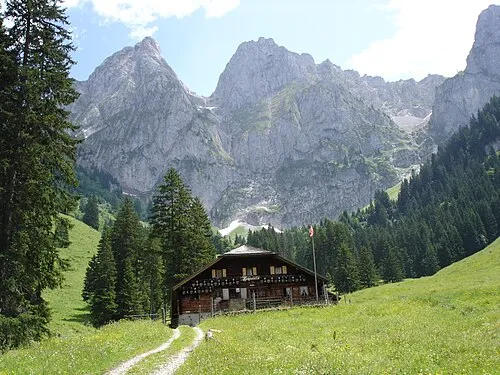 Gummfluh Mountain, Rougemont8.5 km SW
-
Tête de Chat Mountain, Rougemont5.9 km W
Sources & licences
Data last updated: