- Population
- 5
- 5
- Elevation
- 456 m
- above sea level
- Local time
- UTC+01:00
- Europe/Zurich · UTC+01:00
- Airports
- ZRH Zürich Airport13 km
- BSL EuroAirport Basel–Mulhouse–Freiburg72 km
About Chilstig
Chilstig is a village. Location: Urdorf, Dietikon District. Population: 5. Elevation: 456 m. The best months to visit are May–September. The nearest airport is Zürich Airport (13 km). Nearby sights include Letzigrund Stadium and Fahr Abbey.
Photos of Chilstig
-
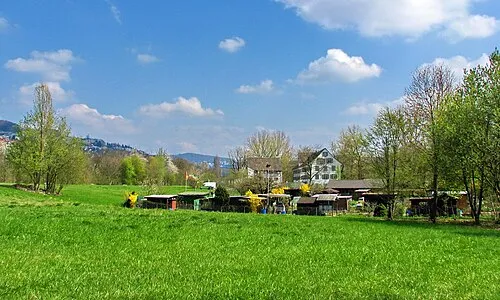
Werdinsel Roland zh · CC BY-SA 3.0 -
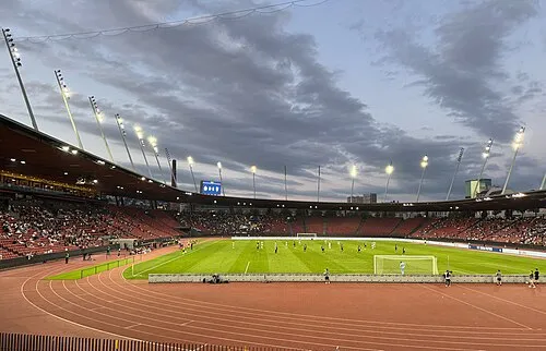
Letzigrund Stadium Seasider53 · CC BY 4.0 -
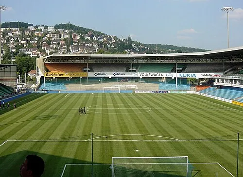
Hardturm Ara gantoise · Public domain


Climate of Chilstig
Best months for sightseeingBest months for sightseeing: May–September.
This month · November
A cold month
Day 7° · Night 1° · Rain 96 mm
- Hottest month
- July (day 24°)
- Coldest month
- January (night -2°)
- Wettest month
- June (124 mm)
- Driest month
- March (73 mm)
Bars: average monthly low and high temperature. Below: precipitation. Monthly averages for 1970–2000 at about 18 km resolution, adjusted for elevation. Highlighted months are mild and relatively dry. Source: WorldClim 2.1 (CC BY 4.0).
Show values as a table
| Month | Jan | Feb | Mar | Apr | May | Jun | Jul | Aug | Sep | Oct | Nov | Dec |
|---|---|---|---|---|---|---|---|---|---|---|---|---|
| Average high (°C) | 3° | 5° | 10° | 14° | 19° | 22° | 24° | 24° | 19° | 14° | 7° | 4° |
| Average low (°C) | -2° | -2° | 1° | 4° | 8° | 11° | 13° | 13° | 10° | 6° | 1° | -1° |
| Precipitation (mm) | 80 | 86 | 73 | 85 | 100 | 124 | 116 | 111 | 84 | 89 | 96 | 93 |
Other places to visit in this season: May June July August September
How to get to Chilstig
The nearest airport is Zürich Airport (ZRH), 13 km to the northeast as the crow flies. The nearest large city is Zurich, 10 km to the east.
Airports
- Zürich Airport (ZRH) Zurich 13 kmnortheast
- EuroAirport Basel–Mulhouse–Freiburg (BSL) Bâle / Mulhouse 72 kmwest
- Bern Airport (BRN) Bern 87 kmsouthwest
Nearby large cities
- Zurich Population: 415.4K 10 kmeast
- Winterthur Population: 111.8K 27 kmnortheast
- Basel Population: 177.6K 67 kmwest
- Freiburg im Breisgau Population: 237.5K 81 kmnorthwest
- Bern Population: 121.6K 88 kmsouthwest
Straight-line distances; road distances are longer. Airport data: OurAirports.
Day trips from Chilstig
Within 100 km: 529 historic and cultural sites, 4,494 natural sites, 881 lakes, rivers and coasts.
0–25 km119 places
- Fahr Abbey Attraction 4 kmNE
- Arbeiterstrandbad Tennwil Beach 17 kmSW
- Saffa Insel Island 9 kmE
- Lorzeninsel Island 23 kmS
25–60 km1,487 places
- Strandbad Steckborn Beach 52 kmNE
- Ufenau Island 33 kmSE
- Insel Lützelau Island 33 kmSE
- Schönenwerd Island 30 kmSE
60–100 km4,298 places
- Kleiner Bremgartenwald Mountain 87 kmSW
- Mainau Island 69 kmNE
- Dominikanerinsel Konstanz Island 66 kmNE
- Strandbad Neuhaus Beach 90 kmSW
Straight-line distances.
Nearby attractions & nature
Everything nearby-
Letzigrund Stadium Landmark, Zurich6.6 km E
-
Fahr Abbey Attraction, Würenlos3.9 km NE
-
Werdinsel Island, Canton of Zurich5.9 km NE
-
Hardturm Landmark, Zurich6.9 km E
-
Chlosterweiher Lake, Spreitenbach4.6 km NW
-
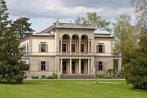 Museum Rietberg Museum, Zurich8.8 km E
Sources & licences
Data last updated: