Horgen
Located in Horgen District, Canton of Zurich Coordinates: 47°14′55″ N 8°35′05″ E
- Population
- 22,992
- 23K
- Elevation
- 654 m
- above sea level
- Local time
- UTC+01:00
- Europe/Zurich · UTC+01:00
- Places inside
- 109
- listed under Horgen
- Airports
- ZRH Zürich Airport23 km
- ACH Sankt Gallen Altenrhein Airport78 km
About Horgen
Horgen is a municipality. Location: Horgen District, Canton of Zurich. Population: 22,992. Elevation: 654 m. The best months to visit are June–September. The nearest airport is Zürich Airport (23 km). Nearby sights include Horgener Bergweiher and Aabach Wasserfall.
Photos of Horgen
-
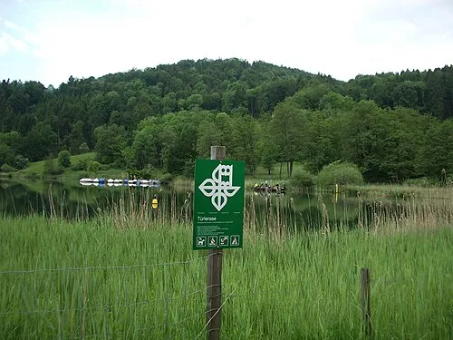
Aeugsterberg Paebi · CC BY-SA 3.0

Climate of Horgen
Best months for sightseeingBest months for sightseeing: June–September.
This month · November
A cold month
Day 7° · Night 1° · Rain 99 mm
- Hottest month
- July (day 22°)
- Coldest month
- January (night -3°)
- Wettest month
- June (146 mm)
- Driest month
- January (72 mm)
Bars: average monthly low and high temperature. Below: precipitation. Monthly averages for 1970–2000 at about 18 km resolution, adjusted for elevation. Highlighted months are mild and relatively dry. Source: WorldClim 2.1 (CC BY 4.0).
Show values as a table
| Month | Jan | Feb | Mar | Apr | May | Jun | Jul | Aug | Sep | Oct | Nov | Dec |
|---|---|---|---|---|---|---|---|---|---|---|---|---|
| Average high (°C) | 2° | 4° | 9° | 12° | 17° | 20° | 22° | 22° | 18° | 13° | 7° | 3° |
| Average low (°C) | -3° | -3° | 0° | 3° | 7° | 10° | 12° | 12° | 9° | 5° | 1° | -2° |
| Precipitation (mm) | 72 | 85 | 78 | 94 | 113 | 146 | 143 | 138 | 101 | 92 | 99 | 89 |
Other places to visit in this season: June July August September
How to get to Horgen
The nearest airport is Zürich Airport (ZRH), 23 km to the north as the crow flies. The nearest large city is Zurich, 13 km to the north.
Airports
- Zürich Airport (ZRH) Zurich 23 kmnorth
- Sankt Gallen Altenrhein Airport (ACH) St. Gallen 78 kmeast
- Bodensee Airport Friedrichshafen (FDH) Friedrichshafen 84 kmnortheast
Nearby large cities
- Zurich Population: 415.4K 13 kmnorth
- Winterthur Population: 111.8K 30 kmnorth
- Basel Population: 177.6K 84 kmnorthwest
- Bern Population: 121.6K 93 kmwest
- Freiburg im Breisgau Population: 237.5K 100 kmnorthwest
Straight-line distances; road distances are longer. Airport data: OurAirports.
Day trips from Horgen
Within 100 km: 525 historic and cultural sites, 5,325 natural sites, 1,016 lakes, rivers and coasts.
0–25 km250 places
- Fahr Abbey Attraction 21 kmNW
- Ufenau Island 15 kmE
- Insel Lützelau Island 16 kmE
- Schönenwerd Island 11 kmSE
25–60 km2,145 places
- Strandbad Steckborn Beach 54 kmNE
- Arbeiterstrandbad Tennwil Beach 28 kmW
- Sankt-Niklausen-Insle Island 30 kmSW
- Neptun-Inseln Island 40 kmS
60–100 km4,471 places
- Kleiner Bremgartenwald Mountain 93 kmW
- Mainau Island 69 kmNE
- Dominikanerinsel Konstanz Island 64 kmNE
- Strandbad Neuhaus Beach 86 kmSW
Straight-line distances.
Places in Horgen
109 places- 1 Horgen 22.7K
- 2 Horgen / Horgen (Dorfkern) 6.1K
- 3 Horgen / Allmend 3.8K
- 4 Horgen / Scheller-Stockerstrasse 2.7K
- 5 Horgen / Oberdorf 2.5K
- 6 Horgen / Käpfnach 810
- 7 Arn 326
- 8 Hirzel 322
- 9 Vorderi Siten 245
- 10 Spitzenmatte 231
- 11 Kirchrain 191
- 12 Bätpur 109
- 13 Moorschwand 68
- 14 Wührenbach 54
- 15 Chronerain 52
- 16 Vorderi Höchi 51
- 17 Vorder-Klausen 48
- 18 Vorder Bächenmoos 46
- 19 Zimmerberg 39
- 20 Oberhof 32
- 21 Heerenrainli 31
- 22 Risi 29
- 23 Bächenmoos 27
- 24 Hintere Rietwies 27
- 25 Sihlbrugg (nordöstl. Teil) 25
- 26 Bocken 24
- 27 Brämenhalden 24
- 28 Dürenmoos 24
- 29 Harüti 23
- 30 Unterhaus 23
- 31 Werkplatz Sihlwald 21
- 32 Chalbisau 20
- 33 Untere Hanegg 20
- 34 Unteri Siten 20
- 35 Höchi 19
- 36 Fänser 18
- 37 Hinter-Klausen 18
- 38 Strickler 18
- 39 Feldstrasse 17
- 40 Neumatt 17
- 41 Schiffli 17
- 42 Mittlere Rietwies 16
- 43 Rennweg 16
- 44 Widenbach 16
- 45 Sihlmatt 15
- 46 Büel 14
- 47 Chelen 13
- 48 Waldhof 13
- 49 Boden 12
- 50 Bruppacher 12
- 51 Gschättli 12
- 52 Obere Hinterrüti 12
- 53 Schlitten 12
- 54 Sihlbrugg (Station) 12
- 55 Sprümüli 12
- 56 Waid 12
- 57 Brestenegg 11
- 58 Geeristeg 11
- 59 Gottshalden 11
- 60 Tableten 11
Bar: population relative to the most populous place in this list.
Nearby attractions & nature
Everything nearby-
Horgener Bergweiher Lake, Canton of Zurich1.2 km SE
-
Aabach Wasserfall Natural site, Canton of Zurich2.9 km E
-
Bürglen Mountain, Hausen am Albis3.7 km W
-
Waldweiher Lake, Thalwil4 km NW
-
Au Peninsula Natural site, Canton of Zurich4.6 km E
-
Ausee Lake, Canton of Zurich4.2 km E
-
Albis Mountain, Langnau am Albis4.9 km NW
-
Gattikerweiher Lake, Thalwil4.6 km NW
Sources & licences
Data last updated: