Ellikon an der Thur
Located in Winterthur District, Canton of Zurich Coordinates: 47°33′47″ N 8°49′27″ E
- Population
- 901
- 901
- Elevation
- 395 m
- above sea level
- Local time
- UTC+01:00
- Europe/Zurich · UTC+01:00
- Places inside
- 8
- listed under Ellikon an der Thur
- Airports
- ZRH Zürich Airport24 km
- FDH Bodensee Airport Friedrichshafen53 km
About Ellikon an der Thur
Ellikon an der Thur is a municipality. Location: Winterthur District, Canton of Zurich. Population: 901. Elevation: 395 m. The best months to visit are May–September. The nearest airport is Zürich Airport (24 km). Nearby sights include Hugiweiher and Hugiweiher.
Photos of Ellikon an der Thur
-
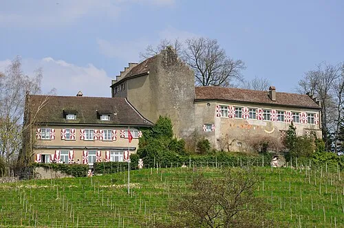
Schloss Schwandegg Hansueli Krapf · CC BY-SA 3.0

Climate of Ellikon an der Thur
Best months for sightseeingBest months for sightseeing: May–September.
This month · November
A cold month
Day 7° · Night 2° · Rain 77 mm
- Hottest month
- July (day 24°)
- Coldest month
- January (night -2°)
- Wettest month
- June (113 mm)
- Driest month
- March (56 mm)
Bars: average monthly low and high temperature. Below: precipitation. Monthly averages for 1970–2000 at about 18 km resolution, adjusted for elevation. Highlighted months are mild and relatively dry. Source: WorldClim 2.1 (CC BY 4.0).
Show values as a table
| Month | Jan | Feb | Mar | Apr | May | Jun | Jul | Aug | Sep | Oct | Nov | Dec |
|---|---|---|---|---|---|---|---|---|---|---|---|---|
| Average high (°C) | 3° | 5° | 10° | 14° | 19° | 22° | 24° | 24° | 20° | 14° | 7° | 4° |
| Average low (°C) | -2° | -2° | 1° | 4° | 8° | 11° | 13° | 13° | 10° | 6° | 2° | -1° |
| Precipitation (mm) | 57 | 66 | 56 | 71 | 86 | 113 | 105 | 99 | 73 | 74 | 77 | 73 |
Other places to visit in this season: May June July August September
How to get to Ellikon an der Thur
The nearest airport is Zürich Airport (ZRH), 24 km to the southwest as the crow flies. The nearest large city is Winterthur, 10 km to the southwest.
Airports
- Zürich Airport (ZRH) Zurich 24 kmsouthwest
- Bodensee Airport Friedrichshafen (FDH) Friedrichshafen 53 kmeast
- Sankt Gallen Altenrhein Airport (ACH) St. Gallen 56 kmeast
Nearby large cities
- Winterthur Population: 111.8K 10 kmsouthwest
- Zurich Population: 415.4K 30 kmsouthwest
- Freiburg im Breisgau Population: 237.5K 87 kmnorthwest
- Basel Population: 177.6K 94 kmwest
- Reutlingen Population: 112.6K 107 kmnorth
Straight-line distances; road distances are longer. Airport data: OurAirports.
Day trips from Ellikon an der Thur
Within 100 km: 609 historic and cultural sites, 4,426 natural sites, 944 lakes, rivers and coasts.
0–25 km158 places
- Strandbad Steckborn Beach 15 kmNE
- Insel Werd Island 11 kmN
- Pfäffikersee Lake 24 kmS
- Luppmenweiher Lake 23 kmS
25–60 km1,227 places
- Mainau Island 32 kmNE
- Fahr Abbey Attraction 34 kmSW
- Dominikanerinsel Konstanz Island 29 kmNE
- Arbeiterstrandbad Tennwil Beach 54 kmSW
60–100 km4,594 places
- Insel Schwanau Island 61 kmS
- Sankt-Niklausen-Insle Island 69 kmSW
- Neptun-Inseln Island 76 kmS
- Mauesee-Insel Island 72 kmSW
Straight-line distances.
Places in Ellikon an der Thur
8 places- 1 Ellikon 477
- 2 Dunaspi 102
- 3 Wald 20
- 4 Langbreiten 12
- 5 Räuchler 11
- 6 Mattenhof 10
- 7 Untergris 7
- 8 Thuracher 4
Bar: population relative to the most populous place in this list.
Nearby attractions & nature
Everything nearby-
Hugiweiher Lake, Frauenfeld2.8 km E
-
Hugiweiher Lake, Frauenfeld3 km E
-
Schloss Schwandegg Historic site, Stammheim7.6 km NW
-
Plättli Zoo Attraction, Frauenfeld7 km E
-
Hasensee Lake, Uesslingen-Buch5 km N
-
Hasensee Lake, Uesslingen-Buch5 km N
-
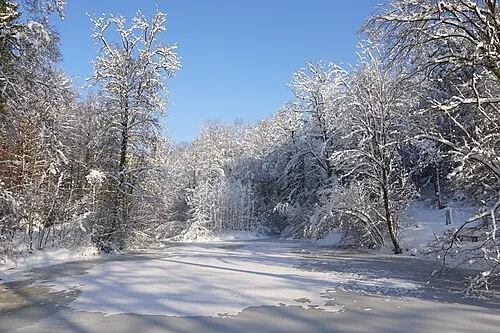 Lindberg Mountain, Winterthur8.1 km SW
-
Kloster Frauenfeld Attraction, Frauenfeld5.6 km E
Sources & licences
Data last updated: