- Population
- 62,615
- 62.6K
- Elevation
- 345 m
- above sea level
- Local time
- UTC+01:00
- Europe/Zurich · UTC+01:00
- Places inside
- 113
- listed under Lugano
- Airports
- LUG Lugano Airport5 km
- MXP Milan Malpensa International Airport46 km
About Lugano
Lugano is a municipality. Location: Lugano District, Canton Ticino. Population: 62,615. Elevation: 345 m. The best months to visit are May–September. The nearest airport is Lugano Airport (5 km). Nearby sights include Lido di Lugano and Cassarate.
Photos of Lugano
-
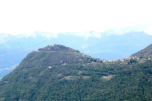
Monte Brè Adrian Michael · CC BY 3.0 -
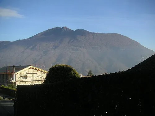
Monte Boglia Fernando Pescia · Public domain


Climate of Lugano
Best months for sightseeingBest months for sightseeing: May–September.
This month · November
A wet month
Day 11° · Night 3° · Rain 101 mm
- Hottest month
- July (day 26°)
- Coldest month
- January (night 0°)
- Wettest month
- May (160 mm)
- Driest month
- February (61 mm)
Bars: average monthly low and high temperature. Below: precipitation. Monthly averages for 1970–2000 at about 18 km resolution, adjusted for elevation. Highlighted months are mild and relatively dry. Source: WorldClim 2.1 (CC BY 4.0).
Show values as a table
| Month | Jan | Feb | Mar | Apr | May | Jun | Jul | Aug | Sep | Oct | Nov | Dec |
|---|---|---|---|---|---|---|---|---|---|---|---|---|
| Average high (°C) | 8° | 9° | 13° | 16° | 20° | 23° | 26° | 26° | 22° | 16° | 11° | 8° |
| Average low (°C) | 0° | 0° | 3° | 6° | 11° | 14° | 16° | 16° | 13° | 8° | 3° | 1° |
| Precipitation (mm) | 77 | 61 | 92 | 129 | 160 | 157 | 128 | 148 | 150 | 143 | 101 | 70 |
Other places to visit in this season: May June July August September
How to get to Lugano
The nearest airport is Lugano Airport (LUG), 5 km to the west as the crow flies. For international flights: Milan Malpensa International Airport (MXP) (46 km). The nearest large city is Zurich, 155 km to the north.
Airports
- Lugano Airport (LUG) Agno 5 kmwest
- Milan Malpensa International Airport (MXP) Ferno (VA) 46 kmsouthwest
- Milano Linate Airport (LIN) Segrate (MI) 67 kmsouth
Nearby large cities
- Zurich Population: 415.4K 155 kmnorth
- Bern Population: 121.6K 157 kmnorthwest
- Winterthur Population: 111.8K 168 kmnorth
- Lausanne Population: 139.1K 189 kmwest
- Basel Population: 177.6K 203 kmnorthwest
Straight-line distances; road distances are longer. Airport data: OurAirports.
Day trips from Lugano
Within 100 km: 99 historic and cultural sites, 4,612 natural sites, 595 lakes, rivers and coasts.
0–25 km182 places
- Isole di Brissago Island 23 kmNW
- Sant' Apollinare Island 23 kmNW
- San Pancrazio Island 23 kmNW
- Laghetto di Muzzano Lake 4 kmW
25–60 km1,064 places
- Lago Nero Lake 60 kmNW
- Lago Tremorgio Lake 56 kmN
- Lago del Sambuco Lake 56 kmNW
- Laghetto Lake 45 kmN
60–100 km4,060 places
- Chaviolas Island 76 kmNE
- Lajets Lake 72 kmNE
- Silvaplanersee Lake 81 kmNE
- Lake Sils Lake 75 kmNE
Straight-line distances.
Lugano and similar cities
Side by side with cities of similar size in the same country: population, elevation and climate.
| Measure | Lugano | Lugano | Biel/Bienne | St. Gallen |
|---|---|---|---|---|
| Population | 62.6K | 63.2K | 55.1K | 75.8K |
| Elevation | 345 m | 284 m | 434 m | 684 m |
| Summer day (hottest month) | 26° | 27° | 24° | 22° |
| Winter night (coldest month) | 0° | 0° | -2° | -3° |
| Annual rainfall | 1,416 mm | 1,416 mm | 987 mm | 1,297 mm |
| Best months | May–Sep | May–Sep | Jun–Sep | Jun–Sep |
| Distance | — | 1 km | 183 km | 161 km |
Climate values are 1970–2000 monthly averages; straight-line distance.
Places in Lugano
113 placesCities & villages42
- Le Spine · Village
- Loreto · Neighbourhood
- Lovasano · Village
- Lugano Centro · Neighbourhood
- Luss · Village
- Maglio di Colla · Village
- Malpensata · Village
- Marsèta · Village
- Molino · Village
- Molino Nuovo · Neighbourhood
- Mugnal · Neighbourhood
- Murio · Village
- Nendum · Village
- Opera castellano del Castello di San Martino · Village
- Osnaga · Village
- Pambio-Noranco · Neighbourhood
- Pazallo · Neighbourhood
- Pazzallo · Village
- Pescumo · Village
- Petrolzo · Village
- Pezza · Village
- Pianca · Village
- Piandera · Village
- Pian Soldin · Village
- Pönt · Village
- Premestivo · Village
- Rödes · Village
- Roncone · Village
- Roslino · Neighbourhood
- Rosone · Village
- Ruvigliana · Village
- San Domenico · Village
- Scareglia · Village
- Scirona · Village
- Sciss · Neighbourhood
- Signôra · Village
- Sonvico · Village
- Soragno · Neighbourhood
- Trecio · Village
- Trivelli · Village
- Valla · Village
- Villa Luganese · Village
Mountains & nature3
- Monte Boglia · Mountain
- Monte Brè · Mountain
- San Salvatore · Mountain
Heritage & sights8
- Museo Cantonale d Arte · Museum
- Museo Cantonale di storia naturale · Museum
- Museo d'Arte · Museum
- Museo delle Culture · Museum
- Museo di Santa Maria degli Angeli · Museum
- Parco botanico San Grato · Attraction
- Stadio Cornaredo · Landmark
- Thyssen-Bornemisza. Fondazione · Museum
Nearby attractions & nature
Everything nearby-
Lido di Lugano Mountain, Canton Ticino0.7 km W
-
Cassarate River, Canton Ticino0.8 km W
-
Lido di San Domenico Mountain, Canton Ticino1.4 km E
-
Lake Lugano Lake, Canton Ticino1.6 km S
-
Museo Doganale Svizzero Cantine di Gandria Museum, Canton Ticino3.9 km E
-
Laghetto di Muzzano Lake, Switzerland3.6 km W
-
Vedeggio River River, Switzerland5.1 km W
-
Swissminiatur Natural site, Canton Ticino6 km S
Sources & licences
Data last updated: