- Elevation
- 698 m
- above sea level
- Local time
- UTC+01:00
- Europe/Zurich · UTC+01:00
- Airports
- LUG Lugano Airport50 km
- MXP Milan Malpensa International Airport84 km
About Foroglio
Foroglio is a village. Location: Cevio, Vallemaggia District. Elevation: 698 m. The best months to visit are July–September. The nearest airport is Lugano Airport (50 km). Nearby sights include Val Bavona and Launc.
Climate of Foroglio
Best months for sightseeingBest months for sightseeing: July–September.
This month · November
A wet month
Day 10° · Night 3° · Rain 106 mm
- Hottest month
- July (day 23°)
- Coldest month
- February (night 0°)
- Wettest month
- June (137 mm)
- Driest month
- February (73 mm)
Bars: average monthly low and high temperature. Below: precipitation. Monthly averages for 1970–2000 at about 18 km resolution, adjusted for elevation. Highlighted months are mild and relatively dry. Source: WorldClim 2.1 (CC BY 4.0).
Show values as a table
| Month | Jan | Feb | Mar | Apr | May | Jun | Jul | Aug | Sep | Oct | Nov | Dec |
|---|---|---|---|---|---|---|---|---|---|---|---|---|
| Average high (°C) | 7° | 7° | 9° | 11° | 16° | 19° | 23° | 22° | 19° | 15° | 10° | 8° |
| Average low (°C) | 0° | 0° | 2° | 4° | 8° | 12° | 14° | 14° | 11° | 8° | 3° | 1° |
| Precipitation (mm) | 83 | 73 | 95 | 120 | 133 | 137 | 131 | 136 | 125 | 127 | 106 | 85 |
How to get to Foroglio
The nearest airport is Lugano Airport (LUG), 50 km to the southeast as the crow flies. For international flights: Milan Malpensa International Airport (MXP) (84 km). The nearest large city is Bern, 106 km to the northwest.
Airports
- Lugano Airport (LUG) Agno 50 kmsoutheast
- Milan Malpensa International Airport (MXP) Ferno (VA) 84 kmsouth
- Bern Airport (BRN) Bern 100 kmnorthwest
Nearby large cities
- Bern Population: 121.6K 106 kmnorthwest
- Zurich Population: 415.4K 110 kmnorth
- Winterthur Population: 111.8K 127 kmnorth
- Lausanne Population: 139.1K 148 kmwest
- Basel Population: 177.6K 151 kmnorthwest
Straight-line distances; road distances are longer. Airport data: OurAirports.
Nearby attractions & nature
Everything nearby-
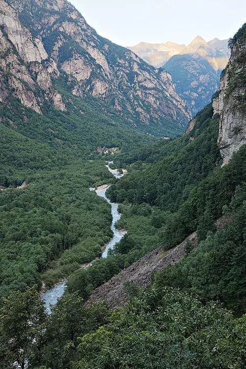 Val Bavona Natural site, Canton Ticino2.1 km NW
-
Launc Mountain, Cevio1.5 km NE
-
Pizzo della Cazzana Mountain, Cevio2.3 km S
-
Matüra Mountain, Cevio2.3 km E
-
Pizzo d'Ogliè Mountain, Cevio2.8 km NE
-
Ciavena Alta Mountain, Cevio2.9 km S
Sources & licences
Data last updated: