Wiesen Viaduct
Located in Davos, Region Prättigau / Davos Coordinates: 46°41′40″ N 9°42′46″ E
- Local time
- UTC+01:00
- Europe/Zurich · UTC+01:00
- Elevation
- 1,169 m
- above sea level
- Airports
- ACH Sankt Gallen Altenrhein Airport89 km
- LUG Lugano Airport98 km
About Wiesen Viaduct
Wiesen Viaduct is a landmark. Location: Davos, Region Prättigau / Davos.
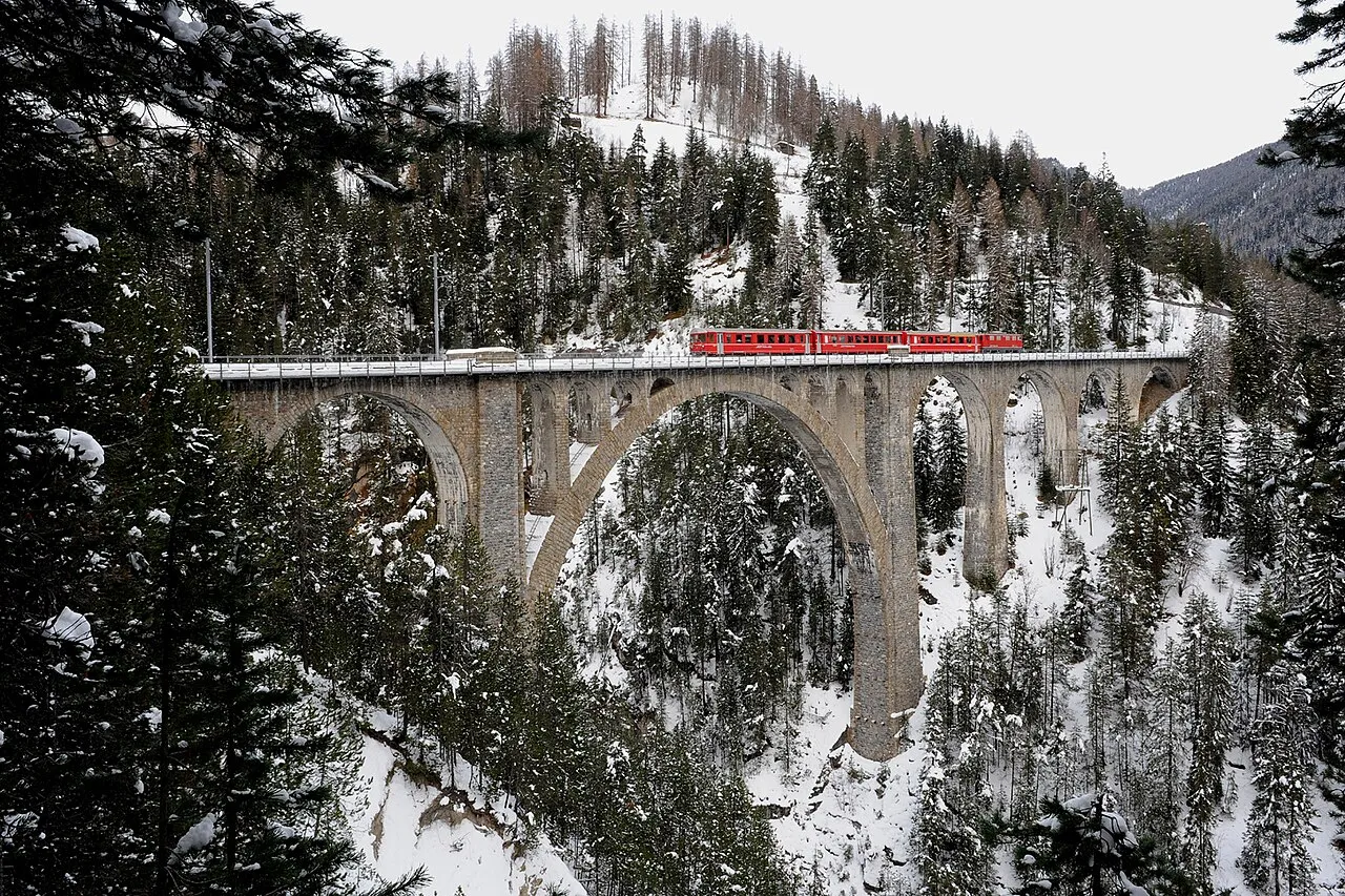
The Wiesen Viaduct (or Wiesener Viaduct; German: Wiesener Viadukt) is a single-track railway viaduct, made from concrete blocks with dimension stone coverage. It spans the Landwasser southwest of the hamlet of Wiesen, in the canton of Grisons, Switzerland. Designed by the then chief engineer of the Rhaetian Railway, Henning Friedrich, it was built between 1906 and 1909 by the contractor G. Marasi (Westermann & Cie, Zürich) under the supervision of P. Salaz and Hans Studer (RhB).
Source: Wikipedia · CC BY-SA 4.0
At a glance
- Built
- 1909
- Opened
- 1909
- Heritage designation
- class B Swiss cultural property of regional significance
- Height
- 88 m
- Length
- 0.2 km
Source: Wikidata
Photos of Wiesen Viaduct
-

Martingarten · CC BY-SA 4.0 -

Kabelleger · CC BY-SA 4.0 -

Capricorn4049 · CC BY-SA 4.0 -
Landwasser Viaduct SchmalspurDVZO · CC BY-SA 4.0


Climate of Wiesen Viaduct
Best months for sightseeingBest months for sightseeing: July–August.
This month · November
A cold month
Day 7° · Night -1° · Rain 98 mm
- Hottest month
- July (day 20°)
- Coldest month
- February (night -5°)
- Wettest month
- July (149 mm)
- Driest month
- February (72 mm)
Bars: average monthly low and high temperature. Below: precipitation. Monthly averages for 1970–2000 at about 18 km resolution, adjusted for elevation. Highlighted months are mild and relatively dry. Source: WorldClim 2.1 (CC BY 4.0).
Show values as a table
| Month | Jan | Feb | Mar | Apr | May | Jun | Jul | Aug | Sep | Oct | Nov | Dec |
|---|---|---|---|---|---|---|---|---|---|---|---|---|
| Average high (°C) | 4° | 4° | 6° | 9° | 14° | 17° | 20° | 20° | 17° | 13° | 7° | 4° |
| Average low (°C) | -5° | -5° | -2° | 1° | 6° | 8° | 11° | 11° | 8° | 4° | -1° | -3° |
| Precipitation (mm) | 85 | 72 | 84 | 93 | 109 | 139 | 149 | 144 | 120 | 99 | 98 | 88 |
How to get to Wiesen Viaduct
The nearest airport is Sankt Gallen Altenrhein Airport (ACH), 89 km to the north as the crow flies. For international flights: Bodensee Airport Friedrichshafen (FDH) (110 km). The nearest large city is Zurich, 116 km to the northwest.
Airports
- Sankt Gallen Altenrhein Airport (ACH) St. Gallen 89 kmnorth
- Lugano Airport (LUG) Agno 98 kmsouthwest
- Bodensee Airport Friedrichshafen (FDH) Friedrichshafen 110 kmnorth
Nearby large cities
- Zurich Population: 415.4K 116 kmnorthwest
- Winterthur Population: 111.8K 117 kmnorthwest
- Innsbruck Population: 132.5K 143 kmnortheast
- Bern Population: 121.6K 175 kmwest
- Basel Population: 177.6K 189 kmnorthwest
Straight-line distances; road distances are longer. Airport data: OurAirports.
Day trips from Wiesen Viaduct
Within 100 km: 197 historic and cultural sites, 6,836 natural sites, 912 lakes, rivers and coasts.
0–25 km668 places
- Lajets Lake 24 kmS
- Lake Davos Lake 18 kmNE
- Lai Alv Lake 15 kmS
- Lej Verd Lake 18 kmS
25–60 km2,944 places
- Chaviolas Island 30 kmS
- Silvaplanersee Lake 28 kmS
- Lake Sils Lake 31 kmS
- Lago di Poschiavo Lake 54 kmSE
60–100 km4,333 places
- Spadalone Mountain 99 kmSE
- Lago Nero Lake 94 kmW
- Ufenau Island 92 kmNW
- Isole di Brissago Island 98 kmSW
Straight-line distances.
Nearby attractions & nature
Everything nearby-
Landwasser Viaduct Landmark, Schmitten (GR)3.2 km SW
-
Cavjaviadukt Landmark, Bergün Filisur1.7 km SW
-
Schmittner Tobel Natural site, Grisons2.3 km W
-
Schmittentobel Viaduct Landmark, Schmitten (GR)3.6 km SW
-
Muchetta Mountain, Bergün Filisur2.6 km SE
-
Hüreli Mountain, Davos3.9 km NW
-
Läger Mountain, Davos4 km N
-
Bodmen Mountain, Davos4.1 km E
Nearest towns and villages
-
Davos Wiesen Village, Davos1.1 km N
-
Schmitten (GR) Municipality, Albula Region2.9 km W
-
Filisur Village, Bergün Filisur3.1 km SW
-
Bergün Filisur Municipality, Albula Region4.4 km S
Sources & licences
Data last updated: · 2 independent sources