Schmittentobel Viaduct
Located in Schmitten (GR), Albula Region Coordinates: 46°40′49″ N 9°40′16″ E
- Local time
- UTC+01:00
- Europe/Zurich · UTC+01:00
- Elevation
- 1,033 m
- above sea level
- Airports
- ACH Sankt Gallen Altenrhein Airport90 km
- LUG Lugano Airport95 km
About Schmittentobel Viaduct
Schmittentobel Viaduct is a landmark. Location: Schmitten (GR), Albula Region. The best months to visit are June–September. The nearest airport is Sankt Gallen Altenrhein Airport (90 km). Nearby sights include Landwasser Viaduct and Wiesen Viaduct.
Photos of Schmittentobel Viaduct
-
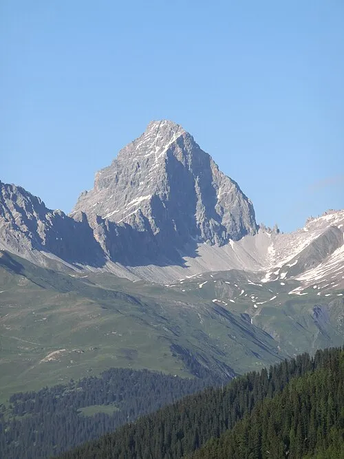
Corn da Tinizong Capricorn4049 · CC BY-SA 3.0 -
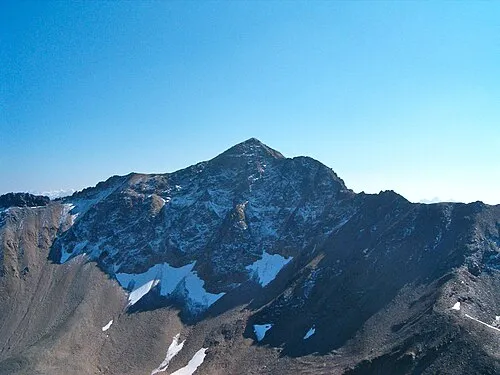
Aroser Rothorn Andres Passwirth · CC BY-SA 3.0 -
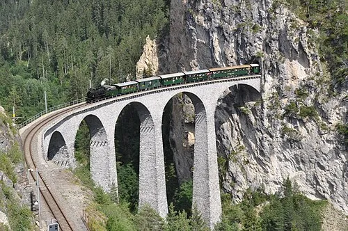
Landwasser Viaduct SchmalspurDVZO · CC BY-SA 4.0 -
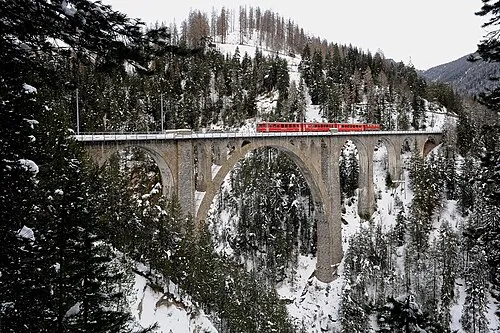
Wiesen Viaduct Хрюша · CC BY-SA 3.0


Climate of Schmittentobel Viaduct
Best months for sightseeingBest months for sightseeing: June–September.
This month · November
A cold month
Day 8° · Night 0° · Rain 98 mm
- Hottest month
- July (day 21°)
- Coldest month
- February (night -4°)
- Wettest month
- July (149 mm)
- Driest month
- February (72 mm)
Bars: average monthly low and high temperature. Below: precipitation. Monthly averages for 1970–2000 at about 18 km resolution, adjusted for elevation. Highlighted months are mild and relatively dry. Source: WorldClim 2.1 (CC BY 4.0).
Show values as a table
| Month | Jan | Feb | Mar | Apr | May | Jun | Jul | Aug | Sep | Oct | Nov | Dec |
|---|---|---|---|---|---|---|---|---|---|---|---|---|
| Average high (°C) | 5° | 5° | 7° | 10° | 15° | 18° | 21° | 21° | 18° | 14° | 8° | 5° |
| Average low (°C) | -4° | -4° | -1° | 2° | 6° | 9° | 11° | 12° | 9° | 5° | 0° | -2° |
| Precipitation (mm) | 85 | 72 | 84 | 93 | 109 | 139 | 149 | 144 | 120 | 99 | 98 | 88 |
Other places to visit in this season: June July August September
How to get to Schmittentobel Viaduct
The nearest airport is Sankt Gallen Altenrhein Airport (ACH), 90 km to the north as the crow flies. For international flights: Bodensee Airport Friedrichshafen (FDH) (111 km). The nearest large city is Zurich, 114 km to the northwest.
Airports
- Sankt Gallen Altenrhein Airport (ACH) St. Gallen 90 kmnorth
- Lugano Airport (LUG) Agno 95 kmsouthwest
- Bodensee Airport Friedrichshafen (FDH) Friedrichshafen 111 kmnorth
Nearby large cities
- Zurich Population: 415.4K 114 kmnorthwest
- Winterthur Population: 111.8K 117 kmnorthwest
- Innsbruck Population: 132.5K 146 kmnortheast
- Bern Population: 121.6K 172 kmwest
- Basel Population: 177.6K 187 kmnorthwest
Straight-line distances; road distances are longer. Airport data: OurAirports.
Day trips from Schmittentobel Viaduct
Within 100 km: 203 historic and cultural sites, 6,924 natural sites, 914 lakes, rivers and coasts.
0–25 km686 places
- Lajets Lake 22 kmS
- Lake Davos Lake 21 kmNE
- Lai Alv Lake 15 kmSE
- Lej Verd Lake 18 kmSE
25–60 km2,943 places
- Chaviolas Island 29 kmS
- Silvaplanersee Lake 27 kmS
- Lake Sils Lake 29 kmS
- Lago di Poschiavo Lake 54 kmSE
60–100 km4,412 places
- Lago Nero Lake 90 kmW
- Ufenau Island 90 kmNW
- Isole di Brissago Island 94 kmSW
- Insel Lützelau Island 90 kmNW
Straight-line distances.
Nearby attractions & nature
Everything nearby-
Landwasser Viaduct Landmark, Schmitten (GR)0.4 km E
-
Wiesen Viaduct Landmark, Davos3.6 km NE
-
Cavjaviadukt Landmark, Bergün Filisur2.1 km E
-
Landwasser River River, Switzerland1.3 km SW
-
Schmittner Tobel Natural site, Grisons2.4 km NE
-
Hübel Mountain, Schmitten (GR)4 km N
-
Bot digl Uors Mountain, Bergün Filisur3.9 km S
-
Chavagl Pitschen Mountain, Bergün Filisur4.3 km SE
Nearest towns and villages
-
Schmitten Village, Schmitten (GR)0.8 km N
-
Filisur Village, Bergün Filisur1.4 km SE
-
Alvaneu Village, Albula/Alvra1.9 km W
-
Bergün Filisur Municipality, Albula Region4.3 km SE
Sources & licences
Data last updated: