Bergün Filisur
Located in Albula Region, Grisons Coordinates: 46°39′18″ N 9°42′47″ E
- Population
- 898
- 898
- Elevation
- 1,081 m
- above sea level
- Local time
- UTC+01:00
- Europe/Zurich · UTC+01:00
- Places inside
- 87
- listed under Bergün Filisur
About Bergün Filisur
Bergün Filisur is a municipality. Location: Albula Region, Grisons. Population: 898. Elevation: 1,081 m.
In comparison
- No. 4 of 6 places in Albula Region by population
- Nearest larger town: Albula/Alvra, 9 km W
- 100 sights and natural places within 10 km Chavagl Pitschen, Chavagl Grond
- Listed here: Mountain: 60, Village: 16, Lake: 7, Natural site: 2
Climate of Bergün Filisur
Best months for sightseeing: July–September.
| Month | Jan | Feb | Mar | Apr | May | Jun | Jul | Aug | Sep | Oct | Nov | Dec |
|---|---|---|---|---|---|---|---|---|---|---|---|---|
| Average high (°C) | 4° | 4° | 6° | 8° | 13° | 17° | 20° | 20° | 17° | 13° | 7° | 5° |
| Average low (°C) | -4° | -4° | -2° | 2° | 6° | 9° | 11° | 12° | 9° | 6° | 1° | -2° |
| Precipitation (mm) | 81 | 66 | 83 | 90 | 97 | 120 | 128 | 125 | 109 | 95 | 92 | 83 |
Monthly averages for 1970–2000 at about 18 km resolution, adjusted for elevation. Highlighted months are mild and relatively dry. Source: WorldClim 2.1 (CC BY 4.0).
Other places to visit in this season: July · August · September
Airports nearest to Bergün Filisur
- Sankt Gallen Altenrhein Airport (ACH) St. Gallen 93 km
- Lugano Airport (LUG) Agno 95 km
- Il Caravaggio International Airport (BGY) Orio al Serio (BG) 110 km
Straight-line distance; airports with scheduled flights only. Source: OurAirports (public domain).
Places in Bergün Filisur
87 places-
Bergün Village526
-
Filisur Village502
-
Albula/Alvra River
-
Alp Mulix Village
-
Bellaluna Village
-
Bot digls Angialets Mountain
-
Bot digl Uors Mountain
-
Bot Radond Mountain
-
Bottas Glischas Mountain
-
Bott'Ota Mountain
-
Büelenhorn Mountain
-
Cavjaviadukt Landmark
-
Chagiosch Village
-
Chantota Mountain
-
Chants Village
-
Chavagl Grond Mountain
-
Chavagl Pitschen Mountain
-
Cho dal Buoch Mountain
-
Corn da Tinizong Mountain
-
Crap Alv Village
-
Cresta Val S-chigra Mountain
-
Cuolm da Latsch Mountain
-
Darlux Village
-
Ducan Pitschen Mountain
-
Fil da Stidier Mountain
-
Foras d'Nes Mountain
-
Gletscher Ducan Mountain
-
Hahnengrat Mountain
-
Igl Compass Mountain
-
Igl Dancler Mountain
-
Igls Cuetschen Mountain
-
Igls Lajets Lake
-
Kesch Pitschen Mountain
-
Lai Lake
-
Lai Alv Lake
-
Lai da Palpuegna Lake
-
Lai Negr Lake
-
Lais digl Crap Alv Lake
-
La Piramida Mountain
-
Latsch Village
-
Mäschengrat Mountain
-
Muchetta Mountain
-
Muot Village
-
Murtels da Fallò Mountain
-
Naz Village
-
Palpuogna Village
-
Peder Blanchetta Mountain
-
Piz Alvra Mountain
-
Piz As-cha Mountain
-
Piz Bial Mountain
-
Piz Crap Mountain
-
Piz Crealetsch Mountain
-
Piz Cuolmet Mountain
-
Piz d'Aela Mountain
-
Piz da l'Antgierna da Salteras Mountain
-
Piz Darlux Mountain
-
Piz digl Barba Peder Mountain
-
Piz d'Uglix Mountain
-
Piz Ela Mountain
Nearby attractions & nature
Everything nearby-
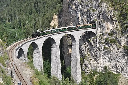 Landwasser Viaduct Landmark, Schmitten (GR)4.1 km NW
-
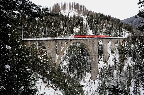 Wiesen Viaduct Landmark, Davos4.4 km N
-
Schmittentobel Viaduct Landmark, Schmitten (GR)4.3 km NW
-
Landwasser River River, Switzerland4.1 km NW
-
Schmittner Tobel Natural site, Grisons5.5 km NW
-
Büelen Mountain, Davos5.6 km NE
-
Ava da Tisch River, Switzerland5.3 km SE
-
Bodmen Mountain, Davos6.5 km NE
Sources & licences
Data last updated: