Balterswil
Located in Bichelsee-Balterswil, Münchwilen District Coordinates: 47°27′15″ N 8°56′12″ E
- Elevation
- 579 m
- above sea level
- Local time
- UTC+01:00
- Europe/Zurich · UTC+01:00
- Airports
- ZRH Zürich Airport29 km
- ACH Sankt Gallen Altenrhein Airport47 km
About Balterswil
Balterswil is a village. Location: Bichelsee-Balterswil, Münchwilen District. Elevation: 579 m. The best months to visit are June–September. The nearest airport is Zürich Airport (29 km). Nearby sights include Bichselsee and Kloster Tänikon.
Climate of Balterswil
Best months for sightseeingBest months for sightseeing: June–September.
This month · November
A cold month
Day 7° · Night 1° · Rain 95 mm
- Hottest month
- July (day 23°)
- Coldest month
- January (night -2°)
- Wettest month
- June (145 mm)
- Driest month
- January (67 mm)
Bars: average monthly low and high temperature. Below: precipitation. Monthly averages for 1970–2000 at about 18 km resolution, adjusted for elevation. Highlighted months are mild and relatively dry. Source: WorldClim 2.1 (CC BY 4.0).
Show values as a table
| Month | Jan | Feb | Mar | Apr | May | Jun | Jul | Aug | Sep | Oct | Nov | Dec |
|---|---|---|---|---|---|---|---|---|---|---|---|---|
| Average high (°C) | 3° | 5° | 9° | 12° | 18° | 20° | 23° | 22° | 19° | 13° | 7° | 4° |
| Average low (°C) | -2° | -2° | 1° | 3° | 8° | 11° | 13° | 13° | 10° | 6° | 1° | -1° |
| Precipitation (mm) | 67 | 78 | 74 | 92 | 111 | 145 | 144 | 135 | 101 | 86 | 95 | 85 |
Other places to visit in this season: June July August September
How to get to Balterswil
The nearest airport is Zürich Airport (ZRH), 29 km to the west as the crow flies. The nearest large city is Winterthur, 17 km to the west.
Airports
- Zürich Airport (ZRH) Zurich 29 kmwest
- Sankt Gallen Altenrhein Airport (ACH) St. Gallen 47 kmeast
- Bodensee Airport Friedrichshafen (FDH) Friedrichshafen 50 kmnortheast
Nearby large cities
- Winterthur Population: 111.8K 17 kmwest
- Zurich Population: 415.4K 31 kmwest
- Freiburg im Breisgau Population: 237.5K 101 kmnorthwest
- Basel Population: 177.6K 103 kmwest
- Reutlingen Population: 112.6K 117 kmnorth
Straight-line distances; road distances are longer. Airport data: OurAirports.
Day trips from Balterswil
Within 100 km: 540 historic and cultural sites, 5,052 natural sites, 1,011 lakes, rivers and coasts.
0–25 km163 places
- Strandbad Steckborn Beach 23 kmN
- Insel Werd Island 23 kmN
- Pfäffikersee Lake 16 kmSW
- Greifensee Lake 23 kmSW
25–60 km1,556 places
- Mainau Island 34 kmNE
- Fahr Abbey Attraction 38 kmW
- Dominikanerinsel Konstanz Island 30 kmNE
- Arbeiterstrandbad Tennwil Beach 57 kmW
60–100 km4,884 places
- Sankt-Niklausen-Insle Island 64 kmSW
- Neptun-Inseln Island 67 kmS
- Mauesee-Insel Island 72 kmSW
- Lorelei-Inseln Island 67 kmS
Straight-line distances.
Nearby attractions & nature
Everything nearby-
Bichselsee Lake, Bichelsee-Balterswil2.8 km W
-
Kloster Tänikon Attraction, Aadorf3.6 km NW
-
Weiherhof Lake, Sirnach4.3 km E
-
Kloster Fischingen Attraction, Fischingen5.3 km SE
-
Schauenberg Mountain, Elgg5.3 km W
-
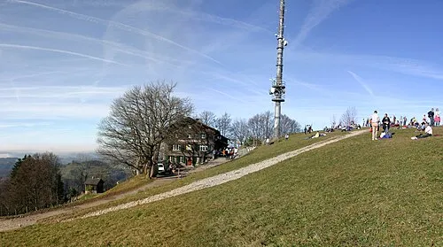 Hörnli Mountain, Fischenthal9.3 km S
Sources & licences
Data last updated: