Langedijke
Located in Ooststellingwerf Municipality, Friesland Coordinates: 52°57′52″ N 6°17′21″ E
- Population
- 295
- 295
- Elevation
- 8 m
- above sea level
- Local time
- UTC+01:00
- Europe/Amsterdam · UTC+01:00
- Airports
- GRQ Groningen Airport Eelde26 km
- AMS Amsterdam Airport Schiphol126 km
About Langedijke
Langedijke is a village. Location: Ooststellingwerf Municipality, Friesland. Population: 295. Elevation: 8 m.
Langedijke (West Frisian: Langedike) is a village consisting of about 290 inhabitants in the municipality of Ooststellingwerf in 2017 in the east of Friesland, the Netherlands. The village was first mentioned in 1408 as Langedijc, and means "long dike". The church was demolished in 1830, and only a bell tower remained. The bell dates from 1300 and is one of the oldest bells of Frieslands. In 1840, Langedijke was home to 36 people.
Source: Wikipedia · CC BY-SA 4.0
Climate of Langedijke
Best months for sightseeingBest months for sightseeing: June–August.
This month · November
A cold month
Day 9° · Night 3° · Rain 86 mm
- Hottest month
- August (day 22°)
- Coldest month
- January (night 0°)
- Wettest month
- November (86 mm)
- Driest month
- April (51 mm)
Bars: average monthly low and high temperature. Below: precipitation. Monthly averages for 1970–2000 at about 18 km resolution, adjusted for elevation. Highlighted months are mild and relatively dry. Source: WorldClim 2.1 (CC BY 4.0).
Show values as a table
| Month | Jan | Feb | Mar | Apr | May | Jun | Jul | Aug | Sep | Oct | Nov | Dec |
|---|---|---|---|---|---|---|---|---|---|---|---|---|
| Average high (°C) | 5° | 5° | 9° | 13° | 17° | 20° | 22° | 22° | 18° | 14° | 9° | 5° |
| Average low (°C) | 0° | 0° | 2° | 4° | 7° | 10° | 12° | 12° | 9° | 6° | 3° | 1° |
| Precipitation (mm) | 76 | 54 | 66 | 51 | 58 | 74 | 80 | 65 | 78 | 78 | 86 | 82 |
How to get to Langedijke
The nearest airport is Groningen Airport Eelde (GRQ), 26 km to the northeast as the crow flies. The nearest large city is Groningen, 34 km to the northeast.
Airports
- Groningen Airport Eelde (GRQ) Groningen 26 kmnortheast
- Amsterdam Airport Schiphol (AMS) Amsterdam 126 kmsouthwest
- Münster Osnabrück Airport (FMO) Greven 132 kmsoutheast
Nearby large cities
- Groningen Population: 244.8K 34 kmnortheast
- Leeuwarden Population: 124.5K 42 kmnorthwest
- Zwolle Population: 129.8K 52 kmsouth
- Apeldoorn Population: 136.7K 87 kmsouth
- Enschede Population: 153.7K 93 kmsoutheast
Straight-line distances; road distances are longer. Airport data: OurAirports.
Day trips from Langedijke
Within 100 km: 83 historic and cultural sites, 299 natural sites, 155 lakes, rivers and coasts.
0–25 km6 places
- Kiekenberg Mountain 13 kmW
- Havelterberg Mountain 20 kmS
- Boschberg Mountain 4 kmSE
- Bendersche Berg Mountain 20 kmS
25–60 km26 places
- Radewijkerbeek River 49 kmSE
- Radewijke River 54 kmSE
- Oosterstrand Beach 60 kmN
- Het Rif Beach 56 kmN
60–100 km505 places
- Texel Island 99 kmW
- Borkum Island 74 kmN
- Juist Island 92 kmNE
- Putjensberg Mountain 66 kmS
Straight-line distances.
Nearby attractions & nature
Everything nearby-
Boschberg Mountain, Ooststellingwerf Municipality4 km SE
-
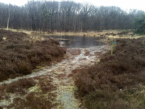 Kiekenberg Mountain, Heerenveen Municipality13 km W
-
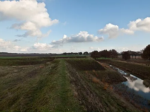 Zwartendijksterschans Historic site, Gemeente Noordenveld14 km N
-
Bendersche Berg Mountain, Gemeente Westerveld20 km S
-
Havelterberg Mountain, Gemeente Westerveld20 km S
-
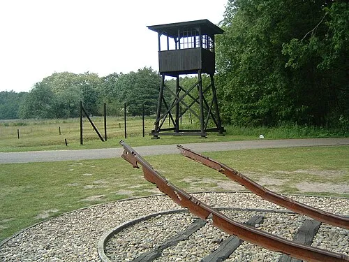 Police Custody Camp Westerbork Historic site, Gemeente Midden-Drenthe25 km SE
Sources & licences
Data last updated: · 2 independent sources