Breda Municipality
Located in North Brabant, The Netherlands Coordinates: 51°34′40″ N 4°45′37″ E
- Population
- 183,448
- 183.4K
- Elevation
- 5 m
- above sea level
- Local time
- UTC+01:00
- Europe/Amsterdam · UTC+01:00
- Places inside
- 20
- listed under Breda Municipality
About Breda Municipality
Breda Municipality is a district. Location: North Brabant, The Netherlands. Population: 183,448.
In comparison
- 5 sights and natural places within 10 km Breda Concentration Camp, Aa
- Listed here: Neighbourhood: 12, Village: 3, Historic site: 2, Town: 2
Places in Breda Municipality
20 places-
Breda City184.1K
-
Hoge Vucht Neighbourhood16K
-
Prinsenbeek Town10.7K
-
Princenhage Neighbourhood8.5K
-
Teteringen Town7.2K
-
Ginneken Neighbourhood5.4K
-
Bavel Neighbourhood5.4K
-
Zandberg Neighbourhood5.3K
-
Heusdenhout Neighbourhood5.2K
-
Biesdonk Neighbourhood5K
-
Gageldonk Village4.9K
-
Ulvenhout Village4.5K
-
Wisselaar Neighbourhood4.2K
-
Belcrum Neighbourhood3.6K
-
Waterdonken Neighbourhood1.1K
-
Krogten Neighbourhood200
-
Emer Neighbourhood75
-
Breda Concentration Camp Historic site
-
Kasteel Bouvigne Historic site
-
Rith Village
Nearby attractions & nature
Everything nearby-
Aa River, The Netherlands2.3 km S
-
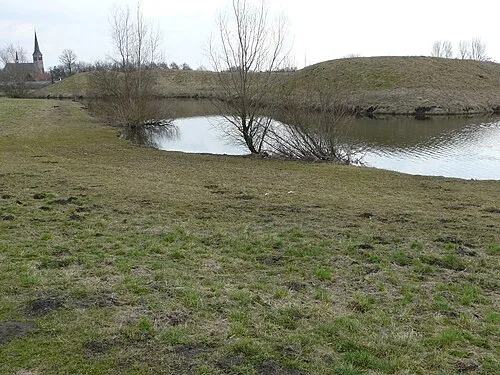 Kleine Schans Historic site, Drimmelen Municipality7.4 km N
-
Leijloop River, Belgium8.8 km S
-
Fluitberg Mountain, Alphen-Chaam Municipality15 km SE
-
Heerlese Loop River, Antwerp Province10 km S
-
Zandberg Mountain, Alphen-Chaam Municipality16 km SE
Sources & licences
Data last updated: