Ulvenhout
Located in Breda Municipality, North Brabant Coordinates: 51°32′57″ N 4°47′58″ E
- Population
- 4,520
- 4.5K
- Elevation
- 6 m
- above sea level
- Local time
- UTC+01:00
- Europe/Amsterdam · UTC+01:00
About Ulvenhout
Ulvenhout is a village. Location: Breda Municipality, North Brabant. Population: 4,520. Elevation: 6 m.
Ulvenhout is a village in the Dutch province of North Brabant. It is located in the municipality of Breda. The village was divided by the A58 motorway. The southern part belongs to the municipality of Alphen-Chaam and is called Ulvenhout AC.
Read more on Wikipedia Text: Wikipedia contributors · CC BY-SA 4.0 · shortened
In comparison
- No. 12 of 17 places in Breda Municipality by population
- Nearest larger town: Ginneken, 2 km N
- 5 sights and natural places within 10 km Kasteel Bouvigne, Aa
Climate of Ulvenhout
Best months for sightseeing: June–August.
| Month | Jan | Feb | Mar | Apr | May | Jun | Jul | Aug | Sep | Oct | Nov | Dec |
|---|---|---|---|---|---|---|---|---|---|---|---|---|
| Average high (°C) | 6° | 6° | 10° | 13° | 18° | 21° | 23° | 23° | 19° | 15° | 9° | 7° |
| Average low (°C) | 0° | 0° | 2° | 4° | 8° | 11° | 13° | 12° | 10° | 7° | 3° | 2° |
| Precipitation (mm) | 69 | 52 | 67 | 48 | 60 | 74 | 73 | 60 | 77 | 76 | 81 | 78 |
Monthly averages for 1970–2000 at about 18 km resolution, adjusted for elevation. Highlighted months are mild and relatively dry. Source: WorldClim 2.1 (CC BY 4.0).
Airports nearest to Ulvenhout
- Eindhoven Airport (EIN) Eindhoven 41 km
- Antwerp International Airport (Deurne) (ANR) Antwerp 46 km
- Rotterdam The Hague Airport (RTM) Rotterdam 52 km
Straight-line distance; airports with scheduled flights only. Source: OurAirports (public domain).
Nearby attractions & nature
Everything nearby-
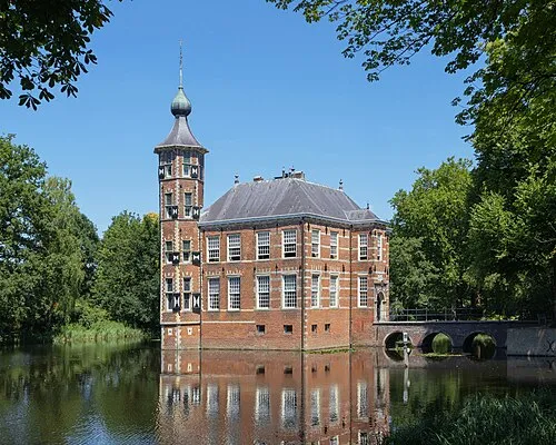 Kasteel Bouvigne Historic site, Breda Municipality1.9 km NW
-
Aa River, The Netherlands3.2 km W
-
Breda Concentration Camp Historic site, Breda Municipality3.3 km NW
-
Leijloop River, Belgium5.6 km S
-
Heerlese Loop River, Antwerp Province7.1 km S
-
Fluitberg Mountain, Alphen-Chaam Municipality11 km SE
Sources & licences
Data last updated: · 2 independent sources