- Population
- 83,640
- 83.6K
- Elevation
- 7 m
- above sea level
- Local time
- UTC+01:00
- Europe/Amsterdam · UTC+01:00
- Airports
- AMS Amsterdam Airport Schiphol30 km
- RTM Rotterdam The Hague Airport59 km
About Hilversum
Hilversum is a town. Location: Hilversum Municipality, North Holland. Population: 83,640. Elevation: 7 m. The best months to visit are June–August. The nearest airport is Amsterdam Airport Schiphol (30 km). Nearby sights include Hoorneboeg and Zwarte Berg.
Photos of Hilversum
-

Jobbew · CC BY-SA 4.0 -

Janwillemvanaalst · CC BY-SA 4.0 -

Jan dijkstra · CC BY-SA 4.0 -

Xavier66 · CC BY-SA 3.0 -

Wim Consenheim / Anefo · CC0


Travel notes for Hilversum
From Wikivoyage
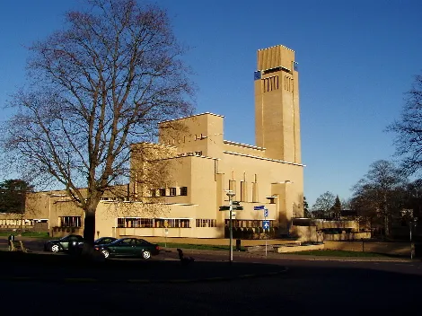
Hilversum is a medium-sized city in the Gooi area of North Holland in the Netherlands. Once called the Garden of Amsterdam, most travellers still come over to cycle and hike through the surrounding forests and heathland. The city is also known for its modern architecture, with Dudok's Hilversum Town Hall being the most significant design. Hilversum is known as "media city", being the home of the radio and television broadcasting industry of the Netherlands.
Understand+
Unlike most of the Netherlands, Hilversum is in a hilly area on sand soil. The town is between the major cities of Amsterdam and Utrecht, and most travellers visit it as a relaxing day off from the urban mayhem. The forests, lakes and heathland surrounding the town can best be explored by bicycle or on foot. Most of these lands are property of the Goois Natuurreservaat Foundation (GNR), a non-profit organisation dedicated to protecting the nature reserves. Another goal is to connect nature reserves that have been separated by motorways and other human-made structures. For this end, the wildlife crossing Zanderij Crailo was completed in 2006, and it is the largest wildlife crossing in the world. It connects the Spanderswoud and the Bussumerheide, and is part of a larger programme to connect nature reserves from the Utrechtse Heuvelrug to Naarden.
The city is also green and breezy with trees pretty much everywhere. A total of 660 different types of trees to be exact, the largest variety of species in the Netherlands. Typical for the city is the way forests and city building naturally blend into each other. Hilversum is called a villadorp (villa village) because of its many villas with large surrounding gardens. The botanical garden Pinetum Blijdenstein is the most remarkable one with an enormous collection of rare and endangered trees and plants, some of which are exotic. It is home to one of the most complete collections of conifers in the world. Hilversum is nationally known as the media city, and goes by its nickname Hillywood. It is home to the country's broadcasting industry and has the two largest television studios in Europe within its borders. Every year, the Dutch points given in the Eurovision Song Contest are announced from Hilversum. Many Dutch celebrities live in the area, and their daily lives are often a topic of national interest.
History:
Get in+
By train:
Because of the central location of its train station, Hilversum can best be reached by the NS railway service. Trains run roughly every 15 minutes between 05:00 and 01:00 to and from Amsterdam, Schiphol Airport, Utrecht, Amersfoort and Almere. The smaller train stations Hilversum Media Park and Hilversum Sportpark are within walking distance of the main train station.
Every day, six international trains to and from Berlin and Hanover stop in Hilversum. You can reserve seats at NS International. This is not required, but can be advised as prices are lower and rush hours can be crowded.
By car:
Hilversum can be reached by motorways A1, A2 and A27. From the northwest and east (Amsterdam and Amersfoort), take A1 exit 9 at Laren, drive south on N525 and follow the signs. From the west (Schiphol Airport and Leiden), get on motorway A2 and take exit 4 at Vinkeveen. From there, drive east on N201. From the north and south (Almere and Utrecht), take motorway A27 and exit 33.
The provincial roads can be used to get to Hilversum as well. By driving on these smaller roads, you see more of the forests and rural areas around the town. N524 is a ride through the Spanderswoud from Bussum in the north. Two other forest rides are N525 from Laren in the northeast and N415 from Baarn in the east. From the south, the rural road N417 makes its way through farm fields and villages. N201 from Vinkeveen in the west goes through flat farmlands as well.
By plane:
1 Hilversum Airport. The town's airport in the southwest. It's only used for recreational flying and training purposes.
Source: Wikivoyage · CC BY-SA 4.0 · abridged
Climate of Hilversum
Best months for sightseeingBest months for sightseeing: June–August.
This month · November
A cold month
Day 9° · Night 3° · Rain 86 mm
- Hottest month
- August (day 22°)
- Coldest month
- February (night 0°)
- Wettest month
- November (86 mm)
- Driest month
- April (47 mm)
Bars: average monthly low and high temperature. Below: precipitation. Monthly averages for 1970–2000 at about 18 km resolution, adjusted for elevation. Highlighted months are mild and relatively dry. Source: WorldClim 2.1 (CC BY 4.0).
Show values as a table
| Month | Jan | Feb | Mar | Apr | May | Jun | Jul | Aug | Sep | Oct | Nov | Dec |
|---|---|---|---|---|---|---|---|---|---|---|---|---|
| Average high (°C) | 5° | 6° | 9° | 13° | 17° | 20° | 22° | 22° | 19° | 14° | 9° | 6° |
| Average low (°C) | 0° | 0° | 2° | 3° | 7° | 10° | 12° | 12° | 10° | 6° | 3° | 1° |
| Precipitation (mm) | 71 | 53 | 68 | 47 | 61 | 70 | 71 | 60 | 76 | 81 | 86 | 83 |
How to get to Hilversum
The nearest airport is Amsterdam Airport Schiphol (AMS), 30 km to the west as the crow flies. The nearest large city is Utrecht, 15 km to the south.
Airports
- Amsterdam Airport Schiphol (AMS) Amsterdam 30 kmwest
- Rotterdam The Hague Airport (RTM) Rotterdam 59 kmsouthwest
- Eindhoven Airport (EIN) Eindhoven 87 kmsouth
Nearby large cities
- Utrecht Population: 376.4K 15 kmsouth
- Amersfoort Population: 139.9K 16 kmsoutheast
- Almere Stad Population: 176.4K 17 kmnorth
- Amsterdam Population: 741.6K 26 kmnorthwest
- Hoofddorp Population: 132.7K 34 kmwest
Straight-line distances; road distances are longer. Airport data: OurAirports.
Day trips from Hilversum
Within 100 km: 151 historic and cultural sites, 132 natural sites, 63 lakes, rivers and coasts.
0–25 km48 places
- Zwarte Berg Mountain 4 kmS
- Hoorneboeg Mountain 3 kmS
- Galgenberg Mountain 16 kmSE
- Eikenberg Mountain 10 kmN
25–60 km116 places
- Putjensberg Mountain 59 kmE
- Eiland van Brienenoord Island 57 kmSW
- Zwarte Berg Mountain 56 kmE
- Zwarte Berg Mountain 41 kmE
60–100 km182 places
- IJsselmonde Island 60 kmSW
- Texel Island 98 kmN
- Wegmeerheide Natural site 93 kmS
- Staatbossen Natural site 94 kmS
Straight-line distances.
Hilversum and similar cities
Side by side with cities of similar size in the same country: population, elevation and climate.
| Measure | Hilversum | Hengelo | Lelystad | Assen |
|---|---|---|---|---|
| Population | 83.6K | 82.3K | 79.8K | 68.8K |
| Elevation | 7 m | 18 m | -1 m | 12 m |
| Summer day (hottest month) | 22° | 23° | 22° | 22° |
| Winter night (coldest month) | 0° | -1° | 1° | -1° |
| Annual rainfall | 827 mm | 777 mm | 803 mm | 829 mm |
| Best months | Jun–Aug | Jun–Aug | Jun–Aug | Jun–Aug |
| Distance | — | 111 km | 38 km | 127 km |
Climate values are 1970–2000 monthly averages; straight-line distance.
Nearby attractions & nature
Everything nearby-
Hoorneboeg Mountain, Hilversum Municipality3 km S
-
Zwarte Berg Mountain, Hilversum Municipality3.7 km S
-
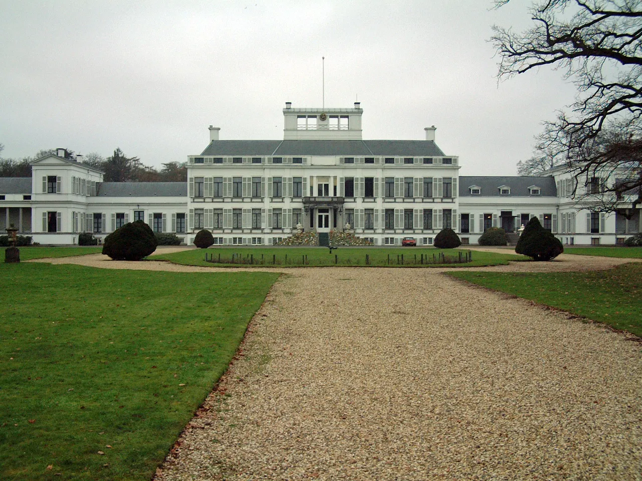 Soestdijk Palace Historic site, Baarn Municipality7.8 km SE
-
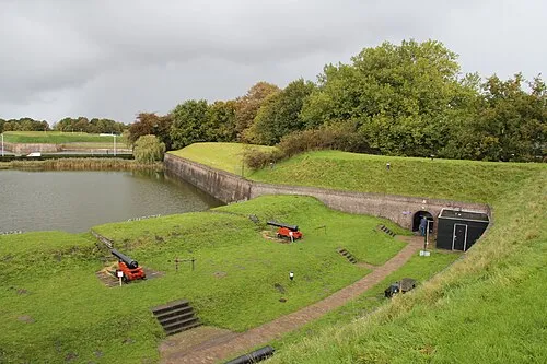 Dutch Fortress Museum Historic site, Gooise Meren7.8 km N
-
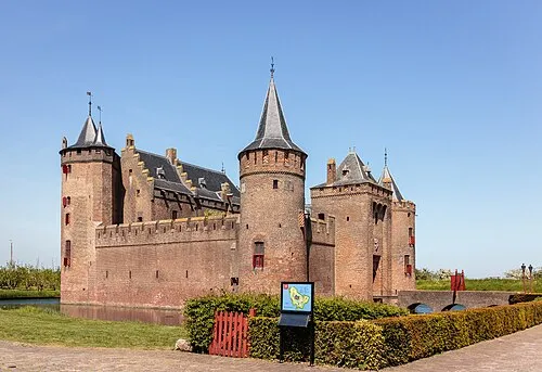 Muiderslot Historic site, Gooise Meren14 km NW
-
 Museum Catharijneconvent Museum, Gemeente Utrecht16 km S
-
 Jacobikerk Attraction, Gemeente Utrecht15 km S
-
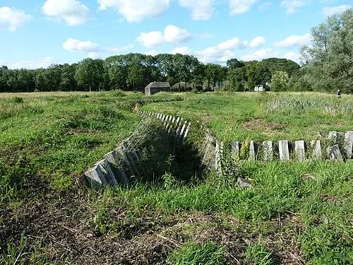 Ruigenhoek Fort Historic site, De Bilt Municipality11 km S
Sources & licences
Data last updated: