- Elevation
- 24 m
- above sea level
- Local time
- UTC+01:00
- Europe/Amsterdam · UTC+01:00
- Airports
- FMO Münster Osnabrück Airport61 km
- GRQ Groningen Airport Eelde91 km
About Gammelke
Gammelke is a village. Location: Gemeente Dinkelland, Overijssel. Elevation: 24 m.
Gammelke is a hamlet in the Dutch province of Overijssel. It is a part of the municipality of Dinkelland, and lies about 5 km west of Oldenzaal. Gammelke is not a statistical entity, and the postal authorities have placed it under Deurningen. It was first mentioned in 1272 as Gamminclo, and means "the forest of Gammo (person)". In 1840, it was home to 267 people. Nowadays it consists of about 100 houses. Seven burial mounds from the Neolithic or Bronze Age have been discovered near Gammelke.
Source: Wikipedia · CC BY-SA 4.0
Climate of Gammelke
Best months for sightseeingBest months for sightseeing: June–August.
This month · November
A cold month
Day 9° · Night 3° · Rain 72 mm
- Hottest month
- August (day 22°)
- Coldest month
- February (night -1°)
- Wettest month
- December (76 mm)
- Driest month
- February (47 mm)
Bars: average monthly low and high temperature. Below: precipitation. Monthly averages for 1970–2000 at about 18 km resolution, adjusted for elevation. Highlighted months are mild and relatively dry. Source: WorldClim 2.1 (CC BY 4.0).
Show values as a table
| Month | Jan | Feb | Mar | Apr | May | Jun | Jul | Aug | Sep | Oct | Nov | Dec |
|---|---|---|---|---|---|---|---|---|---|---|---|---|
| Average high (°C) | 5° | 5° | 9° | 13° | 18° | 20° | 22° | 22° | 19° | 14° | 9° | 6° |
| Average low (°C) | 0° | -1° | 2° | 3° | 8° | 10° | 12° | 12° | 9° | 6° | 3° | 1° |
| Precipitation (mm) | 68 | 47 | 64 | 48 | 56 | 75 | 72 | 61 | 72 | 65 | 72 | 76 |
How to get to Gammelke
The nearest airport is Münster Osnabrück Airport (FMO), 61 km to the east as the crow flies. The nearest large city is Enschede, 12 km to the south.
Airports
- Münster Osnabrück Airport (FMO) Greven 61 kmeast
- Groningen Airport Eelde (GRQ) Groningen 91 kmnorth
- Weeze (Niederrhein) Airport (NRN) Weeze 94 kmsouthwest
Nearby large cities
- Enschede Population: 153.7K 12 kmsouth
- Zwolle Population: 129.8K 56 kmnorthwest
- Apeldoorn Population: 136.7K 61 kmwest
- Münster Population: 308.3K 66 kmsoutheast
- Arnhem Population: 162.4K 75 kmsouthwest
Straight-line distances; road distances are longer. Airport data: OurAirports.
Nearby attractions & nature
Everything nearby-
Kersberg Mountain, Gemeente Dinkelland11 km N
-
Paasberg Mountain, Losser Municipality8.4 km E
-
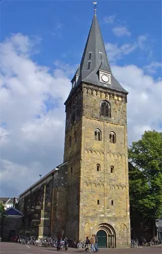 Grote Kerk Attraction, Enschede Municipality11 km S
-
Tutenberg Mountain, Tubbergen Municipality13 km N
-
Braamberg Mountain, Tubbergen Municipality13 km N
-
Galgenberg Mountain, Lower Saxony15 km N
Sources & licences
Data last updated: · 2 independent sources