Beerta
Located in Oldambt Municipality, Province of Groningen Coordinates: 53°10′30″ N 7°05′30″ E

- Elevation
- -1 m
- above sea level
- Local time
- UTC+01:00
- Europe/Amsterdam · UTC+01:00
- Airports
- GRQ Groningen Airport Eelde35 km
- BRE Bremen Airport115 km
About Beerta
Beerta is a village. Location: Oldambt Municipality, Province of Groningen. Elevation: -1 m.
Beerta (Dutch pronunciation: [ˈbeːrtaː]; Gronings: (De) Beert(e) [də ˈbɪːdə]) is a village and former municipality with a population of 2,205 in the municipality of Oldambt in the province of Groningen in the Netherlands. In the 20th century, Beerta was a communist stronghold. In 1933, the municipal council was dismissed by the government, and was ruled by a government commissioner until 1935. Between 1982 and 1990, Beerta was the only municipality with a communist mayor.
Source: Wikipedia · CC BY-SA 4.0
Photos of Beerta
-

Hardscarf · CC BY-SA 4.0 -

Unknown author Unknown author · CC BY-SA 4.0 -

A. J. van der Wal · CC BY-SA 4.0 -

HandigeHarry · Public domain -

Gerardus · Public domain


Places bordering Beerta
- Winschoten
Climate of Beerta
Best months for sightseeingBest months for sightseeing: June–August.
This month · November
A cold month
Day 8° · Night 3° · Rain 77 mm
- Hottest month
- August (day 22°)
- Coldest month
- February (night -1°)
- Wettest month
- November (77 mm)
- Driest month
- February (43 mm)
Bars: average monthly low and high temperature. Below: precipitation. Monthly averages for 1970–2000 at about 18 km resolution, adjusted for elevation. Highlighted months are mild and relatively dry. Source: WorldClim 2.1 (CC BY 4.0).
Show values as a table
| Month | Jan | Feb | Mar | Apr | May | Jun | Jul | Aug | Sep | Oct | Nov | Dec |
|---|---|---|---|---|---|---|---|---|---|---|---|---|
| Average high (°C) | 4° | 5° | 8° | 12° | 17° | 19° | 21° | 22° | 18° | 13° | 8° | 5° |
| Average low (°C) | 0° | -1° | 2° | 4° | 8° | 10° | 13° | 12° | 10° | 7° | 3° | 1° |
| Precipitation (mm) | 64 | 43 | 58 | 44 | 53 | 75 | 76 | 66 | 72 | 70 | 77 | 71 |
How to get to Beerta
The nearest airport is Groningen Airport Eelde (GRQ), 35 km to the west as the crow flies. The nearest large city is Groningen, 35 km to the west.
Airports
- Groningen Airport Eelde (GRQ) Groningen 35 kmwest
- Bremen Airport (BRE) Bremen 115 kmeast
- Münster Osnabrück Airport (FMO) Greven 123 kmsouth
Nearby large cities
- Groningen Population: 244.8K 35 kmwest
- Oldenburg Population: 159.2K 75 kmeast
- Leeuwarden Population: 124.5K 86 kmwest
- Zwolle Population: 129.8K 100 kmsouthwest
- Bremerhaven Population: 118.6K 107 kmnortheast
Straight-line distances; road distances are longer. Airport data: OurAirports.
Day trips from Beerta
Within 100 km: 119 historic and cultural sites, 573 natural sites, 421 lakes, rivers and coasts.
0–25 km26 places
- Hatzumer Sand Island 23 kmNE
- Waldsee Lake 19 kmSE
- Mahlbusen Lake 19 kmN
- Heeder See Lake 24 kmSE
25–60 km383 places
- Borkum Island 52 kmNW
- Juist Island 56 kmN
- Nordstrand Beach 54 kmNW
- Westbad Beach 59 kmN
60–100 km704 places
- East Frisian Islands Island 66 kmN
- Norderney Island 61 kmN
- Insel Spiekeroog Island 78 kmNE
- Baltrum Island 65 kmN
Straight-line distances.
Nearby attractions & nature
Everything nearby-
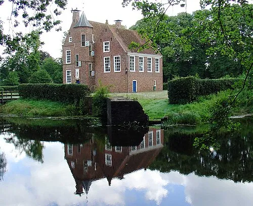 Wedderborg Historic site, Westerwolde Municipality12 km S
-
Bourtange Fortress Historic site, Westerwolde Municipality20 km S
-
Bourtange Fortress Museum Museum, Westerwolde Municipality20 km S
-
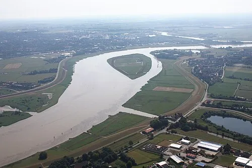 Bingumer Sand Island, Lower Saxony23 km E
-
Early Camp Rhede-Brual Historic site, Rhede (Ems)15 km SE
-
Heester Tief River, Lower Saxony15 km NE
Other cities and towns in Oldambt Municipality

Sources & licences
Data last updated: · 2 independent sources