Zorgvliet
Located in Scheveningen, Gemeente Den Haag Coordinates: 52°05′23″ N 4°17′10″ E
- Elevation
- 10 m
- above sea level
- Local time
- UTC+01:00
- Europe/Amsterdam · UTC+01:00
- Airports
- RTM Rotterdam The Hague Airport18 km
- AMS Amsterdam Airport Schiphol41 km
About Zorgvliet
Zorgvliet is a neighbourhood. Location: Scheveningen, Gemeente Den Haag.
Zorgvliet (Dutch pronunciation: [ˈzɔr(ə)xflit]) is a neighbourhood in the Scheveningen district of The Hague, Netherlands. It is named after the estate of the same name, once owned by the poet and writer Jacob Cats, (since then called the Catshuis), later by 18th century politician Willem Bentinck van Rhoon and later again becoming the official residence of the Dutch Prime Minister. It has 377 inhabitants (as of 1 January 2013) and covers an area of 876 hectares (3.38 sq mi).
Source: Wikipedia · CC BY-SA 4.0
Photos of Zorgvliet
-
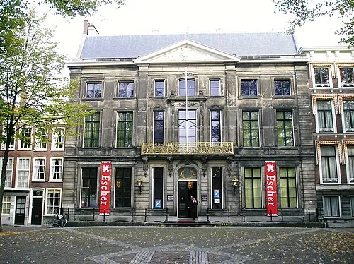
Escher Museum Andrew Crump · CC BY 2.0 -
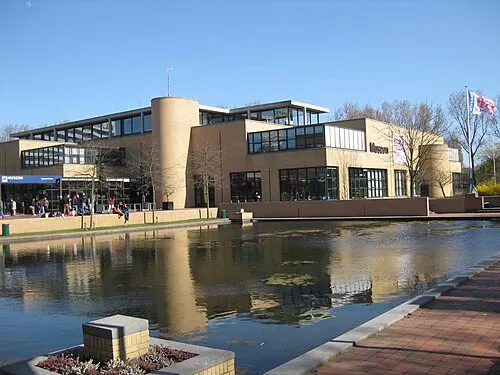
Museon Chemical Engineer · CC BY-SA 3.0 -
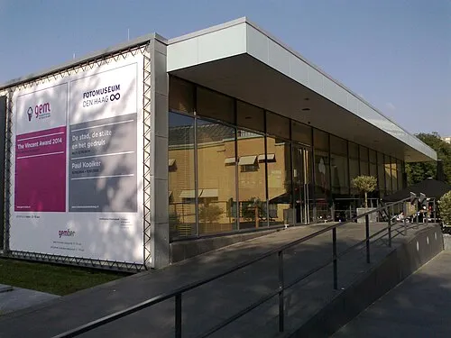
GEM OSeveno · CC BY-SA 4.0


Climate of Zorgvliet
Best months for sightseeingBest months for sightseeing: June–August.
This month · November
A cold month
Day 9° · Night 4° · Rain 98 mm
- Hottest month
- August (day 21°)
- Coldest month
- February (night 0°)
- Wettest month
- November (98 mm)
- Driest month
- April (46 mm)
Bars: average monthly low and high temperature. Below: precipitation. Monthly averages for 1970–2000 at about 18 km resolution, adjusted for elevation. Highlighted months are mild and relatively dry. Source: WorldClim 2.1 (CC BY 4.0).
Show values as a table
| Month | Jan | Feb | Mar | Apr | May | Jun | Jul | Aug | Sep | Oct | Nov | Dec |
|---|---|---|---|---|---|---|---|---|---|---|---|---|
| Average high (°C) | 5° | 6° | 9° | 12° | 16° | 18° | 20° | 21° | 18° | 14° | 9° | 7° |
| Average low (°C) | 1° | 0° | 3° | 4° | 8° | 11° | 13° | 13° | 11° | 8° | 4° | 2° |
| Precipitation (mm) | 69 | 50 | 64 | 46 | 49 | 67 | 67 | 63 | 90 | 94 | 98 | 80 |
How to get to Zorgvliet
The nearest airport is Rotterdam The Hague Airport (RTM), 18 km to the southeast as the crow flies. The nearest large city is The Hague, 2 km to the southeast.
Airports
- Rotterdam The Hague Airport (RTM) Rotterdam 18 kmsoutheast
- Amsterdam Airport Schiphol (AMS) Amsterdam 41 kmnortheast
- Antwerp International Airport (Deurne) (ANR) Antwerp 101 kmsouth
Nearby large cities
- The Hague Population: 474.3K 2 kmsoutheast
- Zoetermeer Population: 115.8K 15 kmeast
- Leiden Population: 119.7K 16 kmnortheast
- Rotterdam Population: 868.1K 23 kmsoutheast
- Hoofddorp Population: 132.7K 36 kmnortheast
Straight-line distances; road distances are longer. Airport data: OurAirports.
Day trips from Zorgvliet
Within 100 km: 167 historic and cultural sites, 64 natural sites, 90 lakes, rivers and coasts.
0–25 km20 places
- Habana Beach Beach 5 kmSW
- Hoek van Holland Natural site 17 kmSW
- Den Haag Concentration Camp Historic site 2 kmSE
- Oud Poelgeest Historic site 17 kmNE
25–60 km79 places
- IJsselmonde Island 29 kmSE
- Ouddorp Beach Beach 40 kmSW
- Badstrand Rockanje Beach 29 kmSW
- Eiland van Brienenoord Island 27 kmSE
60–100 km222 places
- Het Eiland Island 100 kmS
- Putse Moer Lake 79 kmS
- Stappensven Lake 77 kmS
- Kleine Weel Lake 90 kmS
Straight-line distances.
Nearby attractions & nature
Everything nearby-
Museon Museum, Gemeente Den Haag0.4 km W
-
GEM Museum, Gemeente Den Haag0.4 km W
-
Escher Museum Museum, Gemeente Den Haag2.1 km E
-
Den Haag Concentration Camp Historic site, Centrum2.4 km SE
-
Habana Beach Beach, Gemeente Den Haag5.2 km SW
-
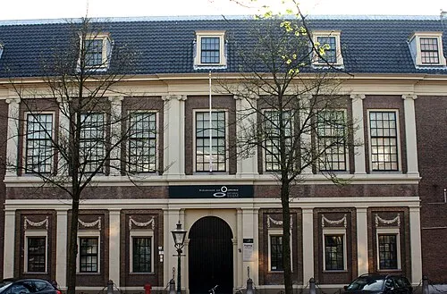 Rijksmuseum van Oudheden Museum, Leiden Municipality16 km NE
Other cities and towns in Scheveningen
-
 Duinoord Neighbourhood, Scheveningen0.8 km SW
-
Belgisch Park Neighbourhood, Scheveningen2.5 km N
Sources & licences
Data last updated: · 2 independent sources