- Population
- 255
- 255
- Elevation
- 2 m
- above sea level
- Local time
- UTC+01:00
- Europe/Amsterdam · UTC+01:00
- Airports
- OST Ostend-Bruges International Airport49 km
- ANR Antwerp International Airport (Deurne)65 km
About Waterlandkerkje
Waterlandkerkje is a village. Location: Sluis Municipality, Zeeland. Population: 255. Elevation: 2 m.
Waterlandkerkje is a village in the Dutch province of Zeeland. It is located in the municipality of Sluis. The village was first mentioned in 1740 as "de Kerk op Waterland, en doorgaans Nieuw of Klein Kerkje geheeten", and means "little church of Waterland". Waterland was a region which was flooded in 1375. The church was established around 1670 by Protestants who went to church in Waterland-Oudeman in the Spanish Netherlands (nowadays: Belgium), but who were removed by force by the Catholics.
Source: Wikipedia · CC BY-SA 4.0
Population of Waterlandkerkje over time
| 1840 | 579 | |
|---|---|---|
| 1849 | 623 | |
| 1859 | 570 | |
| 1869 | 580 | |
| 1879 | 689 | |
| 1889 | 648 | |
| 1899 | 612 | |
| 1909 | 541 | |
| 1920 | 599 | |
| 1930 | 550 | |
| 1947 | 578 | |
| 1960 | 496 |
Censuses and official estimates; source: Wikidata.
Climate of Waterlandkerkje
Best months for sightseeingBest months for sightseeing: June–August.
This month · November
A cold month
Day 10° · Night 5° · Rain 84 mm
- Hottest month
- August (day 22°)
- Coldest month
- February (night 1°)
- Wettest month
- November (84 mm)
- Driest month
- April (47 mm)
Bars: average monthly low and high temperature. Below: precipitation. Monthly averages for 1970–2000 at about 18 km resolution, adjusted for elevation. Highlighted months are mild and relatively dry. Source: WorldClim 2.1 (CC BY 4.0).
Show values as a table
| Month | Jan | Feb | Mar | Apr | May | Jun | Jul | Aug | Sep | Oct | Nov | Dec |
|---|---|---|---|---|---|---|---|---|---|---|---|---|
| Average high (°C) | 6° | 6° | 10° | 13° | 17° | 19° | 22° | 22° | 19° | 15° | 10° | 7° |
| Average low (°C) | 1° | 1° | 3° | 5° | 9° | 12° | 14° | 13° | 11° | 8° | 5° | 2° |
| Precipitation (mm) | 68 | 49 | 60 | 47 | 57 | 73 | 67 | 57 | 75 | 83 | 84 | 79 |
How to get to Waterlandkerkje
The nearest airport is Ostend-Bruges International Airport (OST), 49 km to the west as the crow flies. The nearest large city is Bruges, 26 km to the southwest.
Airports
- Ostend-Bruges International Airport (OST) Oostende 49 kmwest
- Antwerp International Airport (Deurne) (ANR) Antwerp 65 kmeast
- Brussels Airport (BRU) Zaventem 80 kmsoutheast
Nearby large cities
- Bruges Population: 118.5K 26 kmsouthwest
- Ghent Population: 265.1K 32 kmsouth
- Antwerp Population: 529.2K 60 kmeast
- Anderlecht Population: 160.6K 75 kmsoutheast
- Brussels Population: 1M 76 kmsoutheast
Straight-line distances; road distances are longer. Airport data: OurAirports.
Day trips from Waterlandkerkje
Within 100 km: 228 historic and cultural sites, 287 natural sites, 745 lakes, rivers and coasts.
0–25 km33 places
- Knokke-Strand Beach 19 kmW
- Scheutbos Natural site 16 kmS
- Kloosterbos Natural site 24 kmSE
- Kallekensveldbos Natural site 19 kmSW
25–60 km322 places
- Klein Strand Oostende Beach 45 kmW
- Het Eiland Island 30 kmE
- Kleine Weel Lake 44 kmE
- Grote Weel Lake 44 kmE
60–100 km905 places
- IJsselmonde Island 90 kmNE
- Putse Moer Lake 62 kmE
- Stappensven Lake 63 kmE
- Hofstademeer Lake 76 kmSE
Straight-line distances.
Nearby attractions & nature
Everything nearby-
Molenkreek River, East Flanders3.8 km S
-
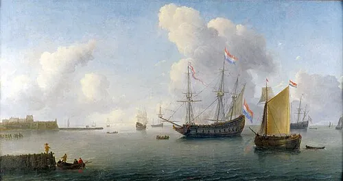 Fort Rammekens Historic site, Gemeente Vlissingen17 km NE
-
Lembeekse Isabellabeek River, East Flanders12 km SE
-
Doodhoekbeek River, East Flanders13 km SE
-
Blauwepoortbeek River, East Flanders13 km SE
-
Eede River, East Flanders13 km SW
Sources & licences
Data last updated: · 2 independent sources