Sluis Municipality
Located in Zeeland, The Netherlands Coordinates: 51°20′06″ N 3°31′11″ E
- Population
- 23,166
- 23.2K
- Elevation
- 0 m
- above sea level
- Local time
- UTC+01:00
- Europe/Amsterdam · UTC+01:00
- Places inside
- 20
- listed under Sluis Municipality
About Sluis Municipality
Sluis Municipality is a district. Location: Zeeland, The Netherlands. Population: 23,166.
In comparison
- Listed here: Village: 20
Places in Sluis Municipality
20 places-
Oostburg Village4.4K
-
Breskens Village4.3K
-
IJzendijke Village1.8K
-
Groede Village720
-
Aardenburg Village2K
-
Sluis Village1.9K
-
Schoondijke Village1.3K
-
Eede Village515
-
Sint Kruis Village120
-
Waterlandkerkje Village255
-
Hoofdplaat Village545
-
Cadzand Village445
-
Zuidzande Village435
-
Sint Anna ter Muiden Village50
-
Nieuwvliet Village275
-
Cadzand-Bad Village185
-
Retranchement Village175
-
Sasput Village
-
Slijkplaat Village
-
Turkeye Village
Nearby attractions & nature
Everything nearby-
Molenkreek River, East Flanders6.1 km S
-
Fort Rammekens Historic site, Gemeente Vlissingen16 km NE
-
Noorderhoofd Landmark, Veere Municipality24 km N
-
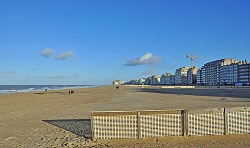 Albertstrand Beach, Knokke-Heist17 km W
-
Verloren-Kreek River, East Flanders13 km SW
-
Eede River, East Flanders13 km SW
Sources & licences
Data last updated: