South Bucks District
Located in Buckinghamshire, England Coordinates: 51°33′35″ N 0°35′19″ W
- Population
- 69,636
- 69.6K
- Elevation
- 78 m
- above sea level
- Local time
- UTC+00:00
- Europe/London · UTC+00:00
- Places inside
- 12
- listed under South Bucks District
- Airports
- LHR London Heathrow Airport13 km
- LTN London Luton Airport38 km
About South Bucks District
South Bucks District is a municipality. Location: Buckinghamshire, England. Population: 69,636. Elevation: 78 m. The best months to visit are June–August. The nearest airport is London Heathrow Airport (13 km). Nearby sights include Denham Country Park and Windsor Castle.
Climate of South Bucks District
Best months for sightseeingBest months for sightseeing: June–August.
This month · November
A cold month
Day 10° · Night 4° · Rain 62 mm
- Hottest month
- July (day 22°)
- Coldest month
- February (night 1°)
- Wettest month
- October (66 mm)
- Driest month
- July (41 mm)
Bars: average monthly low and high temperature. Below: precipitation. Monthly averages for 1970–2000 at about 18 km resolution, adjusted for elevation. Highlighted months are mild and relatively dry. Source: WorldClim 2.1 (CC BY 4.0).
Show values as a table
| Month | Jan | Feb | Mar | Apr | May | Jun | Jul | Aug | Sep | Oct | Nov | Dec |
|---|---|---|---|---|---|---|---|---|---|---|---|---|
| Average high (°C) | 7° | 8° | 10° | 13° | 17° | 20° | 22° | 22° | 19° | 14° | 10° | 8° |
| Average low (°C) | 2° | 1° | 3° | 4° | 7° | 10° | 12° | 12° | 10° | 7° | 4° | 3° |
| Precipitation (mm) | 62 | 43 | 50 | 48 | 53 | 54 | 41 | 52 | 59 | 66 | 62 | 65 |
How to get to South Bucks District
The nearest airport is London Heathrow Airport (LHR), 13 km to the southeast as the crow flies. The nearest large city is Slough, 6 km to the south.
Airports
- London Heathrow Airport (LHR) London 13 kmsoutheast
- London Luton Airport (LTN) Luton, Luton 38 kmnortheast
- London City Airport (LCY) London 45 kmeast
Nearby large cities
- Slough Population: 164.8K 6 kmsouth
- High Wycombe Population: 133.2K 14 kmnorthwest
- Watford Population: 125.7K 17 kmnortheast
- Harrow Population: 149.2K 18 kmeast
- Woking Population: 103.9K 27 kmsouth
Straight-line distances; road distances are longer. Airport data: OurAirports.
Day trips from South Bucks District
Within 100 km: 890 historic and cultural sites, 680 natural sites, 302 lakes, rivers and coasts.
0–25 km202 places
- The Lynch Island 22 kmW
- Holm Island Island 14 kmS
- Sunbury Court Island 22 kmSE
- Rivermead Island 21 kmSE
25–60 km826 places
- White Hart Lane Landmark 37 kmE
- Andersey Island Island 49 kmW
- Ravens Ait Island 26 kmSE
- Rose Isle Island 48 kmW
60–100 km844 places
- Portsea Island Natural site 91 kmS
- Spotlites @ Kings Theatre Attraction 80 kmE
- St Nicholas Church Shoreham Attraction 83 kmS
- The Marlipins Museum Museum 84 kmS
Straight-line distances.
South Bucks District and similar cities
Side by side with cities of similar size in the same country: population, elevation and climate.
| Measure | South Bucks District | Stafford | Maidenhead | Barnsley |
|---|---|---|---|---|
| Population | 69.6K | 70.1K | 70.4K | 71.4K |
| Elevation | 78 m | 77 m | 32 m | 112 m |
| Summer day (hottest month) | 22° | 20° | 23° | 21° |
| Winter night (coldest month) | 1° | 1° | 2° | 0° |
| Annual rainfall | 655 mm | 806 mm | 681 mm | 744 mm |
| Best months | Jun–Aug | Jun–Aug | Jun–Aug | Jun–Aug |
| Distance | — | 174 km | 10 km | 230 km |
Climate values are 1970–2000 monthly averages; straight-line distance.
Places in South Bucks District
12 placesCities & villages12
- Beaconsfield · Village
- Burnham · Village
- Denham · Village
- Dorney · Village
- Farnham Royal · Village
- Fulmer · Village
- Gerrards Cross · Village
- Hedgerley · Village
- Iver · Village
- Stoke Poges · Village
- Taplow · Village
- Wexham · Village
Nearby attractions & nature
Everything nearby-
Denham Country Park Natural site, Hillingdon7.4 km E
-
Windsor Castle Mountain, Windsor and Maidenhead8.5 km S
-
Romney Island Island, Windsor and Maidenhead7.5 km S
-
Windsor Castle Historic site, Windsor and Maidenhead8.5 km S
-
St George's Chapel Attraction, Windsor and Maidenhead8.6 km S
-
Horse Shoe Bay Natural site, Three Rivers8 km NE
-
Slow Grove Island, Cookham7.3 km W
-
Ray Mill Island Island, Windsor and Maidenhead8.1 km W
Other cities and towns in Buckinghamshire
-
Chiltern District Municipality, Buckinghamshire14 km N
-
Gerrards Cross Town, Gerrards Cross3.7 km NE
-
Farnham Royal Town, Farnham Royal2.7 km SW
-
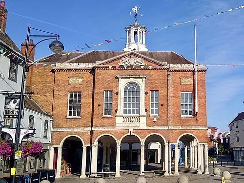 High Wycombe City, Wycombe14 km NW
-
Wycombe Municipality, Buckinghamshire22 km W
-
Burnham Town, Burnham6 km SW
Sources & licences
Data last updated: