The Tower
Located in Hope Woodlands, High Peak District Coordinates: 53°25′11″ N 1°47′21″ W
- Elevation
- 460 m
- above sea level
- Local time
- UTC+00:00
- Europe/London · UTC+00:00
- Airports
- MAN Manchester Airport34 km
- LBA Leeds Bradford Airport50 km
About The Tower
The Tower is a mountain. Location: Hope Woodlands, High Peak District. Elevation: 460 m. The best months to visit are June–August. The nearest airport is Manchester Airport (34 km). Nearby sights include River Westend and River Alport.
Photos of The Tower
-
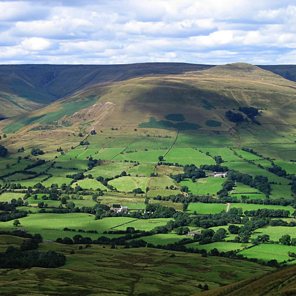
Vale of Edale The original uploader was Bpa at English Wikipedia · CC BY-SA 3.0

Climate of The Tower
Best months for sightseeingBest months for sightseeing: June–August.
This month · November
A wet month
Day 7° · Night 2° · Rain 129 mm
- Hottest month
- July (day 18°)
- Coldest month
- February (night -1°)
- Wettest month
- December (135 mm)
- Driest month
- May (78 mm)
Bars: average monthly low and high temperature. Below: precipitation. Monthly averages for 1970–2000 at about 18 km resolution, adjusted for elevation. Highlighted months are mild and relatively dry. Source: WorldClim 2.1 (CC BY 4.0).
Show values as a table
| Month | Jan | Feb | Mar | Apr | May | Jun | Jul | Aug | Sep | Oct | Nov | Dec |
|---|---|---|---|---|---|---|---|---|---|---|---|---|
| Average high (°C) | 4° | 4° | 7° | 9° | 13° | 16° | 18° | 18° | 15° | 11° | 7° | 5° |
| Average low (°C) | 0° | -1° | 1° | 2° | 5° | 8° | 10° | 10° | 8° | 5° | 2° | 1° |
| Precipitation (mm) | 131 | 97 | 103 | 84 | 78 | 87 | 78 | 95 | 98 | 122 | 129 | 135 |
How to get to The Tower
The nearest airport is Manchester Airport (MAN), 34 km to the west as the crow flies. The nearest large city is Sheffield, 22 km to the east.
Airports
- Manchester Airport (MAN) Manchester, Greater Manchester 34 kmwest
- Leeds Bradford Airport (LBA) Leeds, West Yorkshire 50 kmnorth
- Liverpool John Lennon Airport (LPL) Liverpool 71 kmwest
Nearby large cities
- Sheffield Population: 556.5K 22 kmeast
- Stockport Population: 139.1K 25 kmwest
- Huddersfield Population: 149K 26 kmnorth
- Oldham Population: 237.1K 26 kmnorthwest
- Rotherham Population: 117.6K 29 kmeast
Straight-line distances; road distances are longer. Airport data: OurAirports.
Day trips from The Tower
Within 100 km: 642 historic and cultural sites, 936 natural sites, 180 lakes, rivers and coasts.
0–25 km214 places
- Woodhead Reservoir Lake 9 kmNW
- Valehouse Reservoir Lake 12 kmNW
- Torside Reservoir Lake 10 kmNW
- Rhodeswood Reservoir Lake 12 kmNW
25–60 km552 places
- Beal Island Island 52 kmNE
- Saint George's Island Island 32 kmW
- The Island Island 53 kmNW
- Heron Island Island 58 kmNE
60–100 km992 places
- Great Britain Island 66 kmN
- Thurstaston Beach Beach 91 kmW
- Formby Beach Beach 88 kmW
- Ainsdale Beach Beach 87 kmW
Straight-line distances.
Nearest towns and villages
Nearby attractions & nature
Everything nearby-
River Westend River, England2.1 km NE
-
River Alport River, England2.2 km S
-
Derwent Reservoir Lake, England2.6 km E
-
Alport Moor Mountain, Hope Woodlands3.8 km NW
-
Vale of Edale Natural site, England4.4 km SW
-
Howden Reservoir Lake, England3 km NE
-
Upper Hey Mountain, Bradfield4.6 km NE
-
Bridge-end Pasture Mountain, Hope Woodlands5 km SE
Sources & licences
Data last updated: