Brown's House Top
Located in Dartmoor Forest, West Devon District Coordinates: 50°36′25″ N 3°57′35″ W
- Elevation
- 539 m
- above sea level
- Local time
- UTC+00:00
- Europe/London · UTC+00:00
- Airports
- EXT Exeter International Airport41 km
- NQY Cornwall Airport Newquay76 km
About Brown's House Top
Brown's House Top is a mountain. Location: Dartmoor Forest, West Devon District. Elevation: 539 m. The best months to visit are July–August. The nearest airport is Exeter International Airport (41 km). Nearby sights include Cut Hill and Higher White Tor.
Climate of Brown's House Top
Best months for sightseeingBest months for sightseeing: July–August.
This month · November
A wet month
Day 8° · Night 3° · Rain 153 mm
- Hottest month
- July (day 17°)
- Coldest month
- February (night 0°)
- Wettest month
- December (168 mm)
- Driest month
- July (75 mm)
Bars: average monthly low and high temperature. Below: precipitation. Monthly averages for 1970–2000 at about 18 km resolution, adjusted for elevation. Highlighted months are mild and relatively dry. Source: WorldClim 2.1 (CC BY 4.0).
Show values as a table
| Month | Jan | Feb | Mar | Apr | May | Jun | Jul | Aug | Sep | Oct | Nov | Dec |
|---|---|---|---|---|---|---|---|---|---|---|---|---|
| Average high (°C) | 5° | 5° | 7° | 9° | 13° | 15° | 17° | 17° | 15° | 11° | 8° | 6° |
| Average low (°C) | 1° | 0° | 1° | 2° | 5° | 8° | 10° | 10° | 8° | 6° | 3° | 2° |
| Precipitation (mm) | 164 | 124 | 118 | 89 | 85 | 82 | 75 | 93 | 110 | 140 | 153 | 168 |
How to get to Brown's House Top
The nearest airport is Exeter International Airport (EXT), 41 km to the east as the crow flies. For international flights: Cardiff International Airport (CWL) (98 km). The nearest large city is Plymouth, 29 km to the southwest.
Airports
- Exeter International Airport (EXT) Exeter, Devon 41 kmeast
- Cornwall Airport Newquay (NQY) Newquay 76 kmwest
- Cardiff International Airport (CWL) Cardiff 98 kmnortheast
Nearby large cities
- Plymouth Population: 260.2K 29 kmsouthwest
- Exeter Population: 130.7K 33 kmnortheast
- Cardiff Population: 372.1K 111 kmnortheast
- Swansea Population: 300.4K 113 kmnorth
- Newport Population: 161.5K 128 kmnortheast
Straight-line distances; road distances are longer. Airport data: OurAirports.
Nearest towns and villages
-
Postbridge Village, Dartmoor Forest3.7 km SE
-
Two Bridges Village, Dartmoor Forest5.5 km S
-
Pizwell Village, Dartmoor Forest5.8 km E
-
Princetown Village, Dartmoor Forest7.3 km S
-
Bellever Village, Dartmoor Forest4.9 km SE
-
Rundlestone Village, Dartmoor Forest6.8 km SW
Nearby attractions & nature
Everything nearby-
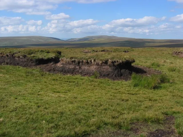 Cut Hill Mountain, Dartmoor Forest2.8 km NW
-
Higher White Tor Mountain, Dartmoor Forest1.9 km S
-
Longaford Tor Mountain, Dartmoor Forest2.5 km S
-
Wistman's Wood National Nature Reserve Natural site, Dartmoor Forest2.6 km S
-
Sittaford Tor Mountain, Dartmoor Forest3.2 km NE
-
Beardown Tors Mountain, Dartmoor Forest3.3 km S
-
White Ridge Mountain, Dartmoor Forest3.8 km NE
-
Black Hill Mountain, Dartmoor Forest4.3 km N
Sources & licences
Data last updated: