- Population
- 71,064
- 71.1K
- Elevation
- 46 m
- above sea level
- Local time
- UTC+00:00
- Europe/London · UTC+00:00
- Places inside
- 74
- listed under North Dorset District
- Airports
- BOH Bournemouth Airport33 km
- BRS Bristol Airport61 km
About North Dorset District
North Dorset District is a municipality. Location: Dorset, England. Population: 71,064. Elevation: 46 m. The best months to visit are June–August. The nearest airport is Bournemouth Airport (33 km). Nearby sights include Old Wardour Castle and Sherborne Abbey.
Climate of North Dorset District
Best months for sightseeingBest months for sightseeing: June–August.
This month · November
A cold month
Day 11° · Night 5° · Rain 80 mm
- Hottest month
- July (day 21°)
- Coldest month
- February (night 2°)
- Wettest month
- December (93 mm)
- Driest month
- July (46 mm)
Bars: average monthly low and high temperature. Below: precipitation. Monthly averages for 1970–2000 at about 18 km resolution, adjusted for elevation. Highlighted months are mild and relatively dry. Source: WorldClim 2.1 (CC BY 4.0).
Show values as a table
| Month | Jan | Feb | Mar | Apr | May | Jun | Jul | Aug | Sep | Oct | Nov | Dec |
|---|---|---|---|---|---|---|---|---|---|---|---|---|
| Average high (°C) | 8° | 8° | 10° | 12° | 16° | 19° | 21° | 21° | 18° | 15° | 11° | 9° |
| Average low (°C) | 2° | 2° | 3° | 4° | 7° | 10° | 12° | 12° | 10° | 8° | 5° | 3° |
| Precipitation (mm) | 90 | 65 | 65 | 53 | 53 | 56 | 46 | 57 | 69 | 79 | 80 | 93 |
How to get to North Dorset District
The nearest airport is Bournemouth Airport (BOH), 33 km to the southeast as the crow flies. For international flights: Bristol Airport (BRS) (61 km). The nearest large city is Poole, 30 km to the southeast.
Airports
- Bournemouth Airport (BOH) Bournemouth 33 kmsoutheast
- Bristol Airport (BRS) Bristol 61 kmnorthwest
- Southampton Airport (SOU) Southampton 63 kmeast
Nearby large cities
- Poole Population: 151.5K 30 kmsoutheast
- Bournemouth Population: 163.6K 35 kmsoutheast
- Bath Population: 101.6K 51 kmnorth
- Southampton Population: 269.8K 60 kmeast
- Bristol Population: 479K 64 kmnorth
Straight-line distances; road distances are longer. Airport data: OurAirports.
Places in North Dorset District
74 placesCities & villages60
- Anderson · Village
- Ashmore · Village
- Blandford · Village
- Blandford St. Mary · Village
- Bourton · Village
- Bryanston · Village
- Buckhorn Weston · Village
- Cann · Village
- Charlton Marshall · Village
- Chettle · Village
- Child Okeford · Village
- Compton Abbas · Village
- Durweston · Village
- East Orchard · Village
- East Stour · Village
- Farnham · Village
- Fifehead Magdalen · Village
- Fifehead Neville · Village
- Fontmell Magna · Village
- Gillingham · Village
- Glanvilles Wootton · Village
- Hammoon · Village
- Hanford · Village
- Hazelbury Bryan · Village
- Hilton · Village
- Hinton St. Mary · Village
- Ibberton · Village
- Iwerne Courtney or Shroton · Village
- Iwerne Minster · Village
- Iwerne Stepleton · Village
- Kington Magna · Village
- Langton Long Blandford · Village
- Lydlinch · Village
- Manston · Village
- Mappowder · Village
- Margaret Marsh · Village
- Marnhull · Village
- Melbury Abbas · Village
- Milborne St. Andrew · Village
- Milton Abbas · Village
- Motcombe · Village
- Okeford Fitzpaine · Village
- Pimperne · Village
- Pulham · Village
- Shaftesbury · Village
- Shillingstone · Village
- Silton · Village
- Spetisbury · Village
- Stalbridge · Village
- Stoke Wake · Village
- Stourpaine · Village
- Stour Provost · Village
- Stourton Caundle · Village
- Sturminster Newton · Village
- Sutton Waldron · Village
- Tarrant Crawford · Village
- Tarrant Gunville · Village
- Tarrant Hinton · Village
- Tarrant Keyneston · Village
- Tarrant Launceston · Village
Nearby attractions & nature
Everything nearby-
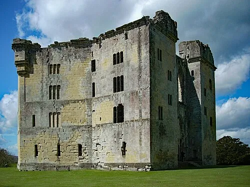 Old Wardour Castle Historic site, Donhead St. Andrew18 km NE
-
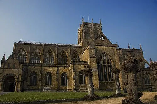 Sherborne Abbey Attraction, Sherborne18 km W
-
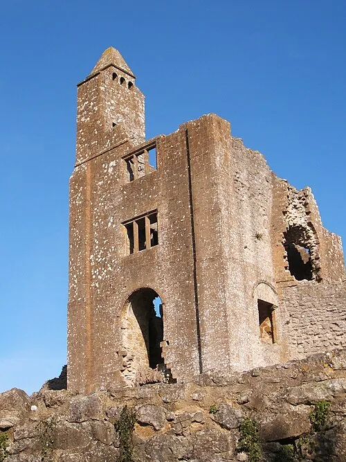 Sherborne Old Castle Historic site, Castleton17 km W
-
Ballands Castle Historic site, Pen Selwood19 km N
-
Little Hill Mountain, Sedgehill and Semley13 km NE
-
Win Green Mountain, Donhead St. Mary13 km NE
-
Henning Hill Mountain, Melcombe Horsey13 km SW
-
Lyscombe Hill Mountain, Melcombe Horsey13 km SW
Sources & licences
Data last updated: