- Population
- 92,236
- 92.2K
- Elevation
- 25 m
- above sea level
- Local time
- UTC+00:00
- Europe/London · UTC+00:00
- Places inside
- 28
- listed under Hastings District
- Airports
- LGW London Gatwick Airport62 km
- SEN London Southend Airport79 km
About Hastings District
Hastings District is a municipality. Location: East Sussex, England. Population: 92,236. Elevation: 25 m. The best months to visit are June–September. The nearest airport is London Gatwick Airport (62 km). Nearby sights include Wilting Manor and Covehurst Bay.
Climate of Hastings District
Best months for sightseeingBest months for sightseeing: June–September.
This month · November
A cold month
Day 10° · Night 5° · Rain 87 mm
- Hottest month
- August (day 21°)
- Coldest month
- February (night 2°)
- Wettest month
- November (87 mm)
- Driest month
- May (45 mm)
Bars: average monthly low and high temperature. Below: precipitation. Monthly averages for 1970–2000 at about 18 km resolution, adjusted for elevation. Highlighted months are mild and relatively dry. Source: WorldClim 2.1 (CC BY 4.0).
Show values as a table
| Month | Jan | Feb | Mar | Apr | May | Jun | Jul | Aug | Sep | Oct | Nov | Dec |
|---|---|---|---|---|---|---|---|---|---|---|---|---|
| Average high (°C) | 7° | 7° | 10° | 12° | 16° | 19° | 21° | 21° | 18° | 15° | 10° | 8° |
| Average low (°C) | 2° | 2° | 3° | 5° | 8° | 11° | 13° | 13° | 11° | 8° | 5° | 3° |
| Precipitation (mm) | 80 | 49 | 56 | 47 | 45 | 56 | 46 | 49 | 68 | 84 | 87 | 79 |
Other places to visit in this season: June July August September
How to get to Hastings District
The nearest airport is London Gatwick Airport (LGW), 62 km to the northwest as the crow flies. The nearest large city is Eastbourne, 24 km to the southwest.
Airports
- London Gatwick Airport (LGW) London 62 kmnorthwest
- London Southend Airport (SEN) Southend-on-Sea, Essex 79 kmnorth
- London City Airport (LCY) London 80 kmnorthwest
Nearby large cities
- Eastbourne Population: 101.7K 24 kmsouthwest
- Maidstone Population: 107.6K 45 kmnorth
- Brighton Population: 283.9K 51 kmwest
- Gillingham Population: 101.2K 58 kmnorth
- Crawley Population: 124K 60 kmnorthwest
Straight-line distances; road distances are longer. Airport data: OurAirports.
Day trips from Hastings District
Within 100 km: 517 historic and cultural sites, 397 natural sites, 181 lakes, rivers and coasts.
0–25 km49 places
- Camber Sands Beach 17 kmNE
- Hastings Beach Beach 2 kmSW
- Isle of Oxney Island 20 kmNE
- Burnthouse Pen Lake 23 kmNE
25–60 km238 places
- Spotlites @ Kings Theatre Attraction 57 kmN
- Sunny Sands Beach 49 kmNE
- St Mary's Island Island 60 kmN
- Hoo Island Island 60 kmN
60–100 km808 places
- Isle of Sheppey Island 62 kmN
- White Hart Lane Landmark 94 kmNW
- St Nicholas Church Shoreham Attraction 61 kmW
- The Marlipins Museum Museum 61 kmW
Straight-line distances.
Hastings District and similar cities
Side by side with cities of similar size in the same country: population, elevation and climate.
| Measure | Hastings District | Darlington | Southport | Chester |
|---|---|---|---|---|
| Population | 92.2K | 92.4K | 91.7K | 90.5K |
| Elevation | 25 m | 40 m | 9 m | 34 m |
| Summer day (hottest month) | 21° | 20° | 20° | 20° |
| Winter night (coldest month) | 2° | 1° | 2° | 1° |
| Annual rainfall | 746 mm | 674 mm | 800 mm | 695 mm |
| Best months | Jun–Sep | Jun–Sep | Jun–Sep | Jun–Aug |
| Distance | — | 432 km | 395 km | 352 km |
Climate values are 1970–2000 monthly averages; straight-line distance.
Places in Hastings District
28 placesHastings
Population: 92.9K
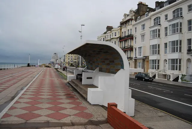
Saint Leonards-on-Sea
Population: 10K

Hollington
Population: 6.1K

Ore
Population: 5.2K
Cities & villages17
- Blacklands · Neighbourhood
- Bohemia · Neighbourhood
- Broomgrove · Neighbourhood
- Bulverhythe · Neighbourhood
- Church Wood · Neighbourhood
- Clive Vale · Neighbourhood
- Glyne Gap · Neighbourhood
- Halton · Neighbourhood
- Harley Shute · Neighbourhood
- High Wickham · Neighbourhood
- Old Town · Neighbourhood
- Silverhill Park · Neighbourhood
- St Helen's · Neighbourhood
- St. Helen's · Neighbourhood
- St Leonards Green · Neighbourhood
- The America Ground · Village
- West Hill · Neighbourhood
Mountains & nature3
- North's Seat · Mountain
- Saint Helen's Wood · Natural site
- St Helen's · Mountain
Lakes, rivers & coasts1
- Hastings Beach · Beach
Heritage & sights1
- Hastings Castle · Historic site
Nearby attractions & nature
Everything nearby-
Wilting Manor Historic site, Crowhurst4.7 km W
-
Covehurst Bay Natural site, England4.1 km E
-
Blackhorse Hill Mountain, Battle5.2 km NW
-
St Peter's Church Attraction, Rother District7.6 km W
-
River Brede River, East Sussex11 km NE
-
Bexhill-on-Sea Mediumwave Transmitter, Mast Southeast Landmark, Rother District9.9 km W
-
Bexhill-on-Sea Mediumwave Transmitter, Mast Northwest Landmark, Rother District10 km W
-
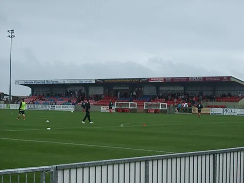 Priory Lane Landmark, Eastbourne District20 km W
Sources & licences
Data last updated: