- Population
- 27,535
- 27.5K
- Elevation
- 8 m
- above sea level
- Local time
- UTC+00:00
- Europe/London · UTC+00:00
- Airports
- SEN London Southend Airport13 km
- LCY London City Airport35 km
About Wickford
Wickford is a town. Location: Basildon District, Essex. Population: 27,535. Elevation: 8 m.
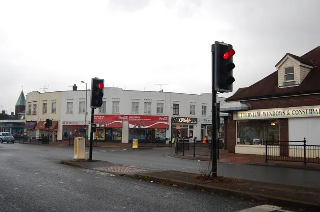
Wickford is a town and civil parish in the Borough of Basildon of Essex, England. It is located approximately 30 miles (48 km) east of London and 4 miles (6 km) north-east of Basildon. At the 2021 census, the parish had a population of 27,601 and the built-up area, as defined by the Office for National Statistics, was 27,535. Wickford has a main high street which includes a wide range of shops; it also has a swimming pool, library, open-air market and a community centre within the vicinity of the town centre.
Source: Wikipedia · CC BY-SA 4.0
Photos of Wickford
-

John Myers · CC BY-SA 2.0 -

John Myers · CC BY-SA 2.0 -

The Bridge Engineer · CC BY-SA 2.0 -

RobertP4591 · CC BY-SA 4.0 -

kitmasterbloke · CC BY 2.0


Travel notes for Wickford
From Wikivoyage
Wickford is in Essex, England.
Understand+
Wickford is a town on the River Crouch.
Get in+
Wickford is on the A129 and A132, of the A130 and A127. Wickford has a railway station, 1 Wickford Railway Station, Station Approach, SS11 7AT. (updated Feb 2021) in between Shenfield (Brentwood) and Southend-on-Sea.
Source: Wikivoyage · CC BY-SA 4.0 · abridged
Climate of Wickford
Best months for sightseeingBest months for sightseeing: June–August.
This month · November
A cold month
Day 10° · Night 4° · Rain 56 mm
- Hottest month
- July (day 22°)
- Coldest month
- February (night 2°)
- Wettest month
- November (56 mm)
- Driest month
- February (33 mm)
Bars: average monthly low and high temperature. Below: precipitation. Monthly averages for 1970–2000 at about 18 km resolution, adjusted for elevation. Highlighted months are mild and relatively dry. Source: WorldClim 2.1 (CC BY 4.0).
Show values as a table
| Month | Jan | Feb | Mar | Apr | May | Jun | Jul | Aug | Sep | Oct | Nov | Dec |
|---|---|---|---|---|---|---|---|---|---|---|---|---|
| Average high (°C) | 7° | 7° | 10° | 12° | 16° | 20° | 22° | 22° | 19° | 15° | 10° | 8° |
| Average low (°C) | 2° | 2° | 3° | 4° | 7° | 10° | 13° | 13° | 10° | 7° | 4° | 3° |
| Precipitation (mm) | 52 | 33 | 41 | 38 | 41 | 52 | 39 | 48 | 50 | 55 | 56 | 51 |
How to get to Wickford
The nearest airport is London Southend Airport (SEN), 13 km to the east as the crow flies. For international flights: London Stansted Airport (STN) (36 km). The nearest large city is Basildon, 7 km to the southwest.
Airports
- London Southend Airport (SEN) Southend-on-Sea, Essex 13 kmeast
- London City Airport (LCY) London 35 kmwest
- London Stansted Airport (STN) London, Essex 36 kmnorthwest
Nearby large cities
- Basildon Population: 144.9K 7 kmsouthwest
- Chelmsford Population: 111.5K 14 kmnorth
- Southend-on-Sea Population: 295.3K 16 kmsoutheast
- Gillingham Population: 101.2K 25 kmsouth
- Dagenham Population: 108.4K 26 kmwest
Straight-line distances; road distances are longer. Airport data: OurAirports.
Day trips from Wickford
Within 100 km: 769 historic and cultural sites, 456 natural sites, 298 lakes, rivers and coasts.
0–25 km82 places
- Yantlet beach Beach 19 kmSE
- Osea Island Island 21 kmNE
- Northey Island Island 18 kmNE
- Isle of Grain Island 22 kmSE
25–60 km626 places
- Isle of Sheppey Island 32 kmSE
- White Hart Lane Landmark 41 kmW
- Spotlites @ Kings Theatre Attraction 26 kmS
- West Mersea Beach Beach 33 kmNE
60–100 km815 places
- Camber Sands Beach 78 kmS
- Aldeburgh's Beach Beach 96 kmNE
- Sunny Sands Beach 75 kmSE
- Hastings Beach Beach 85 kmS
Straight-line distances.
Nearby attractions & nature
Everything nearby-
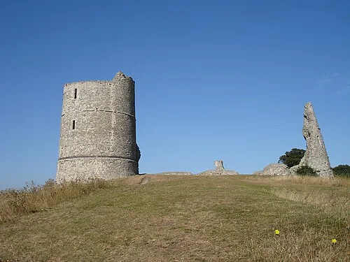 Hadleigh Castle Historic site, Castle Point District9.5 km SE
-
Thundersley Hill Mountain, Castle Point District6.7 km SE
-
Rayleigh Mount Historic site, Rayleigh6.1 km SE
-
Langdon Hill Mountain, Basildon District9.6 km SW
-
Bell Hill Mountain, Billericay7.4 km W
-
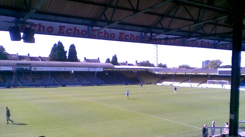 Roots Hall Landmark, Southend-on-Sea14 km SE
-
Rayleigh Mediumwave Transmitter Landmark, Rayleigh8.7 km E
-
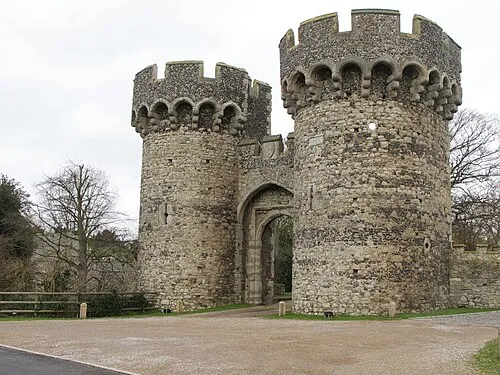 Cooling Castle Historic site, Cooling17 km S
Sources & licences
Data last updated: · 2 independent sources